Virtual Public Involvement (VPI)

What is Virtual Public Involvement (VPI)?

Innovative virtual public involvement techniques provide State departments of transportation (DOTs), transit agencies, metropolitan planning organizations (MPOs), and rural transportation planning organizations (RTPOs) with a platform to inform the public and receive feedback. These strategies increase the number and variety of channels available to agencies for remotely disseminating information to the public and create efficiencies in how input is collected and considered, which can potentially accelerate planning and project development processes.

Encouraging Public Engagement

Public involvement is a critical component in the transportation decision-making process, allowing for meaningful consideration and input from interested individuals. As daily users of the transportation system, the public has useful opinions, insights, and observations to share with their State DOT and local agencies on the performance and needs of the transportation system or on specific projects. Early and strong public engagement has the potential to accelerate project delivery by helping identify and address public concerns early in the planning process, thereby reducing delays from previously unknown interests late in the project delivery process.

Nearly all State DOTs and most local agencies use websites to post information about their activities. With the increased use of social media tools and mobile applications, the public can access user-friendly features such as online videos, podcasts, crowdsourced maps, and other interactive forums to receive information and provide input.

Benefits

Efficiency and Low Cost. Virtual tools and platforms can be made accessible to communities efficiently, many at a lower cost than traditional public engagement methods.

Accelerated Project Delivery. Robust public engagement helps identify issues early in the project planning process, which reduces the need to revisit decisions.

Communication and Collaboration. Virtual public involvement can aid in establishing a common vision for transportation and ensure the opinions and needs of the public are understood and considered during transportation planning and project development.

Expanded Engagement. Virtual tools can facilitate inclusion of stakeholders who do not participate in traditional approaches to public involvement. Greater and more diverse engagement can improve project quality.

Learn more about this EDC-6 Innovation.

Virtual Public Involvement in NJ

Stage of Innovation:
INSTITUTIONALIZED
(March 2023)

Collaboration. NJDOT has collaborated with the state's three MPOs to integrate VPI practices in all stages of capital project implementation, from concept development to construction.

Local Agency Advancement. New Jersey's counties and municipalities are using lessons learned from state efforts to increase their engagement with local stakeholders.

Expanding Reach. Transportation partners throughout the state have utilized VPI practices in a wide variety of projects, especially since the onset of the COVID-19 pandemic. This work has provided robust demonstration of expanded attendance to VPI online events. However, concerns still exist about documentation of virtual feedback versus that gained through in-person communications, as well as the issue of equity in reaching, and gaining insight, from a wide variety of participants including underserved and disadvantaged populations.

What's Next?

NJDOT and its partners are seeking to increase public engagement of various stakeholder groups. The Department plans to include VPI in its updated Public Involvement Action Plan. The agency understands that input through VPI is as important, and considered equal to, in-person input. VPI can enhance and increase access to many populations, particularly those who are underserved, but the need exists to strike a balance of in-person and virtual engagement.

Virtual Public Involvement (VPI): NEW & NOTEWORTHY 

No post found

Project Bundling

What is Project Bundling?

The U.S. transportation system is aging, with many States seeing an ever-increasing number of highways and bridges that need more immediate attention. As a result, system performance is reduced, leading to potentially adverse impacts to quality of life, mobility, travel time, freight movements, and emergency response times. Often the most pressing needs are on the local systems, as evidenced by bridges that are being posted for reduced loads.

Project bundling helps address this national issue. By awarding a single contract for several similar preservation, rehabilitation, or replacement projects, agencies can streamline design and construction, reduce costs, and effectively decrease transportation project backlogs.

This proven practice draws upon efficiencies found through project delivery streamlining, as well as benefits from alternative and traditional contracting methods. A bundled contract could cover a single county, district, or State, and it may be tiered to allow a combination of work types (design, preservation, rehabilitation, or complete replacement). Bundling design and construction contracts saves procurement time, leverages design expertise, and builds momentum toward keeping critical assets in a state of good repair.

Learn more about this EDC-5 Innovation.

NJ's Use of Project Bundling

Stage of Innovation:
INSTITUTIONALIZED

New Jersey implemented project bundling prior to the start of EDC-5:

Adopted Project Bundling Across NJDOT. Project bundling has been used in NJ for years as a way to save time in the procurement of designers and contractors, as well as to save money through economies of scale and reduced staff paperwork. It is incorporated into the Department's policies and procedures and most commonly referred to as batch solicitation.

Routinely Uses Project Bundling for the Delivery of Federally-Funded Capital Projects and State-Funded Maintenance Projects. NJDOT assesses projects and programs at the planning phase for their suitability for a project bundling approach for either design, construction, or both. Major programs that use project bundling include:

- Sign Structure Replacement Program
- ADA Compliance Program
- Maintenance Roadway Repair Contracts
- Statewide Guiderail Replacement

When possible, NJDOT looks to use project bundling on smaller projects as well to save time and money.

PROJECT BUNDLING: NEW & NOTEWORTHY 

Project Bundling Webinar Series

Project Bundling Webinar Series

FHWA provides online webinars on the subject of project bundling to share best practices with interested agencies. ...
Project Bundling

Project Bundling

Awarding a single contract for several preservation, rehabilitation, or replacement projects helps agencies reduce costs and achieve program goals. Project bundling offers a comprehensive and accelerated ...

Reducing Rural Roadway Departures

What is Reducing Rural Roadway Departures?

Reducing fatalities on rural roads remains a major challenge in the United States. Roadway departures on the rural road network account for one-third of traffic fatalities. Systemic application of proven roadway departure countermeasures, such as rumble strips, friction treatments, and clear zones, helps keep vehicles in their travel lanes, reduce the potential for crashes, and reduce the severity of those crashes that do occur.

Data-driven systemic analysis can help agencies prioritize the locations and countermeasures that will be most effective by taking a broad view to evaluate risks across an entire roadway system. It can be used to proactively implement countermeasures where crashes are likely to happen, even for locations where no crashes have been recorded. The benefits include safer roads, quick deployment, and flexibility.

Learn more about this EDC-5 Innovation.

NJ Expands Systemic Application of Proven Safety Countermeasures

Stage of Innovation:
DEVELOPMENT
(January 2021)

With EDC-5, NJ plans to expand their current practices to reduce rural roadway departures:

Utilizes Crash Data for Proactive Systemic Approach. Currently, NJ uses crash data to analyze transportation systems for all public roads and applies a proactive systemic approach including rumble striping, low-cost countermeasure mitigation, high friction surface treatments, and signage improvements, unless a location is on the high crash list. Then NJ provides project-specific mitigation to reduce or eliminate the issue. NJ implements these approaches on rural roads through the Local Safety, High Risk Rural Roads, and Preliminary Engineering and Design Assistance Programs.

What's Next?

Be Proactive and Organize Workshops. The FHWA Resource Center conducted a Train-the-Trainer Workshop at NJDOT Headquarters in June 2019.  Training events, hosted by the state's MPOs, were being planned for safety professionals, rural roadway facility owners and maintainers on roadway departures, location identification, systemic approach to safety, and proven safety countermeasures, with the assistance of the FHWA Safety Program Office and the FHWA Resource Center.

The planned in-person workshops were cancelled due to COVID restrictions and CDC/State guidelines. Instead NJDOT and FHWA plan to host virtual training sessions presented by the FHWA Resource Center, tentatively scheduled for March 2021.

Reducing Rural Roadway Departures: NEW & NOTEWORTHY 

No post found

Safe Transportation for Every Pedestrian (STEP)

What is Safe Transportation for Every Pedestrian (STEP)?

Pedestrians account for over 17.5 percent of all fatalities in motor vehicle traffic crashes, and the majority of these deaths occur at uncontrolled crossing locations (such as non-intersections) or at intersections with no traffic signal or STOP sign. Cost-effective countermeasures with known safety benefits can help reduce pedestrian fatalities in these scenarios.

FHWA promoted the following safety countermeasures through EDC-4 and EDC-5:

Road Diets can reduce vehicle speeds, limit the number of lanes pedestrians cross, and create space to add new pedestrian facilities.

Pedestrian Hybrid Beacons (PHBs) are a beneficial intermediate option between Rectangular Rapid Flash Beacons (RRFBs) and a full pedestrian signal. They provide positive stop control in areas without the high pedestrian traffic volumes that typically warrant signal installation.

Pedestrian Refuge Islands provide a safe place to stop at the midpoint of the roadway before crossing the remaining distance. This is particularly helpful for older pedestrians or others with limited mobility.

Raised Crosswalks can reduce vehicle speeds.

Crosswalk Visibility Enhancements, such as crosswalk lighting and enhanced signing and marking, help drivers detect pedestrians—particularly at night.

Learn more about this EDC-4 and EDC-5 Innovation.

NJ's Progress Towards Institutionalizing STEP

Stage of Innovation:
INSTITUTIONALIZED
(January 2021)

NJ's work on STEP began with EDC-4 and continued to progress during EDC-5:

Developed an Action Plan for Implementing Pedestrian Crossing Countermeasures at Uncontrolled Locations. For this collaborative effort, NJDOT and FHWA reviewed existing practice and policies impacting crossings and recommended actions for targeting specific safety countermeasures to help reduce the number and rate of pedestrian crashes, fatalities, and injuries on NJ highways.

Devised Recommendations Following STEP Guidance for Implementing Lower-Cost Countermeasures. The recommended countermeasures can be deployed based on specific needs, have a proven record of reducing crashes, and represent underutilized innovations that can have an immediate impact.

Developed NJ 2020 Strategic Highway Safety Plan. STEP strategies have been included in the 2020 NJ Strategic Highway Safety Plan update, completed in August 2020 and implementation efforts of proposed actions items are underway.

What's Next?

New Jersey has developed strategies in the 2020 Strategic Highway Safety Plan and will implement these strategies with the goal of eliminating all pedestrian and bicyclist fatalities and serious injuries on all public roads.

Click for the STEP Fact Sheet.

SAFE TRANSPORTATION FOR EVERY PEDESTRIAN (STEP): NEW & NOTEWORTHY 

ATLANTIC AVENUE, ATLANTIC CITY: Planning for Safer Conditions for All Roadway Users

ATLANTIC AVENUE, ATLANTIC CITY: Planning for Safer Conditions for All Roadway Users

Following a decade of transportation planning studies, including a Road Safety Audit (RSA), pedestrian and cyclist improvements are being programmed for Atlantic City's Atlantic ...
Research Spotlight: Evaluating the Pedestrian Hybrid Beacon’s Effectiveness:  A Case Study in New Jersey

Research Spotlight: Evaluating the Pedestrian Hybrid Beacon’s Effectiveness:  A Case Study in New Jersey

Pedestrian Hybrid Beacons, one of FHWA’s seven Safe Transportation for Every Pedestrian (STEP) countermeasures, proven methods of reducing pedestrian collisions, are the subject of a ...
STEP-Aligned HAWK Signal Installed in Bergen County

STEP-Aligned HAWK Signal Installed in Bergen County

EDC STEP-aligned projects have been successfully deployed in locations across New Jersey, including a recent pedestrian improvement project along Washington Avenue in the Borough of ...
TECH TALK! Webinar: EDC Safe Transportation for Every Pedestrian

TECH TALK! Webinar: EDC Safe Transportation for Every Pedestrian

Please join the NJDOT Bureau of Research on April 2nd for an Innovation Exchange Webinar, EDC Safe Transportation for Every Pedestrian (STEP), that we are ...
NJLTAP – Proven Safety Countermeasures Workshops – Upcoming Events

NJLTAP – Proven Safety Countermeasures Workshops – Upcoming Events

The New Jersey Local Technical Assistance Program (NJLTAP) has partnered with the FHWA Division Office, NJDOT Bureau of Safety, Bicycle and Pedestrian Programs and Local ...
EDC-5 STEP – Safe Transportation for Every Pedestrian

EDC-5 STEP – Safe Transportation for Every Pedestrian

On October 30th the NJDOT Bureau of Research hosted the Lunchtime Tech Talk! Event on EDC-5 STEP: Safe Transportation for Every Pedestrian. ...
NJDOT Safety Countermeasures Training and Education Videos

NJDOT Safety Countermeasures Training and Education Videos

The following videos describe six of FHWA’s Proven Safety Countermeasures that improve pedestrian safety. NJDOT developed these videos to train and educate viewers on the ...
NJLTAP – Safe Transportation for Every Pedestrian Workshop

NJLTAP – Safe Transportation for Every Pedestrian Workshop

The NJ Local Technical Assistance Program is holding an all-day workshop training event to learn more about the FHWA EDC-5 innovative initiative: Safe Transportation for ...
Local Safety Peer Exchanges: Summary Report

Local Safety Peer Exchanges: Summary Report

The Local Safety Peer Exchange Summary Report describes a series of peer exchange events that highlighted local initiatives that demonstrate best practice in addressing traffic ...
Local Peer Safety Exchange – 3rd Event

Local Peer Safety Exchange – 3rd Event

The third event in the series to discuss local initiatives that demonstrate best practice in addressing traffic safety was held on March 26, 2019. ...
New Jersey To Expand Data-Driven Approach to Highway Safety Management

New Jersey To Expand Data-Driven Approach to Highway Safety Management

Aided by STIC funding, NJDOT pilots a sofware package to proactively identify sites for safety improvement. ...
Local Safety Peer Exchange – 2nd Event

Local Safety Peer Exchange – 2nd Event

The second event in the series to discuss local initiatives that demonstrate best practice in addressing traffic safety was held on June 13th. ...
Road Diets Are Making Roads Safer in New Jersey

Road Diets Are Making Roads Safer in New Jersey

FHWA recognizes road diets as one of 20 “Proven Safety Countermeasures” to reduce serious injuries and fatalities on American highways and roads. ...
Local Safety Peer Exchange – 1st Event

Local Safety Peer Exchange – 1st Event

The first event in the series to discuss local initiatives that demonstrate best practice in addressing traffic safety was held on December 6th. ...

Unmanned Aerial Systems

What is Unmanned Aerial Systems (UAS)?

UAS offer several transformative aspects for highway transportation, enhancing safety and productivity, while also reducing cost.

Unmanned aerial systems (UAS), sometimes referred to as drones, are multi-use aircraft controlled from a licensed operator on the ground. The benefits of UAS are wide ranging and impact nearly all aspects of highway transportation—replacing boots on the ground, increasing accuracy, speeding up data collection, and providing access to hard-to-reach locations.

UAS provide high-quality survey and data mapping that can be collected automatically or remotely. Large areas can be mapped relatively quickly in comparison to traditional survey and mapping practices. Other uses include survey and imagery as part of emergency response events, where traditional surveying and mapping practices may be inadequate or sites impossible to access. UAS can supplement conventional activities, such as bridge safety inspection and routine construction inspection, to increase safety and collect data from otherwise unattainable perspectives.

UAS improve operations, construction, inspection, and safety by collecting data needed to design, build, and operate the highway system. Bridge inspection enhanced by UAS improves safety for the inspection team and the traveling public by reducing the need for temporary work zones and specialized access equipment, which can also be very cost effective. Construction inspection with UAS allows for a bird’s eye view of a project’s progress and for the development of three-dimensional (3D) terrain models that document the construction process and assist in assessment of earthwork quantity measurement.

UAS technology gives State departments of transportation (DOTs) eyes-in-the-sky during incident responses for roadway disturbances and for damage assessments following fires, earthquakes, and bridge hits. It allows States to obtain quality data to make better-informed decisions, all collected from a relatively low-cost platform.

Learn more about this EDC-5 Innovation.

Field tours demonstrate UAS capabilities to staff and partnering organizations.

Integrating UAS in NJ Transportation Operations

Stage of Innovation:
INSTITUTIONALIZED
(December 2021)

NJ has been a national leader in UAS and initiated several activities before and since EDC-5:

Established Drone Program. NJDOT’s Division of Multi-Modal Services established a drone program and hired a UAS Coordinator position in Aeronautics to lead NJDOT’s UAS initiatives.

Leveraged Federal Financial Assistance. NJDOT successfully applied for three FHWA grants, including:

FHWA Tech Transfer Deployment Funds to hold a UAS Peer Exchange on Best Practices. A national UAS Peer Exchange was held based on the successful NJ model and NJDOT’s UAS Coordinator presented at the event in Washington DC.

FHWA STIC Incentive Program Funding to purchase equipment and training to evaluate the use of UAS for structural inspections, Traffic Incident Management (TIM), surveying and accelerating construction projects, determining flooding adjacent to state highways, and bridge deck thermography mapping.

FHWA State Planning & Research Program funds for research into Best Practices, Policies and Procedures to recommend potential legislative and regulatory remedies, enforcement and compliance strategies and tools, and training products for engineers and consultants involved in UAS operations.

Conducted Research and Field Demonstration Studies. Integrating UAS in transportation has been the subject of research and field studies to demonstrate the use case for high-mast light pole inspections, traffic incident management and monitoring, dredging and beach replenishment, photogrammetry, bridge inspection, and watershed management, among other topics.  

In 2019 after the kick-off EDC-5, NJDOT established a protocol to streamline requests for UAS usage on projects through the SimpliGov online system. The agency also developed an internal Night Training Powerpoint Course to fulfill the FAA COA night authorization requirements, helping to support future requests for NJDOT UAS operations at night. Additionally, the agency created an interactive UAS display for "Take Your Child to Work Day" to promote staff and youth education of the program's work. This display was done as part of the NJDOT Commitment to Communities initiative and under the Bureau of Aeronautics' mandate to promote aviation awareness and showcase UAS unit benefits. By 2020, the NJDOT UAS program had supported more than a dozen construction management projects.

STIC Incentive Funding helped build the capacity of the UAS Program.  Work on this grant was completed and the final report is available here.  The NJDOT UAS Program was featured in the FHWA EDC-5 Webinar Series: (SR200). The presentation, Developing a UAS Program: From Startup to Additional Tasking, highlighted key challenges, benefits and lessons in standing up a UAS Program at a state DOT.  The NJDOT UAS Program was highlighted in a video highlighting the innovation and benefits of the program for the state.  The NJDOT UAS Program was featured in the UAS for Traffic Monitoring Applications webinar as part of the EDC-5 series of webinars in December 2020.

What's Next?

The UAS Program subsequently was awarded a second STIC Incentive Funding Grant to purchase additional equipment and to perform UAS Remote Pilot in Command (RPIC) trainings to support transportation emergency response and operations safety units.  The NJDOT UAS Program is working with other state DOT agencies and domestic vendors to domestically source drone technology in response to the American Innovation and Competitiveness Act expected to go in effect in 2023.

Click for the Fact Sheet: Unmanned Aerial Systems

Click for Infographic: Benefits of UAS for High Mast Inspection

UNMANNED AERIAL SYSTEMS: NEW & NOTEWORTHY

NJDOT UAS/Drone Procedures Manual and Best Practices for Use in New Jersey

NJDOT UAS/Drone Procedures Manual and Best Practices for Use in New Jersey

NJDOT’s Unmanned Aircraft Systems Flight Operations Manual (UASFOM) is an example of knowledge sharing through development of a procedures manual that guides practice within the ...
Launching the UAS Program: STIC Incentive Funding Grant – Final Report

Launching the UAS Program: STIC Incentive Funding Grant – Final Report

The final report for this STIC incentive project describes the use of the grant to assist in establishing the UAS program within the Bureau of ...
Drone Technology at NJDOT

Drone Technology at NJDOT

This video features NJDOT's Unmanned Aerial Systems program in the Bureau of Aeronautics and explores how the adoption of drone technology can serve NJDOT's goals ...
Drone Program Reaches New Heights, Seeks to Go Higher

Drone Program Reaches New Heights, Seeks to Go Higher

Three years after its establishment, the UAS Program at NJDOT continues to reach new heights and seeks to go higher. ...
Drone Program Takes Off in Bureau of Aeronautics

Drone Program Takes Off in Bureau of Aeronautics

So what does it take to start a new and innovative NJDOT Drone program when it has never been done before? ...
Unmanned Aerial Vehicle (UAV) Peer Exchange at NJDOT

Unmanned Aerial Vehicle (UAV) Peer Exchange at NJDOT

NJDOT held a Peer Exchange on Unmanned Aircraft Systems (UAS, also known as Drones) on October 3-5, with representatives including six state DOTs and FAA. ...

Federal Highway Administration Releases Second EDC-5 Progress Report

The second EDC-5 Progress Report summarizes the deployment progress of the 10 innovations in the fifth round of the the Federal Highway Administration’s Every Day Counts program for July through December, 2019. The EDC program coordinates the deployment of new strategies and technologies within State Departments of Transportation. These strategies help transportation stakeholders to shorten the project delivery process, enhance roadway safety, reduce traffic congestion, and integrate automation to better serve the nation.

The national report analyzes each state’s implementation stages for the 10 innovations using charts and maps. The report also presents the number of states that have demonstrated, assessed, or institutionalized innovations, and presents goals for how many states should reach these stages by December 2020. New Jersey Department of Transportation has fully institutionalized Crowdsourcing for Operations, Project Bundling, and Unmanned Aerial Systems. The agency has reached the assessment stage for Safe Transportation for Every Pedestrian, and the demonstration (testing and piloting) stage for Advanced Geotechnical Exploration Methods and Collaborative Hydraulics. Two other innovations are in the development phase.

FHWA compiles a progress report every six months regarding the state of practice for the current round of EDC initiatives. An online version of the EDC-5 Progress Report can be found here.

How New Jersey Counties are Reducing Rural Roadway Departures

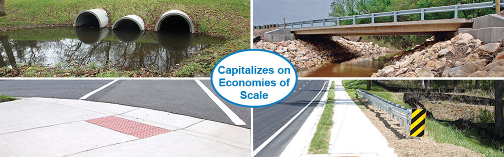
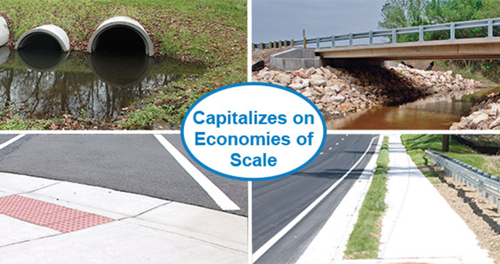
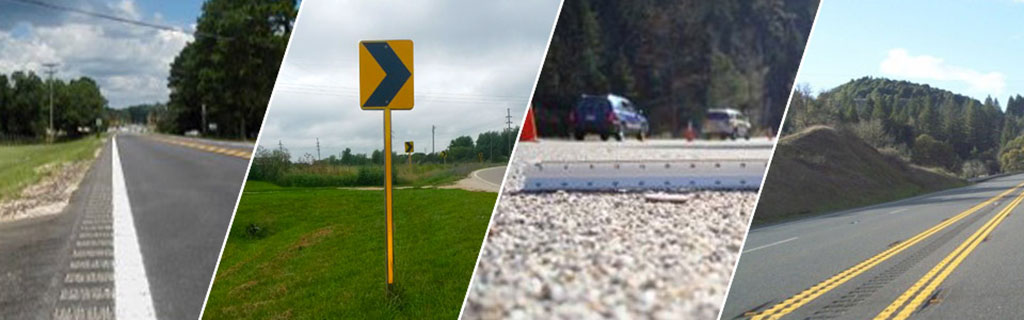
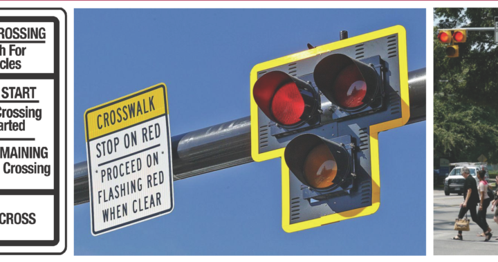
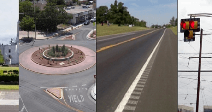
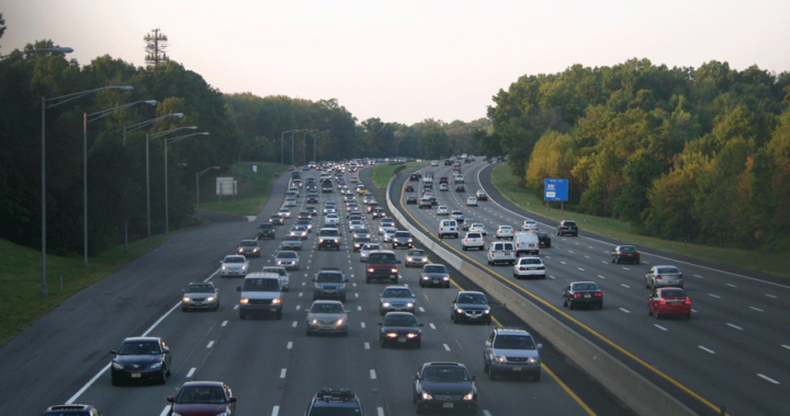
Reducing fatalities on rural roads is a key challenge for transportation agencies in the United States, where roadway departures on rural networks account for one-third of traffic fatalities. The Federal Highway Administration (FHWA) has identified safety countermeasures that are proven to improve rural roadway safety and reduce the number of traffic deaths. In the fifth round of the agency’s Every Day Counts (EDC) State-based model, FHWA identified “Reducing Rural Roadway Departures” as a proven, yet underutilized, innovation. The four pillars of the initiative are: all public roads, proven countermeasures, a systemic approach, and safety action plans. FHWA Proven Safety Countermeasures for rural roadway departures fall into three broad categories: helping drivers stay in their lane, reducing the risk of a crash with lane departures, and minimizing the severity in the case of a crash. Specifically, FHWA safety countermeasures related to rural roadway departures include rumble strips and stripes, SafetyEdgeSM, high friction surface treatment, and backplates with retroreflective borders. A recent FHWA video, Focusing on Reducing Rural Road Departures, provides information on how these low-cost measures help drivers stay in their travel lanes and reduce the potential, or minimize the severity, of rural roadway crashes.

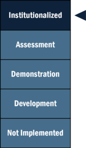
Through EDC, FHWA seeks to support rapid deployment of identified initiatives at the State and local level, which results in cost, time, and resource savings. As of December 2019, New Jersey is in the “development” phase of the Reducing Rural Roadway Departures initiative; NJDOT is collecting guidance and best practices, while building support with partners and stakeholders to develop an implementation process. The goal is to reach the “demonstration” stage by the end of EDC-5 (December 2020), when they would begin testing and piloting the innovation.

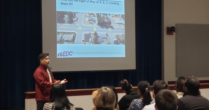
In order to achieve this goal, NJDOT seeks to improve the knowledge of rural roadway facility owners and maintainers through training, with the assistance of the FHWA Resource Center. In 2018 and 2019, FHWA and NJDOT hosted a series of Local Safety Peer Exchanges at which engineering staff from Cumberland and Somerset counties shared their experience with implementation of countermeasures on high risk rural roads (HRRR).

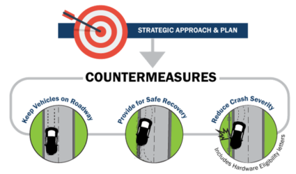
FHWA’s Strategic Approach and Plan to reduce roadway departure crashes and fatalities. Photo Source: FHWA, 2019.

The Cumberland County Engineering Office manages infrastructure that includes 540 miles of county roads, 50 traffic signals and flashers, 54 bridges, and 169 minor bridges. One important source of funding for their work is the Highway Safety Improvement Federal-aid Program (HSIP). The purpose of HSIP is to achieve a significant reduction in highway fatalities and serious injuries on all public roads, using a data-driven, strategic approach focused on improving performance. The County focuses on two types of projects for HSIP: systemic projects and “hot-spot” projects. Systemic projects apply a given improvement method over a large number of applicable locations in order to deter “random” crash events and reduce risk across an entire roadway system.

Hot-spot projects need more in-depth data collection and analysis to determine appropriate site-specific improvements related to crash history. To collect data for hot-spot projects, South Jersey Transportation Planning Organization (SJTPO), the regional Metropolitan Planning Organization (MPO) for Cumberland County, worked with Rutgers University’s Center for Advanced Infrastructure and Transportation (CAIT) to use NJDOT’s Plan4Safety multi-layered decision support tool to create four network screening lists for the region. Each list provided weighted scores for a given timeframe based on a location’s number and severity of crashes. The four screening lists identify pedestrian intersection hot spots, pedestrian corridor hot spots, intersection hot spots, and HRRR hot spots.

Selecting the appropriate countermeasure is critical to project success. When using network screening lists, the countermeasure should address the particular type of crash occurring at the location, while countermeasures used with the systemic approach should address the specific geometric trait(s) that are related to the specific crash type.

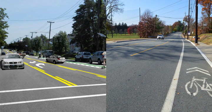
Cumberland County highlighted two countermeasures at the Peer Exchange: centerline rumble strips and high friction surface treatment on horizontal curves. Centerline rumble strips reduce the risk of cross centerline crashes and are often part of a systemic approach. With the help of NJDOT’s Bureau of Transportation Data and Safety, SJTPO created a candidate list of potential centerline rumble strip locations. NJDOT’s criteria limit installation to two-lane urban or rural roadways with a 20-foot minimum pavement width, and a speed limit of 35 mph or greater. In addition, Cumberland County limited installation to asphalt roadways 10 years old or less in less dense residential neighborhoods due to the noise the rumble strips produce. Based on these criteria, the County selected approximately 150 roadway miles across 11 municipalities. Installation was performed at night to lessen the impact on traffic, improve safety conditions for construction workers and inspectors, and shorten installation time.

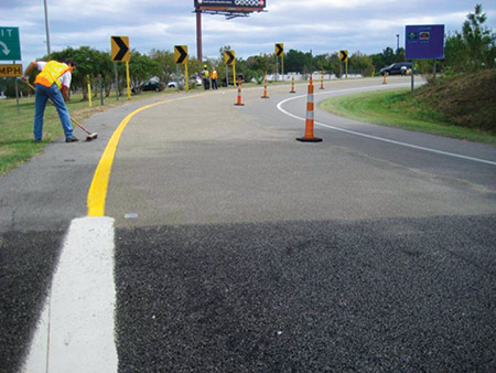
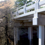
HFST installation at a horizontal curve. Photo Source: FHWA, 2018.

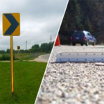
The second method, high friction surface treatment (HFST) on horizontal curves, addresses the challenges that horizontal curves pose due to the change in alignment that can cause issues for driver navigation, especially at night or in inclement weather. According to data analysis cited by SJTPO, 28 percent of fatal crashes nationwide occur on horizontal curves. HFST compensates for the high friction demand at the curves in areas where the current pavement condition does not adequately support operation speed, due to a number of factors such as sharp curves, wet conditions, polished roadway surfaces, inadequate cross-slope design, and driving speeds above the curve advisory speed. HFST are proven to reduce wet road crashes by 52 percent and curve crashes by 24 percent according to the FHWA. Additionally, these treatments are safe for all vehicle types and have high durability. However, the county engineer also noted the high unit cost and the lack of contractors within the region capable of HFST installation. When properly installed, the pavement life is equal to, our greater than, asphalt pavement but improper installation potentially limits the usefulness and life expectancy of the pavement treatment.

Locations were selected from the HRRR list, along with spots familiar to the Engineering Department based on geometry, crash history, residential input, and municipality information. Additionally, pavement condition was taken into consideration as a factor that could affect the treatment’s durability.

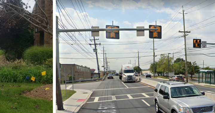
Cumberland County staff highlighted the importance of updating and upgrading existing safety features during the project such as size, location, spacing, and retroreflectivity of signage. They noted important considerations moving forward: data used in the network screening lists is aging; the rumble strip projects had a long delivery timeline of 22 months from application submission to construction notice to proceed; and the centralized project review process eliminated interactions with the local public agency which tends to have the most detailed knowledge of the project area.

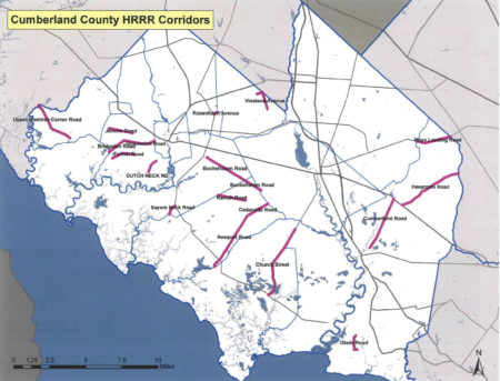
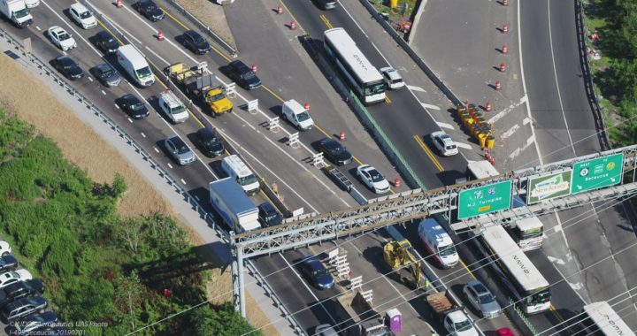
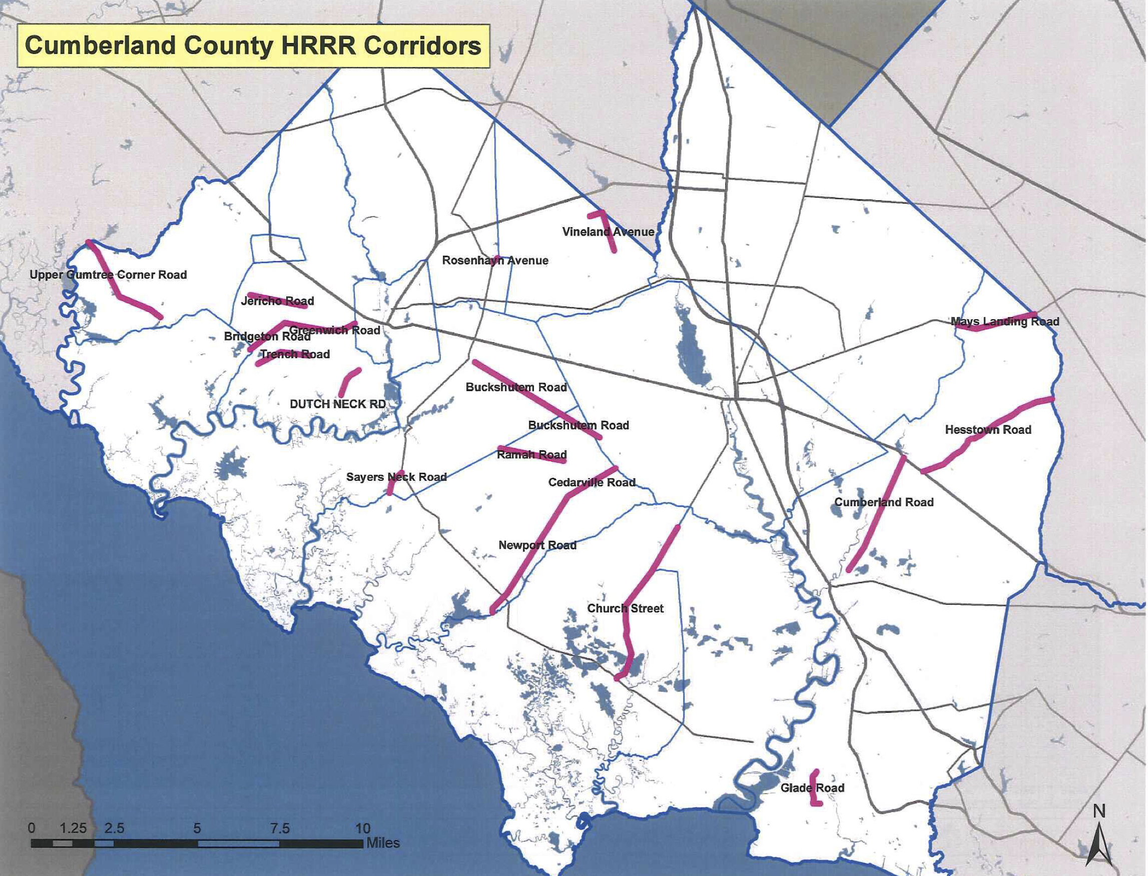
Cumberland County High Risk Rural Roads Locations in Cumberland County. Photo Source: Whitaker, 2018.

A representative of the Somerset County Engineering Office shared their systemic safety approach to horizontal curves with high friction surface treatment. The Engineering Office manages infrastructure for 250 miles of county roads, 193 traffic signals, and 762 bridges, along with county sites, facilities, and parks. Annually, their work includes 15 miles of road resurfacing, 1.2 miles of road reconstruction, 7 bridge replacements, installation or upgrade of 10 traffic signals, and replacing more that 150 ADA curb ramps. The catalyst to pursue pavement friction treatments was the availability of crash data from the Plan4Safety crash database, which allowed Somerset County and their MPO, North Jersey Transportation Planning Authority (NJTPA), to analyze crash trends in the region in order to plan for infrastructure improvements based on need and types of issues.

Based on this analysis, the county identified and prioritized horizontal curves where they decided pavement friction treatments would be the best countermeasure. The next questions they had were: what is the correct treatment method; when is treatment appropriate; and how do they determine the length of need on the horizontal curve. Initially, the county used micro milling which provides a high friction surface to reduce “run-off’ road crashes for a low cost of installation. Downsides for the treatment include a short life expectancy, complaints from motorcyclists and bicyclists, and negative public perception associated with milling a newly paved surface.

Based on this experience, the county turned next to high friction surface treatment as an option that is safe for all vehicle types and has a longer life expectancy than micro milling. As did Cumberland County, Somerset County noted the treatment’s high cost at $35-65 per square yard and the specialized nature of the installation. Somerset County’s evaluation method for determining when HFST should be used requires the following data: centerline alignment geometry, roadway cross slope, road profile slope, posted speed limit, and posted curve advisory plate speed. The resulting evaluation produces friction ranges to guide the action taken.

Initial micro milling treatment in Somerset County. Photo Source: Bates Smith, 2017.

Somerset County found a comparison of crashes in the years prior to the treatment with crash data from the year after the treatment revealed a significant reduction in crashes, although they cautioned that there may be other factors at play. In the case of Chimney Rock Road, annual crashes dropped 84 percent from 73 to 12 for the year after HFST was applied to 5 curves on a 1-mile road segment. Looking to the future, the county plans to prioritize high crash locations for evaluation to either implement additional signage or HFST, based on data from GIS crash mapping, along with the NJ Regional Curve Inventory and Safety Assessment for the NJTPA region. They additionally highlighted important resources that have emerged, including the FHWA’s HFST Curve Selection and Installation Guide.

Cumberland and Somerset counties are just two examples of rural roadway departure safety improvements happening around the state. In the NJTPA region, Monmouth County received $2,967,000 from NJTPA’s FY 2017-18 High Risk Rural Roads (HRRR) Program for corridor improvements on Stage Coach Road in Upper Freehold Township, including the application of high friction surface treatment, safety edging, and centerline rumble strips. To help support and expand these efforts, NJDOT will be holding train-the-trainer events at DVRPC, SJTPO, and NJTPA later this year for county and municipal representatives, MPO staff, and NJDOT staff. This training will help New Jersey advance to the next stage of this EDC-5 initiative and improve safety on rural roads throughout the State.

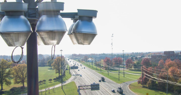
Featured Image Source: FHWA, 2016.

Resources

Bates Smith, P. (2019). Pavement Friction Surface Treatments. Retrieved from https://www.njdottechtransfer.net/wp-content/uploads/2019/04/E_Somerset-PAVEMENT-FRICTION-surface-treatments-3-21-19.pdf

FHWA. (2019). Reducing Rural Roadway Departures. Retrieved from https://www.fhwa.dot.gov/innovation/everydaycounts/edc_5/roadway_departures.cfm

FHWA. (2020). Proven Safety Countermeasures. Retrieved from https://safety.fhwa.dot.gov/provencountermeasures/

FHWA. Focus on Reducing Rural Roadway Departures (FoRRRwD) Overview Video. (2019). Retrieved from https://www.youtube.com/watch?v=WfdBrrl0WwU&t=87s

NJTPA. (2020). Local Safety Program/High Risk Rural Roads. Retrieved from https://www.njtpa.org/localsafety.aspx

SJTPO. (2020). Highway Safety Improvement Program – Safety Infrastructure. Retrieved from https://www.sjtpo.org/hsip/

Whitaker, D. W. (2018). Systemic Safety Improvements. Retrieved from https://www.njdottechtransfer.net/wp-content/uploads/2018/06/Cumberland-Systemic.pdf

Final Report Released for the Connected Vehicles Program Pilot Testing of Technology for Distributing Road Service Safety Messages from Safety Service Patrols

NJDOT’s top priority is to improve highway safety. To support this goal, in September 2018, New Jersey began a pilot study of the effectiveness of using connected vehicle technology to alert the motoring public to the presence of safety service patrol (SSP) workers at incident sites.  With the support of the NJ State Innovation Council (NJ STIC) and a STIC Incentive Funding grant of $39,600 awarded by FHWA, NJDOT piloted the use of Beacon Hazard Lights technology on 32 safety service vehicles to alert drivers to the presence of workers via the mobile navigation app Waze. The device, which is produced by iCone, uses GPS location and wireless communication technology to transmit the location of the SSP vehicles to the iCone Data Server in the cloud where it can be picked up by Waze. Together with the New Jersey Institute of Technology’s (NJIT) ITS Resource Center, NJDOT published a final report of their findings from the pilot project in December 2019, available here.

The SSP location and message shown on the Waze.com website. Photo Source: Cowan et al., 2019.

The primary goal of the study was to test the feasibility of the iCone technology on SSP vehicles by analyzing the time elapsed between device activation and Waze notification, to examine the Verizon 4G cellular network strength for potential coverage loss that could result in service disruption in communication, and to analyze the effectiveness of the equipment through several testing means. The methods of evaluation to complete these objectives were field and remote testing of the technology and documentation of the equipment installation and repairs. Field testing was conducted from January to October 2019 by activating the iCone-enabled SSP truck hazard lights and Dynamic Message Board (DMS) at 2-mile intervals along the entire 280-mile SSP coverage area. An analyst conducted remote testing through monitoring of the iCone and Waze web-based interfaces.

The results of field testing showed that, on average, communication with Waze was successful 76 percent of the time, 20 percent of the time the device communicated with the iCone Data Server but not Waze, and the remaining 4 percent of the time the device did not transmit its location to the iCone Data Server or Waze. The average time elapsed from the iCone device activation to its appearance in Waze was 2 minutes and 41 seconds. On two days of testing along the SSP coverage area, there was no communication between the iCone device and iCone Data Server or Waze.

In addition to field testing, analysts conducted remote testing of 85 active instances of the iCone device by observing the iCone and Waze web portals. In 59 percent of these 85 instances, the active iCone device was detected in Waze, with 29 percent of these successful detections showing the exact timestamp in both Waze and iCone. These results were shared with Waze so that the company could address the issues related to missing and delayed data transmission. For equipment evaluation, results showed that by April 2019, 12 of the units had technical problems that were attributed to the winter weather conditions in New Jersey including snow, road salt, and extreme cold. The iCone engineering team was responsive to the issues and re-evaluated the device design so that replaced units could withstand the weather conditions. A prototype of the newly-designed replacement devices was delivered to NJDOT in December 2019 and has been installed in five of the vehicles.

The installation of the device on an SSP vehicle by an iCone technician. Photo Source: Cowan et al., 2019.

The researchers believe that this technology evaluation pilot project was the first of any state DOT to seek to inform the public of SSP patrol vehicle locations with the sole objective of increasing safety.  The pilot project provided valuable analysis and lessons learned to inform next steps for NJDOT. Testing and analysis of installed devices and their replacements will continue until the end of the product warranty period on September 1, 2021. Additionally, researchers recommended further investigation of the disruptions and delays in the communication path from the iCone device to Waze.  Additional coordination with each technical partner during the steps of the testing process could help to identify the cause of service disruptions.

During the study, NJIT and iCone were unable to obtain Waze data showing how many people clicked the “thumbs up” to the message on the app. Future analysis should investigate how to gather reactions of the motoring public to Waze notifications. The researchers recommended exploring partnerships with crowdsourcing GPS navigation providers to further learn how drivers are reacting, which should include a data transfer process and strategies for reducing latency between iCone data server and Waze.

The Final Report contains additional information on the purpose of the research, the role of various stakeholder organizations in the research, a description of the technology devices and tools procured and used in the research, and the evaluation results.  The Final Report was submitted to the FHWA and is available to review here.

Featured Image Source: NJDOT, 2019.

Data-Driven Safety Analysis: New Jersey Case Study

The New Jersey Department of Transportation (NJDOT), in partnership with the Delaware Valley Regional Planning Commission (DVRPC) and Burlington County officials, used predictive safety analysis tools to help secure funding for a modern roundabout at a rural intersection.  The intersection of county road 528 and county road 660 in Chesterfield Township had experienced severe crashes and had been identified for improvement in a prior study conducted by the DVRPC. However, state or county construction funding was not available. The team decided to apply for Highway Safety Improvement Program (HSIP) funding. However, HSIP requires a thorough safety analysis of projects before funding approval to ensure the chosen design provides the best benefit/cost ratio.

The analytical effort was recognized by the Federal Highway Administration in both a case study with links to several useful resources and the below video.

FHWA highlighted the data-driven safety analysis used by NJDOT and partners to select a roundabout.

Drone Program Reaches New Heights, Seeks to Go Higher

In May 2016 the New Jersey Department of Transportation’s Division of Multimodal Services established the Unmanned Aircraft Systems (UAS) Program as a unit within the Bureau of Aeronautics.  The UAS program coordinator position was created within the Bureau of Aeronautics to lead NJDOT’s UAS initiatives. This position was established to provide leadership, guidance, and coordination for division flight operations. Other responsibilities of the position include ensuring compliance with state and federal aviation regulations, coordinating FAA airspace waivers and authorizations, assisting RFP efforts when contracting consultants, and informing NJDOT of public perception and liability.

In standing up the program, a survey was distributed to all other NJDOT Divisions to identify potential missions that could benefit from the integration of UAS. The 38 survey responses were analyzed and condensed into common mission categories such as structural inspections and construction project management. The missions were also evaluated to determine whether the use case had the potential to improve safety, increase efficiency, save time and save money for their routine operations. A suitable mission profile was developed and risk analysis conducted to create pilot projects for testing.

An early NJDOT study revealed the cost-effectiveness of high mast light pole inspections

UAS brings new tools forward for 3-D “Reality Modeling” with photogrammetry.

Initially, pilot project flights were conducted in support of structural evaluations, construction project management, traffic management, and watershed evaluations.   Valuable lessons were garnered from these initial pilot projects.  For example, a study of the benefits of using UAS for high-mast light pole inspections (HMLP) was shared with FHWA and a topic covered in NJDOT’s presentation at an invite-only national peer exchange held in Washington DC by the FHWA in 2018.

NJDOT’s UAS Coordinator, Glenn Stott, who had previously organized and hosted an NJDOT Peer Exchange on UAS, was invited to participate in the national peer exchange.  HMLP inspections, Stott observed, could be performed more quickly and less expensively than by traditional means. Cost savings include lost productivity due to the traveling public experiencing congestion issues. One advantage of UAS inspections is that they do not require shutting down a travel lane for a bucket truck to occupy. Furthermore, a UAS inspection only requires a crew of three to complete an inspection: two controllers: one pilot and one engineer, each with a camera and screen, and a third visual observer to monitor the site. Using this method, NJDOT was able to complete six or seven inspections per day compared with one or two using traditional methods, contributing to “significant” cost savings.

Going forward under EDC-5, the goal of the NJDOT UAS Program is the institutionalization of UAS technology and its integration throughout NJDOT operations. NJDOT hopes to leverage recently awarded STIC incentive funding to remove barriers in equipment and training toward advancing several potential use cases, including:

  • Survey Rendering of 3D Models. 3D modelling is a valuable tool that saves time and money by cutting person-hours and eliminating rework for transportation projects. 3D modeling of bridge decks and infrastructure is becoming a cost-effective inspection method for evaluating bridge decks to detect delamination in concrete. Using the right UAS technology, 3D modeling can rapidly determine the volume of stockpiles with a high degree of accuracy. Georgia DOT reports that that select UAS equipment can match GPS and LIDAR survey equipment and found the UAS reported volumes were within 1 percent of the traditional methods.
  • Watershed Resiliency. In March of 2018 NJDOT conducted several UAS photography missions along Routes 80 and 23 to support a Watershed Resiliency Analysis. Traditional photos were taken, but a thermal imaging capability would allow the NJDOT to more accurately determine the extent of flooding along our state highways. Thermal imaging overlays can more accurately define the extent of highway runoff and flooding issues. Thermal imaging is a better tool to detect water through the tall grass in flooded areas. Minnesota DOT has researched this use case and the NJDOT would like to expand on this research.

    Field tours demonstrate UAS capabilities to staff and partnering organizations.

  • Bat Counts Under Bridges. North Carolina is using infrared thermography to conduct counts on bat populations under bridges. New Federal regulations require state DOT’s to ensure they do not disturb a protected species while conducting inspections. The NJDOT Division of Environmental Resources has requested UAS assistance in conducting bat counts under bridges because they live in high and dark areas. A thermal imaging camera mounted on a UAS will confirm the presence of bats and should allow the counting of individual bats in near total darkness by detecting their body heat.
  • Thermal Inspections of Concrete Bridge Decks. Infrared thermography of bridge decks is becoming a valuable and cost-effective inspection method for evaluating bridge decks to detect delamination in concrete. The delamination photos can be rendered by addition of higher-end gaming computers into a 3D model that can be used to determine the exact location of each delamination.
  • Large Potholes and Longitudinal Joint Separations. The efficient identification of large potholes and longitudinal joints would require autonomous UAS that can be programmed to safely fly over long distances. Current regulations require small UAS to fly within the line of sight of the operator which makes this use case currently very inefficient and not cost-effective.
  • Thermal Imaging for Paving Project Management. DelDOT is examining the use of UAS to detect significant thermal anomalies during the laying of new asphalt. The UAS would take standard photographs and thermal photos of the same area. The photos would then be compared to detect potential quality issues in the new pavement. Sets of thermal and visual photos can be rendered through higher end gaming computers into a 3D model that can be used to generate a guide sheet to make it easier for work crews quickly find each problem area at the work site.
  • Construction Project Management. Several on-site inspectors, resident engineers, and traffic engineers have commented that the tiny UAS screen located on the UAS controller is difficult for a field team to view. A larger monitor mounted in the rear of the UAS Program vehicle can allow supervisors, upper management, and other non-participants to safely view UAS output in real time without interfering with the movement of the UAS crew.

Three years after its establishment, New Jersey’s UAS Program, continues to reach new heights as it discovers how it can effectively work with NJDOT’s divisions and bureaus to improve safety, increase efficiency, save time and save money in routine operations.  The UAS program challenges both the agency’s leaders and staff to adapt to new technologies, seek the training to develop new skills, and find new ways to collaborate to advance innovations in its transportation operations.