Connected Vehicles Program Pilot Testing of Technology for Safety Service Patrol Workers Continues

Video screenshot of hazard display message received

The rise of crowdsourced navigation applications and connected vehicle applications provide new opportunities to relay road service safety information to the motoring public.  NJDOT has initiated a Connected Vehicle: Road Service Safety Message pilot study that evaluates the effectiveness of using connected vehicle technology to alert the motoring public to the presence of safety service workers at an incident site. NJDOT is piloting the use of a Beacon Hazard Lights technology to alert drivers to the presence of workers when safety service vehicles turn on their hazard lights. The piloting of the technology has received the support of the NJ State Innovation Council (NJ STIC) and a STIC Incentive Funding grant of $39,600 awarded by FHWA.

The primary objective behind the initiative is to inform the public of the presence of Safety Service Patrol (SSP) personnel thru various services and applications that share real-time traffic and roadway information once they have responded to an incident or to help a motorist.  A short demonstration video of how a technology-equipped NJDOT safety service vehicle interfaces with crowdsourcing platforms in the field can be accessed here.

Periodic interim reports for the pilot study are being prepared to evaluate the technology’s application during the STIC grant period. Previously, NJDOT and New Jersey Institute of Technology (NJIT) personnel conducted a field evaluation of the technology following the device-equipped SSP vehicle then subsequently maintained a data log of the device’s activity in the field and through mobile and web-based interfaces.  In continuation of this effort, the NJIT team proceeded with a similar analysis by studying the correlation between the data recorded via the device log and the crowdsourced navigation applications web-based interface. In addition, the radio logs maintained by the Safety Service Patrol were used to further support this evaluation effort.


Local Safety Peer Exchanges: Summary Report

NJDOT, FHWA and NJDOT held a series of three Local Safety Peer Exchange events for municipal and county representatives to share best practices in addressing traffic safety.  These full-day events brought together representatives of NJDOT, FHWA, counties, municipalities, and Metropolitan Planning Organizations (MPOs) to discuss project prioritization, substantive safety, implementation of FHWA safety countermeasures, and use of a systemic safety approach.

The Local Safety Peer Exchanges Summary Report provides an overview of the event proceedings, including the presentations, workshop activities and key observations from the Local Safety Peer Exchanges held in December 2017, June 2018, and March 2019.

The Local Safety Peer Exchanges were funded, in part, though the use of a State Transportation Incentive Funding (STIC) grant.  The Local Safety Peer Exchange events are well-aligned with the FHWA Technology Innovation Deployment Program (TIDP) goal: “Develop and deploy new tools and techniques and practices to accelerate the adoption of innovation in all aspects of highway transportation.”  The focus of the Local Safety Peer Exchanges is also consistent with two of the FHWA's Every Day Counts (EDC-4) Innovative Initiatives: Safe Transportation for Every Person (STEP) which supports the use of cost-effective countermeasures with known safety benefits to address locations of fatal pedestrian crashes; and Data-Driven Safety Analysis (DDSA) that uses crash and roadway data to reliably determine the safety performance of projects.


On December 6, 2017 municipal and county representatives gathered to discuss best practices to address traffic safety. Topics discussed included NJ safety performance targets, use of Safety Voyager, substantive vs. nominal approaches to design, systemic vs. hot spot approaches to safety, and discussion of FHWA safety countermeasures.

The summary report provides documentation of the agenda, presentations, highlighted tools and model practices, and workshop activities for each of the Local Safety Peer Exchange events, including the December 2017 event.

EDC-4 Final Report Highlights Innovations

The EDC-4 Final Report highlights the results of round four of the Every Day Counts program to rapidly deploy proven innovations to enhance the transportation system. “Every Day Counts: An Innovation Partnership With States” documents progress in accelerating the implementation of 11 innovations in 2017 and 2018 and success stories from States across the country.  View the report’s maps and highlights to learn how innovation implementation was advanced across the country.

New Jersey’s use of “Ultra High Performance Concrete (UHPC)” for the Pulaski Skyway deck replacement in northern New Jersey is a featured “Innovation Spotlight” example in this national report.  The report highlights NJDOT’s use of precast deck panels connected with UHPC, stainless steel rebar, and a polyester concrete overlay to maximize the durability of the new deck and minimize the need for future repairs and traffic disruption.  The project is recognized as the largest user of UHPC to date in North America.  Moreover, in 2012, when NJDOT selected UHPC for the Pulaski Skyway only five other transportation agencies had used UHPC for bridge construction.  Since then, the skyway has served as an informative example for other agencies. NJDOT continues to use UHPC connections and completed five other bridges in 2018, bringing the State’s total to nine bridges.

An online version of the FHWA report is viewable here.


Local Peer Safety Exchange – 3rd Event

FHWA and NJDOT held a series of three Local Safety Peer Exchanges for municipal and county representatives to discuss local initiatives that demonstrate best practice in addressing traffic safety. The third of these peer exchanges was held on March 26, 2019. Topics discussed included NJ safety performance targets, use of Safety Voyager, substantive vs. nominal approaches to design, systemic vs. hot spot approaches to safety, and discussion of FHWA safety countermeasures, among others.

Make Your Mark

Safety Voyager

Project Screening

Data-Driven Safety Analysis

Pavement Friction Surface Treatments

A Municipal Perspective

Proven Safety Countermeasures

New Jersey To Expand Data-Driven Approach to Highway Safety Management

NJDOT is investigating a powerful set of tools to more effectively manage New Jersey’s roads and highways. The agency has been piloting a study of Safety Analyst, a software package used by state and local highway agencies to identify highway safety improvement needs and projects for funding. The New Jersey State Transportation Innovation Council (STIC) applied Federal Highway Administration’s STIC Incentive Program funding to purchase the Safety Analyst license and service units from AASHTOWare. Following the kickoff and first year, NJDOT has continued to fund the project through FHWA’s Highway Safety Improvement Program (HSIP).

According to AASHTOWare, Safety Analyst helps agencies “proactively determine which sites have the highest potential for safety improvement, as opposed to reactive safety assessment done conventionally” (SafetyAnalyst.org). The software automates procedures and assists agencies to implement the six main steps of the highway safety management (HSM) process—network screening, diagnosis, countermeasure selection, economic appraisal, priority ranking, and countermeasure evaluation. Safety Analyst features four tool modules to perform the six HSM steps:

  • Module one utilizes the network screening tool and identifies sites with potential for safety improvement
  • Module two provides the diagnosis and countermeasure selection tool, which establishes the nature of accident patterns at specific sites
  • Module three includes the economic appraisal and priority ranking tool, which evaluates cost considerations of countermeasures for a specific site
  • Module four provides the countermeasure evaluation tool, which allows users to conduct before and after evaluations of implemented safety improvements

A detailed explanation of the benefits and capabilities of these four modules can be found in a series of white papers available from AASHTOWare.

NJDOT’s plans for using Safety Analyst

After receiving funds for Safety Analyst, NJDOT began a pilot study in Burlington County using the software. The objective of this study is to determine a methodology for meeting statewide goals. Items under review include implementation methodology (i.e., the manner and locations of data collection) and the resource requirements (i.e., the time, effort, and cost of implementing the software). NJDOT plans to use the software to more efficiently allocate its resources, time, and funds to improve the state’s roadways. Previously, NJDOT screened roads by identifying equivalent property damage, based on average frequency and severity of crashes and, depending on the project list, other factors such as annual average daily traffic and bicycle/pedestrian generators. Using Safety Analyst, NJDOT anticipates identifying needed road improvement more comprehensively using additional variables, such as roadway volume and characteristics, driveway density, and lane widths.

According to NJDOT Bureau of Transportation Data and Support’s Peter Brzostowski, who is working with the Bureau of Data and Safety, the agency is exploring other innovative ways to gather data for Safety Analyst. Leading ideas include:

  • Encouraging collaboration among several NJDOT Bureaus for data collection, including Traffic Engineering, Mobility and Systems Engineering, and Access Management
  • Employing monitoring systems to capture data, e.g., using existing/new cameras and radar monitoring
  • Utilizing Model Inventory of Roadway Elements (MIRE) (i.e., the FHWA Roadway Safety Data Program’s recommended list of roadway and traffic elements critical to safety management)
  • Developing official NJDOT policy for data collection standards
Who’s using Safety Analyst?

Motor traffic on Garden State Parkway, New Jersey, photographed in the evening. Most of the cars are southbound, moving from New York to the suburban homes in New Jersey.

State transportation departments and partner educational institutions can use Safety Analyst. At least eleven U.S. states have Safety Analyst licenses—Arizona, Illinois, Kansas, Kentucky, Michigan, Missouri, Nevada, New Hampshire, Ohio, Pennsylvania, and Washington, as well as Ontario, Canada. Some examples of its use include:

  • Ohio DOT employed their Safety Analyst model to develop the Access Ohio 2040 Long-Range Transportation Plan, which utilized crash data from the statewide AASHTOWare Safety Analyst model to predict the future safety impacts of alternative networks.
  • Michigan DOT is using Safety Analyst and GIS tools to develop a work-order-based maintenance management system and is exploring how to integrate new data collection tools, such as Light Detection and Ranging, or LIDAR, into its use of the software. See this MDOT case study for more information.
  • At least eight universities, including United Arab Emirates University, have educational licenses to use Safety Analyst.

The Safety Analyst software tool requires access to a minimum set of data elements including roadway segment characteristics, intersection characteristics, ramp characteristics, and crash data. Agencies or institutions that do not have the ability to collect the minimum data will not be able to utilize Safety Analyst.

According to AASTHOWare’s project manager, Vicki Schofield, the states that have been part of the Highway Safety Improvement System, a multi-state database that contains crash, roadway inventory, and traffic volume, typically have sufficient data resources to utilize the Safety Analyst software. She noted, however, that “all states should be using Safety Analyst or something as robust and researched.” She offered that Safety Analyst is an ideal tool to begin to evaluate the data, even if a state has not completely collected the system data.

How states can begin implementing SafetyAnalyst

Ms. Schofield explained that to implement Safety Analyst effectively, states should work in partnership with other state and federal agencies to assign roles and responsibilities and leverage expertise and capacity. For example, the state transportation planning office can be used to collect roadway and attribute data; the state enforcement office (i.e., Division of Highway Traffic Safety in New Jersey) to compile crash data; the state IT office to manage secure access to databases; and the FHWA division office to connect the state agencies with other resources.

With the Safety Analyst tool, a state will be able to efficiently perform highway safety management—a data-intensive and statistically complex process—to better predict long-term levels of safety at various locations. The tool supports more effective decision-making and provides justification for expenditures of Highway Safety Improvement Program funds, resulting in greater benefits for New Jersey residents and drivers from every dollar invested.

According to Ms. Schofield, the cost for purchasing the software is relatively minor and the primary barrier to implementing Safety Analyst is the time it takes to ready the data-intensive tool for use. Regional or local universities may be able to help expedite implementation by performing tasks that a transportation agency cannot and to help ensure integrity of the tool.

The NJDOT Bureau of Transportation and Support reports that work on the Safety Analyst Pilot Study is almost complete.  The Pilot Study is expected to provide information on areas that need to be addressed when developing a full scale contract for the implementation and development of Safety Analyst on a statewide level.  The goal will be to maximize the benefit of Safety Analyst to NJDOT and to provide the necessary structure for a sustainable future for the program.

Sources

AASHTOWare. 2010. SafetyAnalyst: Software Tools for Safety Management of Specific Highway Sites:

Brzostowski, P. 2017. AASHTOWare Safety Analyst. Presentation to the New Jersey State Transportation Innovation Council. Winter Meeting.

Harwood, D. W., Torbic, D. J., Richard, K. R., & Meyer, M. M. 2010. SafetyAnalystTM: Software Tools for Safety Management of Specific Highway Sites. FHWA-HRT-10-063. Turner-Fairbank Highway Research Center.

LiSanti, D., and C. Trueman. 2018. CIA Safety Team. Presentation to New Jersey State Transportation Innovation Council. Summer Meeting.

LiSanti, D., and K. Skilton. 2018. CIA Safety Team. Presentation to New Jersey State Transportation Innovation Council. Fall Meeting.

NJDOT Awarded Accelerated Innovation Deployment Grant to Start Weather-Savvy Roads Pilot Program

The Federal Highway Administration has awarded NJDOT a $322,461 Accelerated Innovation Deployment (AID) Demonstration grant to “start a ‘weather-savvy roads’ pilot program to improve roadway safety and operational efficiency.”

Preliminary plans include equipping up to 20 NJDOT road maintenance vehicles with dash-mounted cameras and weather sensors, which will feed real-time data directly to NJDOT year-round. The data will support improved awareness of road conditions and faster response times during weather events.[1] New Jersey’s winter season includes frequent precipitation, making for slick road conditions and added congestion. The data retrieved from the cameras and sensors will help quicken operations and also enhance deployment of incident management strategies.

This is the first AID grant applied for through New Jersey’s State Transportation Innovation Council (STIC). This year, FHWA awarded $8.4 million to nine states for work on innovative highway and bridge projects to improve safety and operational efficiency.

Importance of Weather-Responsive Management Strategies

Weather effects on our nation’s roads have enormous social and economic costs. According to the FHWA, 1.2 million (or 21 percent) of the more than 5.7 million vehicle crashes over the past 10 years were weather-related. Nearly 6,000 people are killed and over 445,000 are injured in weather-related crashes each year. In terms of mobility, the weather is responsible for 25 percent of non-recurring delays as well as congestion costs of up to $9.5 billion per year for 85 urban areas[2] and $3.4 billion in freight costs.

To address these problems, states can implement weather-responsive management strategies, which have many benefits including reducing crash risks and delays, lowering negative environmental impacts by minimizing road salt use, and enabling travelers to make better driving decisions.

In recent years, the FHWA Road Weather Management Program has focused on using mobile observations and connected vehicle data to support traffic and maintenance management. States such as Nevada, Michigan, and Minnesota have already implemented winter maintenance/anti-icing strategies using “Integrating Mobile Observations” (IMO), which involves collecting weather and road condition data from government fleet vehicles. Pathfinder, another solution, is a collaborative strategy across state DOTs to disseminate road weather information for proactive transportation system management ahead of, and during, adverse weather events.

Every Day Counts and State Transportation Innovation Councils

The AID program works closely with the FHWA Every Day Counts (EDC) program to foster a culture of innovation. Every two years, FHWA works with state DOTs and other public and private stakeholders to identify new sets of innovative technologies that merit widespread deployment to address transportation challenges. State Transportation Innovation Councils (STICs) from all fifty states then meet to evaluate these innovations and lead deployment efforts.

Weather management was named a priority in recent years. In 2017-2018 the fourth round of EDC (EDC-4) cited11 innovations including “Road Weather Management – Weather-Savvy Roads.” In 2018-2019, EDC-5 identified 10 innovations including “Weather-Responsive Management Strategies.

See the FHWA’s Innovation Spotlight video on Road Weather Management: Weather Savvy Roads.

New Jersey Pilots Connected Vehicles Program to Protect Safety Service Patrol Staff

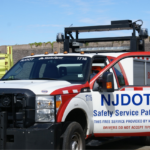
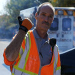
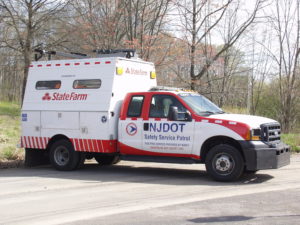
NJDOT safety service patrol vehicle. Source: NJDOT

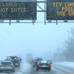
Each day New Jersey’s safety service patrol (SSP) workers put their own safety at risk to assist motorists in need and to assist other first responders. In addition to warning other motorists about recent traffic incidents, they remove disabled vehicles, provide gasoline, and perform vehicle repairs. Safety service patrol workers use temporary signage, traffic cones, flares, and portable variable message signs (PVMS), existing overhead message signs, the NJ511 phone and website systems as well as the SafeTrip application to warn motorists about their presence.

Unfortunately, collisions involving safety service patrol workers still occur. Cars often travel at excessive speeds near staff who work on the scene of such collisions. In 2015, the Federal Highway Administration (FHWA) reports that a work zone crash occurred once every 5.4 minutes in the United States. The impact of crashes can be catastrophic. Every day 70 work zone crashes occurred that resulted in at least one injury, while every week 12 work zone crashes occurred that resulted in at least one fatality. The NJDOT’s continued efforts to reduce work zone fatalities since the 1990s has resulted in one of the lowest rates in the nation. Despite this, at least one service worker has died in a New Jersey work zone each year since 2007. In 2016 seven fatal crashes occurred in New Jersey work zones, including the death of one service worker.

The automobile manufacturing industry is in the technology development phase of putting connected and automated systems fully in place.  Once deployed, first responders and/or their response vehicles would be detected by these systems to prevent crashes resulting from oncoming traffic.  Until those systems are deployed, the most used applications to alert motorists to roadside incidents, stopped police vehicles and other types of hazards is by Google, Waze, or HERE.

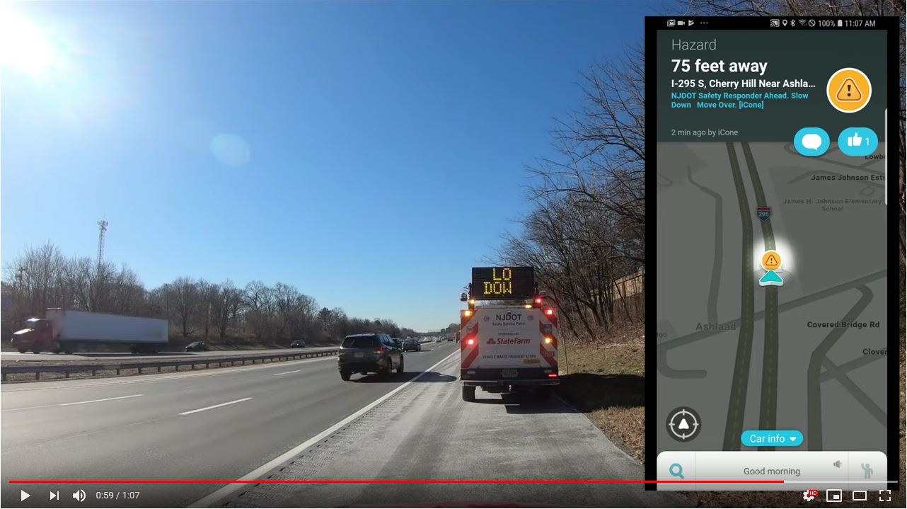
To help ensure the safety of service patrol staff, NJDOT has initiated a pilot study that will examine the effectiveness of using connected vehicle technology to alert the motoring public to the presence of safety service workers at an incident site. Starting in September 2018 NJDOT will pilot the use of a Beacon Hazard Lights technology to alert drivers to the presence of workers when safety service vehicles turn on their hazard lights. The piloting of the technology has received the support of the NJ State Innovation Council and a State Innovation Council Incentive Funding grant of $39,600 awarded by FHWA.  More information about the STIC Incentive Funding source can be found here.

According to Ross Scheckler, the managing partner of iCone, the product supplier for the hazard light technology to be piloted in the NJ study, the firm seeks to build technologies that will increase the availability of data about work zones to the traveling public.  Their tools alert drivers in real-time to the presence of workers, lane-closures and construction related back-ups by making them available on the cloud, where state traffic centers and navigations companies like HERE and Waze can pick them up.  A primary goal of the technology is to let drivers of vehicles know that the rescue truck or the flagger is in the road miles ahead so that the driver or the automation system can slow down and move over, or maybe choose a different route.

In the New Jersey pilot program, the iCone technology will transmit the location of worker vehicles within two minutes of the activation of a vehicle’s hazard lights. The location updates every 15 minutes and is re-transmitted if the vehicle moves more than 500 feet.

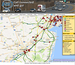
Data from 31 SSP vehicles will alert drivers via 511NJ as well as mapping & traffic apps

Thirty-one Safety Service Patrol (SSP) vehicles in Harding and Cherry Hill Yards will pilot iCone’s GPS technology to alert drivers using the 511NJ website and mapping, and traffic apps including Google Maps, Waze, and Here.  A Texas DOT study found that deploying iCone’s traffic beacons reduced crashes at a busy highway up to 45 percent (WorkZoneSafety.org). In addition, beacons deployed on roads resulted in crash cost reductions between $6,600 and $10,000 per night. Arlington is one of more than 450 partners including city, state and country government agencies, nonprofits and first responders to partner with the Waze Connected Citizen Partner program, a free data-share of publicly available traffic data, to deliver road and construction work information to cars.

Different states have used iCone’s technology in various ways, according to Mr. Sheckler. For example, Nevada has focused on relaying lane closures through iCone’s “Smart Arrow Board” modification product. Colorado on the other hand, has focused on the location of traffic cones around work zones through the ‘iPin’ product.  New Jersey’s initiative will examine the effectiveness of iCone’s technology on service patrol vehicles.

One benefit of the approach being tested is that the data appears to be comparatively low-cost and effective in reaching the traveling public through available traffic flow applications.  Mr. Scheckler, iCone’s product supplier representative, notes that most states can quickly accommodate to the data flow that the firm produces since the data feed is modeled off the Waze format.  “When states aren’t ready to integrate the data flow, the data still goes out to millions of cars through partners like Waze, HERE and Panasonic. This works so well that in states that haven’t started picking up the feed, we still have contractors using our equipment because they want their workers to show up in the car.”

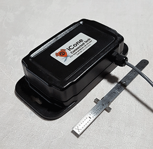
iCone’s Vehicle Hazard Light Radio Adaptation GPS device. Source: iCone

In New Jersey, one of the program’s goals is to enhance awareness of the State’s Move Over Law enacted in 2009. The law requires a driver who sees an emergency safety vehicle to approach cautiously and, if possible, make a lane change into a lane not adjacent to the emergency vehicle. Emergency safety vehicles include those operated by fire or police departments, ambulance services, tow trucks and highway maintenance or emergency service vehicles, many of which display flashing yellow, amber or red lights. Drivers must create an empty lane of traffic or prepare to stop, if possible, or face fines of no less than $100 and a much as $500.

NJDOT plans to evaluate the success of the program during Year 1 and determine interest and opportunities for collaboration with transportation agencies in other states and first responder organizations. NJDOT is part of TRANSCOM (XCM), a coalition of 16 transportation and public safety agencies that improves communication and technology by the use of traffic and transportation management systems and in partnership with technology companies. XCM currently provides NJDOT incident data to Google, Waze, and Here as well as the 511NJ web and phone platform, however SSP vehicle location data is not integrated into any of these programs.

Sources:

Cowan, S. (2018). Spring 2018 STIC presentation: Connected Vehicle — Road Service Safety Messages. Retrieved from: https://www.njdottechtransfer.net/wp-content/uploads/2018/04/CIA-Team.pdf

Hsieh, E. Y., Ullman, G. L., Pesti, G., & Brydia, R. E. (2017). Effectiveness of End-of-Queue Warning Systems and Portable Rumble Strips on Lane Closure Crashes. Journal of Transportation Engineering, Part A: Systems, 143(11), 04017053. Retrieved from:  https://ascelibrary.org/doi/abs/10.1061/JTEPBS.0000084

National Work Zone Safety Information Clearinghouse. (c2016). 2016 New Jersey Work Zone Fatal Crashes and Fatalities. Retrieved from https://www.workzonesafety.org/crash-information/work-zone-fatal-crashes-fatalities/#new%20jersey

Ullman, G. L., Iragavarapu, V., & Brydia, R. E. (2016). Safety effects of portable end-of-queue warning system deployments at Texas work zones. Transportation Research Record: Journal of the Transportation Research Board, (2555), 46-52. Retrieved from https://doi.org/10.3141/2555-06

Local Safety Peer Exchange – 2nd Event

FHWA and NJDOT are holding a series of three Local Safety Peer Exchanges for municipal and county representatives to discuss local initiatives that demonstrate best practice in addressing traffic safety. The second of these peer exchanges was held on June 13, 2018. Topics discussed included NJ safety performance targets, use of Safety Voyager, substantive vs. nominal approaches to design, systemic vs. hot spot approaches to safety, and discussion of FHWA safety countermeasures, among others. The third event will be held in Fall 2018.

Make Your Mark

Data-Driven Safety Analysis

Proven Safety Countermeasures

A Municipal Perspective

Systemic Safety Improvements

Project Screening

Safety Voyager

Road Diets Are Making Roads Safer in New Jersey

Across the country and in some New Jersey municipalities (at least 50 in the last six years), road diets have been implemented as a low-cost safety countermeasure for motorists and non-motorists alike by reducing travel lanes, vehicle speeds and freeing up space for bicycles and pedestrians. Road diets are recognized by the Federal Highway Administration (FHWA) as one of twenty “Proven Safety Countermeasures” to reduce serious injuries and fatalities on American highways and roads.

According to the FHWA, a road diet most commonly involves converting an existing four-lane undivided roadway to a three-lane roadway consisting of two through lanes and a center two-way left-turn lane.

Digitally-enhanced photo shows potential changes for Livingston Avenue in New Brunswick. From Costs and Benefits of a Road Diet Conversion, 2015.

Implemented across the US for at least two decades, road diets have become standard practice and increasingly widespread as their benefits, including economic development, have become popularized. Studies indicate a 19-47% reduction in overall crashes when a road diet is installed on a four-lane undivided facility. For some roadways, these improvements have reduced crashes by up to 70% (See Reston, Virginia case study).

In New Brunswick, a partial road diet has been installed on Livingston Avenue, prompted by concerns expressed by many residents in 2014 when three children in a crosswalk were struck by a vehicle. There are plans for a complete road diet in the future. According to the Middlesex County Engineer’s Office, the project is currently obtaining federal aid and state approval to begin work. This road diet was supported by a cost-benefit evaluation that found the benefits of safety improvements would overwhelmingly exceed the costs over a 20 year period.

In Burlington City, NJDOT implemented a road diet on Route 130 to create a buffer for vehicles and pedestrians after many years of work with local officials. For six consecutive years, the Tri-State Transportation Campaign named Route 130 as the state’s most dangerous road for walking with 11 pedestrians killed by vehicles between 2012 and 2014. These hazardous conditions particularly affected students, who had to cross the divided highway to get to Burlington High School. The death of 17-year old Antwan Timbers, a sophomore at the school, inspired classmates to fight for safer streets around their school and state with the “25 Saves Lives” campaign, which advocated for legislation to reduce speed limits to 25mph near school zones along Route 130. The road diet reduced the roadway from six lanes to four lanes. Large “School Speed Limit 25mph” signs and “No Turn On Red” signs were also installed at busy intersections. Additional improvements are planned for the spring of 2018.

Passaic County’s road diet in Wayne has resulted in reduced dangerous crashes.

In Woodbury, NJDOT converted Route 45, a multi-lane roadway into a road with one travel lane in each direction, a left turn lane and bicycle lanes. According to the FHWA, the roadway was plagued with excessive speeding, improper lane changes, parking difficulties, and safety concerns. The road diet succeeded in reducing crashes and vehicle speeds while helping pedestrians feel safer. The improvements had no negative effect on emergency vehicle response times, which had been an initial concern of the Woodbury Police.

Passaic County has been active in installing road diets on several of their oversized suburban throughways. In 2016, case study research examined more closely the approaches that the County had taken and explored the lessons that they learned and some outcomes of implementing successful road diet projects. For 2018, the County is working with the North Jersey Transportation Planning Authority to bring road diets to three additional corridors – including narrowing a roundabout.

In Ewing, NJDOT and Mercer County and other local partners are conducting a study to identify and recommend improvements to make Parkway Avenue, near NJDOT headquarters, a safer corridor. Parkway Avenue was one of two corridors (out of 99 potential locations) identified as a feasible, suitable and beneficial location to implement a road diet in NJDOT’s 2015 Road Diet Pilot Program. The public may keep up to date and share input on the Parkway Avenue Safety website.


See more information on how road diets work, the benefits they provide, and New Jersey case studies:

Drone Program Takes Off in Bureau of Aeronautics

The Drone program within the Division of Multimodal’s Bureau of Aeronautics has begun to take shape as staff, funding, and a multitude of innovative ideas have come together. So what does it take to start a new and innovative NJDOT Drone program when it has never been done before? First, it starts with knowledgeable staff. A UAS (Unmanned Aerial Systems) Coordinator position was created within the Bureau of Aeronautics to lead NJDOT’s UAS initiatives. The UAS Coordinator’s role is to:

  • Provide leadership, guidance, and coordination for flight operations to Divisions
  • Ensure compliance with State and Federal Aviation Regulations
  • Ensure flight operations are based on the most current best practices
  • Coordinate FAA Airspace Waivers and ATC Authorizations
  • Develop Implementation and Staff Training Plans
  • Assist with the drafting of RFP’s for consultants
  • Keep NJDOT informed of public perception and liability

Captain Glenn Stott is the current UAS Coordinator for the NJDOT. He is a retired Canadian Air Force jet instructor, Test Pilot, and Flight Commander. Glenn is an FAA designated examiner and authorized to grant the highest level of pilot license. In addition to his aviation experience, Glenn’s understanding of emerging technologies earned him part-time positions as an Adjunct Technology Professor for both Kean and Seton Hall Universities. Glenn’s UAS background started over 20 years ago with remote control helicopters. Currently, he serves on the NASAO (National Association of State Aviation Officials) UAS Committee and is a frequent speaker regarding drone technology in the transportation industry.

Funding was the next big issue in setting up a new program of this caliber. NJDOT applied for three FHWA grants and was fortunate enough to be awarded all three. These three separate grants are: FHWA Tech Transfer Deployment Funds for a UAS Peer Exchange on Best Practices, FHWA State Transportation Innovation Council (STIC) Incentive program for equipment & training, and FHWA State Planning & Research Program for Best Practices, Policies and Procedures.

Runway 32 Taxiway construction at Eagles Nest Airport, West Creek, NJ. Photographed by Glenn Stott via drone

Runway 32 Taxiway construction at Eagles Nest Airport, West Creek, NJ. Photographed by Glenn Stott via drone

There are numerous potential areas for public use in transportation where UAS technology makes sense that many New Jerseyans may not be aware of. Some of the initiatives being explored are:

  • Traffic Incident Management
  • Structural Inspections
  • Traffic Congestion Assessment
  • Aerial 3D Corridor Mapping
  • 3D Reality Modeling from Photogrammetry
  • Emergency Response Assessment
  • Real-time Construction Project Management
  • Landfill volume calculations
  • Inspections of confined or hazardous spaces

Professional UAS operations possess many advantages over traditional methods for daily operations. Some of these advantages include a relatively low cost compared to the manpower, time and equipment traditionally used, rapid deployment, a very low carbon footprint, and the ability to operate in areas that are risky or dangerous to humans. For example, NJDOT owns and operates 250 High Mast Light Poles (HMLP) near NJ roadways. HMLPs are approximately 100-feet high, and are traditionally inspected with either binoculars or bucket trucks. While there is an inherent safety risk in performing inspections so high up near a busy roadway, UAS can alleviate this risk by providing upclose inspection of HMLPs. In addition to the safety advantage, UAS provide a higher quality inspection with closer views, higher definition photos, and with less disruption to traffic as the need for a lane closure is eliminated. To date, 241 out of 250 NJDOT HMLP inspections have been successfully completed with UAS, and photo logs have been created to identify and track problem areas. UAS structural inspection does not replace the human inspector, it is simply a tool used by the inspection team to identify potential problem areas that require closer examination.

Dredging project in Brigantine, Atlantic County. Photographed by Glenn Stott via drone

Beach Replenishment in Manasquan, NJ. Photographed by Glenn Stott via drone

NJDOT UAS projects are selected and pursued based on the opportunity to increase safety, increase efficiency, save money, and save time. Projects at this time range from collecting aerial photos over marshlands that cannot be traversed on foot, to aerial photos and videos of dredging projects at all stages in order to view the direction of the tide as well as the shoals and shallows. Drones are also being used to create 3D models that offer representation of a site and surface elevation. For example, a drone has been used to map a section of Route 26 to evaluate the potential of creating 3D maps for surface surveys. Areas are still being surveyed by hand in order to evaluate the accuracy of the drone survey elevations and calibrate the systems. 3D “Reality Modeling” with Photogrammetry provides real-world models for conceptual design, construction, and operational decisions, using simple photography rather than expensive LIDAR. 3D models created using drone Photogrammetry can be assessed and shared in CAD or GIS. The Association for Unmanned Vehicle Systems International (AUVSI) released their 2017 Economic Impact Report that estimates in the first 3 years of integration more than 70,000 jobs and 13.6$ billion economic growth for the United States. By 2025 they estimate 100,000 jobs created and an economic impact of $82 billion. As you can see, the possibilities for the use of UAS are numerous and innovative. The Bureau of Aeronautics looks forward to pursuing projects that enhance safety, efficiency, and cost-effectiveness for NJDOT in a variety of areas.

Contributed by Glenn Stott & Kinan Tadmori
Feature image (above) is a High Mast Light Pole on Route 1, Mercer County. Photographed by Glenn Stott
This article first appeared in the December 2017 CIPGA Scoop, the employee newsletter of the [NJDOT] Capital Investment, Planning and Grant Administration.