

In May 2016 the New Jersey Department of Transportation’s Division of Multimodal Services established the Unmanned Aircraft Systems (UAS) Program as a unit within the Bureau of Aeronautics. The UAS program coordinator position was created within the Bureau of Aeronautics to lead NJDOT’s UAS initiatives. This position was established to provide leadership, guidance, and coordination for division flight operations. Other responsibilities of the position include ensuring compliance with state and federal aviation regulations, coordinating FAA airspace waivers and authorizations, assisting RFP efforts when contracting consultants, and informing NJDOT of public perception and liability.
In standing up the program, a survey was distributed to all other NJDOT Divisions to identify potential missions that could benefit from the integration of UAS. The 38 survey responses were analyzed and condensed into common mission categories such as structural inspections and construction project management. The missions were also evaluated to determine whether the use case had the potential to improve safety, increase efficiency, save time and save money for their routine operations. A suitable mission profile was developed and risk analysis conducted to create pilot projects for testing.
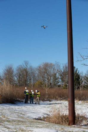
An early NJDOT study revealed the cost-effectiveness of high mast light pole inspections
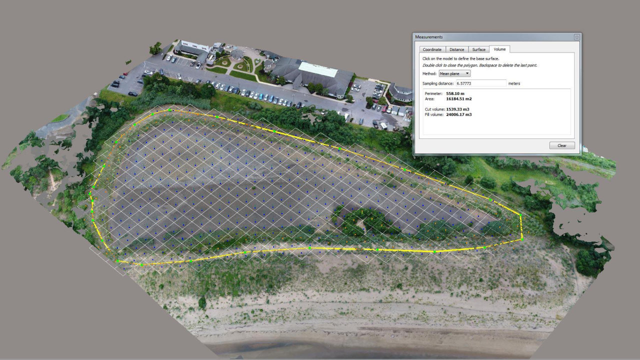
UAS brings new tools forward for 3-D “Reality Modeling” with photogrammetry.
Initially, pilot project flights were conducted in support of structural evaluations, construction project management, traffic management, and watershed evaluations. Valuable lessons were garnered from these initial pilot projects. For example, a study of the benefits of using UAS for high-mast light pole inspections (HMLP) was shared with FHWA and a topic covered in NJDOT’s presentation at an invite-only national peer exchange held in Washington DC by the FHWA in 2018.
NJDOT’s UAS Coordinator, Glenn Stott, who had previously organized and hosted an NJDOT Peer Exchange on UAS, was invited to participate in the national peer exchange. HMLP inspections, Stott observed, could be performed more quickly and less expensively than by traditional means. Cost savings include lost productivity due to the traveling public experiencing congestion issues. One advantage of UAS inspections is that they do not require shutting down a travel lane for a bucket truck to occupy. Furthermore, a UAS inspection only requires a crew of three to complete an inspection: two controllers: one pilot and one engineer, each with a camera and screen, and a third visual observer to monitor the site. Using this method, NJDOT was able to complete six or seven inspections per day compared with one or two using traditional methods, contributing to “significant” cost savings.
Going forward under EDC-5, the goal of the NJDOT UAS Program is the institutionalization of UAS technology and its integration throughout NJDOT operations. NJDOT hopes to leverage recently awarded STIC incentive funding to remove barriers in equipment and training toward advancing several potential use cases, including:
- Survey Rendering of 3D Models. 3D modelling is a valuable tool that saves time and money by cutting person-hours and eliminating rework for transportation projects. 3D modeling of bridge decks and infrastructure is becoming a cost-effective inspection method for evaluating bridge decks to detect delamination in concrete. Using the right UAS technology, 3D modeling can rapidly determine the volume of stockpiles with a high degree of accuracy. Georgia DOT reports that that select UAS equipment can match GPS and LIDAR survey equipment and found the UAS reported volumes were within 1 percent of the traditional methods.
- Watershed Resiliency. In March of 2018 NJDOT conducted several UAS photography missions along Routes 80 and 23 to support a Watershed Resiliency Analysis. Traditional photos were taken, but a thermal imaging capability would allow the NJDOT to more accurately determine the extent of flooding along our state highways. Thermal imaging overlays can more accurately define the extent of highway runoff and flooding issues. Thermal imaging is a better tool to detect water through the tall grass in flooded areas. Minnesota DOT has researched this use case and the NJDOT would like to expand on this research.

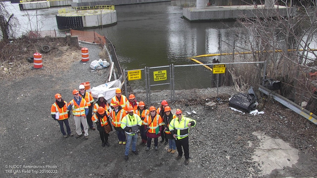
Field tours demonstrate UAS capabilities to staff and partnering organizations.
- Bat Counts Under Bridges. North Carolina is using infrared thermography to conduct counts on bat populations under bridges. New Federal regulations require state DOT’s to ensure they do not disturb a protected species while conducting inspections. The NJDOT Division of Environmental Resources has requested UAS assistance in conducting bat counts under bridges because they live in high and dark areas. A thermal imaging camera mounted on a UAS will confirm the presence of bats and should allow the counting of individual bats in near total darkness by detecting their body heat.
- Thermal Inspections of Concrete Bridge Decks. Infrared thermography of bridge decks is becoming a valuable and cost-effective inspection method for evaluating bridge decks to detect delamination in concrete. The delamination photos can be rendered by addition of higher-end gaming computers into a 3D model that can be used to determine the exact location of each delamination.
- Large Potholes and Longitudinal Joint Separations. The efficient identification of large potholes and longitudinal joints would require autonomous UAS that can be programmed to safely fly over long distances. Current regulations require small UAS to fly within the line of sight of the operator which makes this use case currently very inefficient and not cost-effective.
- Thermal Imaging for Paving Project Management. DelDOT is examining the use of UAS to detect significant thermal anomalies during the laying of new asphalt. The UAS would take standard photographs and thermal photos of the same area. The photos would then be compared to detect potential quality issues in the new pavement. Sets of thermal and visual photos can be rendered through higher end gaming computers into a 3D model that can be used to generate a guide sheet to make it easier for work crews quickly find each problem area at the work site.
- Construction Project Management. Several on-site inspectors, resident engineers, and traffic engineers have commented that the tiny UAS screen located on the UAS controller is difficult for a field team to view. A larger monitor mounted in the rear of the UAS Program vehicle can allow supervisors, upper management, and other non-participants to safely view UAS output in real time without interfering with the movement of the UAS crew.
Three years after its establishment, New Jersey’s UAS Program, continues to reach new heights as it discovers how it can effectively work with NJDOT’s divisions and bureaus to improve safety, increase efficiency, save time and save money in routine operations. The UAS program challenges both the agency’s leaders and staff to adapt to new technologies, seek the training to develop new skills, and find new ways to collaborate to advance innovations in its transportation operations.