New Jersey Innovates!
The NJDOT’s Innovation Program within the Bureau of Research works to identify, develop, promote, and institutionalize innovative transportation-related ideas, practices, and initiatives within the Department and beyond. NJDOT has recently shown its commitment to building a culture of innovation by adding an Innovation Coordinator to the Bureau of Research staff.
NJDOT’s Innovation page provides links to several agency efforts that support innovation. NJDOT promotes innovation in NJ’s transportation community through several initiatives including the NJ Transportation Research Ideas Portal to share ideas and turn some ideas into funded research projects. Anyone can submit ideas through the NJDOT Innovative Ideas portal and via a designated innovative ideas email address, DOT-Innovative.Idea@dot.nj.gov.

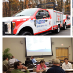
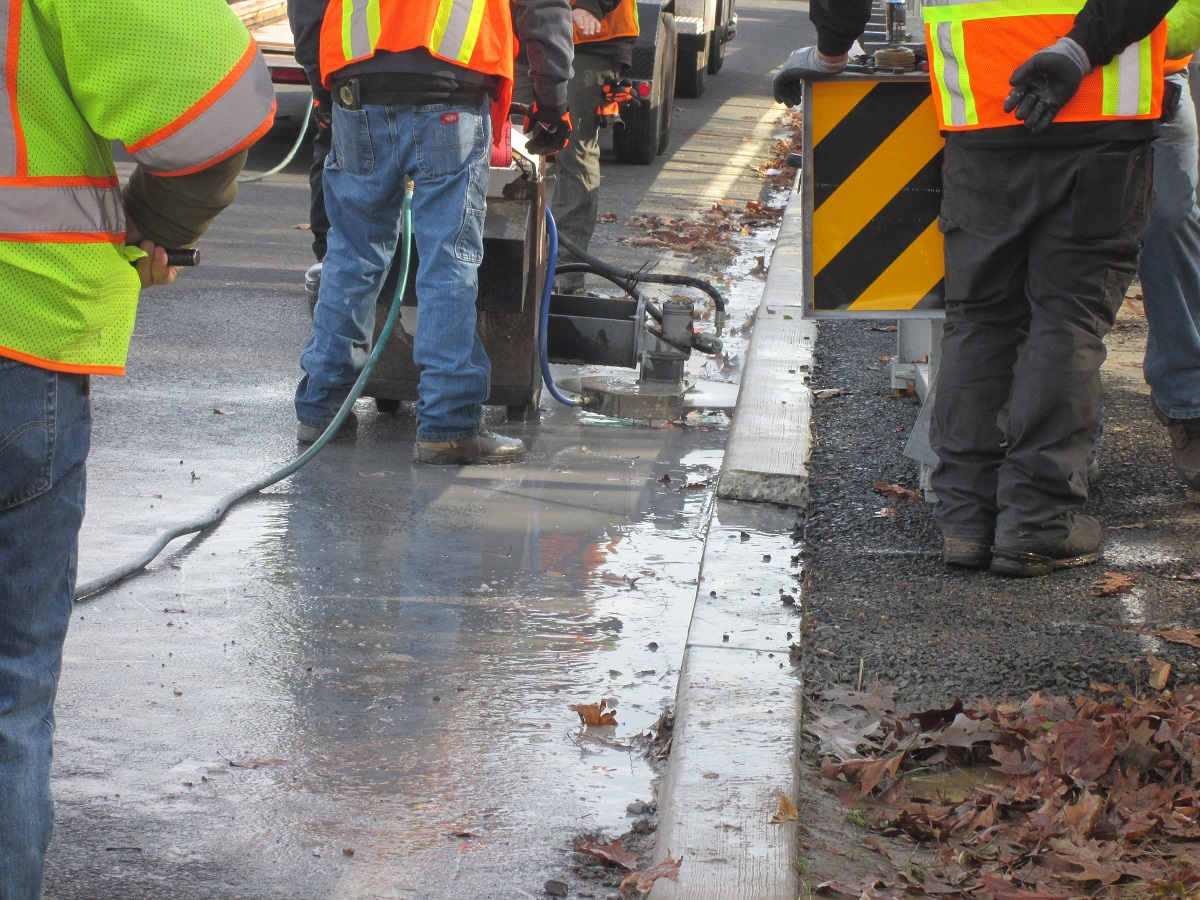
NJDOT Build a Better Mousetrap winner, Sawcut Vertical Curb, is a response to a change in standards requiring existing curbing at guide rails to be reduced in height. This innovation increases safety and cost savings.
NJDOT has been promoting the annual Build a Better Mousetrap (BABM) Competition for several years to encourage submissions from employees of local and state public agencies who have developed new solutions to problems or found better ways of doing things. Current and past award winners explain these solutions and their benefits in videos found here, including the 2022 BABM winner's Sawcut Vertical Curb, an innovative response to a change in standards for curbing at guide rails.
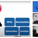
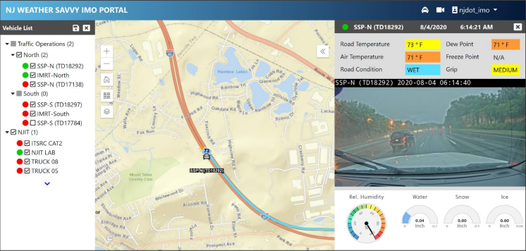
Several NJ-based innovations will be among those featured as part of the FHWA EDC Innovation Showcase during the Every Day Counts Virtual Summit in February 2023. Innovations that will be highlighted include Weather-Responsive Management Strategies, Commercial Service Vehicle Alerts, Mercer County's Bike-Friendly Resurfacing Program, Montgomery Township’s Inlet Repair Trailer, New Jersey Metropolitan Planning Organization Virtual Public Involvement, and Ultra-High Performance Concrete for Bridges. Information about these and other innovations are often featured on the Innovation Spotlight page and NJ STIC Innovative Initiatives page of the NJDOT Technology Transfer website.
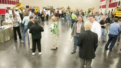
During Innovations Challenge showcases, MoDOT employees are able to physically see potential new best practices and ask questions about them in professional environment.
What Caught Our Eye
The Missouri Department of Transportation (MoDOT) has promoted a culture of innovation through its Innovation Challenge contest, which showcases and proliferates improvements to MoDOT’s tools and processes annually. Spurred on by MoDOT’s commitments to performance management between 2004 and the present, and its expressed values that ”embrace new ways of doing work” (1), this competition enables employees at all levels of the Department to introduce innovations that generate measurable results and cost savings. Since its inception in 2007, the Innovation Challenge has given thousands of MoDOT employees the opportunity to share their office’s improvements to productivity, tools, and project processes with the wider agency.
MoDOT employees receive small cash rewards for the highest ranked innovations, in addition to formalized recognitions such as the Dixon People's Choice Award or the Directors’ Safety Award. Innovations are divided into three categories (2) to convey the nature of each potential improvement:
- Tools and Equipment. Innovations to items that were fabricated or modified by MoDOT employees.
- Project. Innovative project implementations that produce exceptional results for transportation users or internal operations.
- Productivity. Improvements to office and field processes, materials, and product submissions.

llinois DOT's "Innovative Ideas" Contest has recognized and promoted innovations such as a Mobile Plow Racking Emergency Stand System, Rotating Sign Holders, and an improved Payroll Calculator.
After an Innovation Challenge showcase, subject matter experts evaluate the innovations to determine if they should be recognized as best practices for MoDOT to adopt and promote. MoDOT has implemented over 300 showcased innovations to the level of best practices since 2007. The institutional benefit of rewarding innovation extends beyond the findings of the showcase itself; fostering a culture of innovation through this event motivates MoDOT teams to consider how to improve their work throughout the rest of the year. Giving hundreds of employees the opportunity to learn from their co-workers in such a celebratory way also increases buy-in for new transportation technologies and methods. Additionally, MoDOT notes that providing a space for employees at all levels of the Department to share ideas “can result in employee retention and boost teamwork” (2).
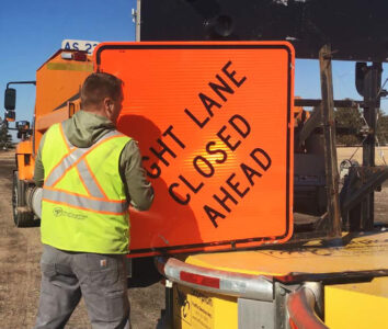
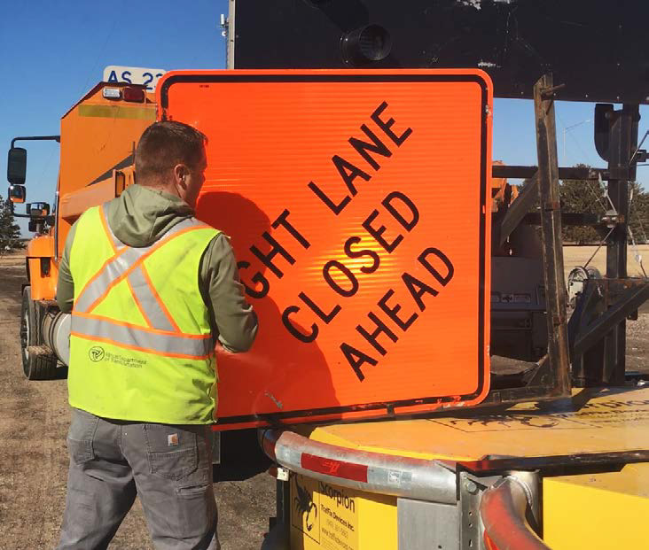
This winner of the Illinois Innovative Ideas Contest is a work zone sign holder for Truck Mounted Attenuators (TMA) that rotates to the side for installation, thereby increasing safety and avoiding damage to the TMA frame.
The MoDOT’s Innovation Challenge is one means by which agency leadership can encourage staff to "Live MoDOT Values" in accordance the agency's "Missions, Values and Tangible Results" statement. Three of these stated MoDOT values — “Be Bold,” “Be Better,” and “Be One Team” — acknowledge the extra effort and risk-taking needed to innovate processes and products, even if it invites the potential for failure (3). By “empowering staff (particularly middle-management leaders), encouraging innovation, demanding measurable results and cost savings, and holding staff accountable for results” (3), MoDOT and its Innovation Challenge foster an innovation-oriented mindset.
In the 2020 National STIC Showcase, FHWA recognized the Illinois Innovative Ideas Contest, Illinois DOT’s annual innovation competition inspired by MoDOT’s, showing that this approach has potential outside of Missouri. Information on Illinois DOT’s sister initiative is available here (4).