Image of backed up traffic and first responder in neon vest standing on highway

Talking TIM Webinar Series (TIM) Webinar Series

The Federal Highway Administration's (FHWA) Talking TIM webinar series provides best practices, new technological innovations, and successful implementations. The webinar series provides a forum where TIM champions with any level of experience can exchange information about current practices, programs, and technologies.  Each month, the FHWA TIM Program Team seeks to feature content that highlights successful programs, identifies best practices, and showcases technology that advances the profession.

The FHWA-sponsored webinars are hosted by the National Operations Center of Excellence (NOCoE). Talking TIM typically takes place the fourth Wednesday of each month from 1:30 PM – 3:00 PM.  Click here to view upcoming webinars.

Below is a list of past webinars:

  • January 2021: The International Association of Fire Chiefs (IAFC) Role in TIM, Digital Alert Pilots in St Louis and Kansas City, and FHWA Every Day Counts Round Six (EDC-6) NextGen TIM Overview
  • February 2021: Innovative Tools for Responder and Road Worker Safety
  • March 2021: AASHTO's Role in TIM, Nebraska Tow Temporary Traffic Control Program, Fire Truck Attenuators for Temporary Traffic Control, Massachusetts Legislation for Driver and Responder Safety
  • April 2021: Wisconsin's Traffic Incident Management Enhancement (TIME) Program, City of Seattle TIM and Response Team Program, and North Central Texas Council of Governments (NCTCOG) TIM Innovations
  • May 2021: National Highway Traffic Safety Administration's (NHTSA) Role in TIM, Incident Detours Involving Railroad Crossings, Washington State's TIM Program and Virtual Coordination, and Responder Vehicle to Traffic Management Center Video Sharing
  • June 2021: Unmanned Aerial Systems (UAS) for Traffic Incident Management
  • July 2021: Lubbock Fire and Rescue Helmet Innovation,  RESQUE-1 Electric and Hybrid Vehicle Assistance, Geographically-Tagged Information from Travelers
  • August 2021: CDOT TIM for Localities, Texas Commission on Law Enforcement TIM Training Requirement, Schertz Fire and Rescue TIM Training Institutionalization, Institutionalizing TIM training for EMS Professionals in Georgia
  • September 2021: Rural Roadway Strategies for Incident Management
  • October 2021: Autonomous Truck Mounted Attenuator Testing and Implementation in Colorado, Autonomous and Driverless Pilots for Large Trucks in Arizona, Rural-Focused Towing Programs in Florida
  • November 2021: National Kickoff: Crash Responder Safety Week 2021
  • December 2021: In-Cab Incident Alerts for Commercial Vehicles
  • January 2022: Illinois TIM Program Overview and Training Video Use, Law Enforcement and First Responder Interactions Plans for Automated Driving Systems (ADS), Total Solar Eclipse Planning for 2023 and 2024
  • February 2022: Public Safety Announcements across Nine States for Motorist and Traffic Incident Responder Safety, TIM Video Sharing Use Cases: Findings from the Recent EDC-6 Next Generation TIM Workshop, TRACS and MACH: Software to Simplify Electronic Crash Reporting and Computer Aided Dispatch (CAD)
  • March 2022: Outreach for Responder Safety through Collaborations with the American Automobile Association (AAA) and the Towing and Recovery Association of America, North Carolina Tethered Unmanned Aircraft Systems (UAS) Program, and Advanced Responder Warning through Safety Vests Fueled by Video Analytics
  • April 2022: Smart Lighting Strategies for Responder Vehicles, Incident Response After Action Reviews Using Unmanned Aerial Systems (UAS) Imagery, Incident Response After Action Reviews Using Unmanned Aerial Systems (UAS) Imagery
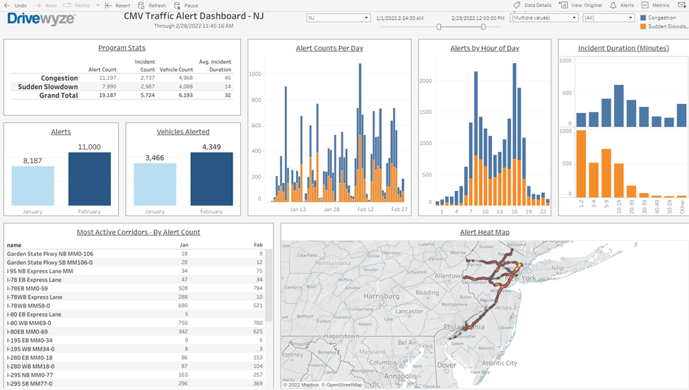
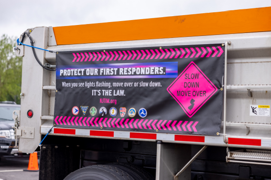
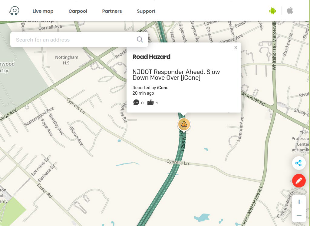
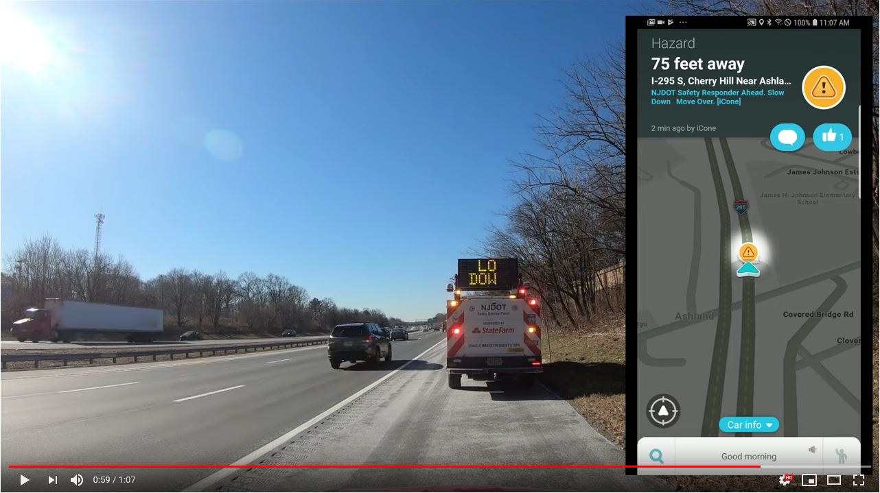
  • May 2022: Data Use and Visualization, Promoting Roadway Safety Through Move Over Law and Responder Struck-By Awareness, The New Jersey TIM Program
  • June 2022: Ohio DOT Quick Clear Demonstration, Electric Vehicle Battery Fires and the TIM Timeline, Montana's TIM Program
  • July 2022: The National Unified Goal: What Is It and How Do We Make It Relevant?, Planning and Responding to Special Events in Minnesota, Iowa DOT TIM Program Overview and Strategies for Quicker Incident Detection
  • August 2022: Overview of the Florida Heartland TIM Committee and Florida's Expanded Deployment of Cameras on Road Ranger Vehicles, What's New for the 2022 TIM Capability Maturity Self-Assessment, The TIM National Unified Goal: Relevancy of the TIM NUG Strategies
  • September 2022:  Move Over and Responder Safety Technologies, Houston Traffic Incident Management and Training
    National Unified Goals Review and Feedback.
  • January 2023:  Mitigating Work Zone Traffic Incidents Using Unmanned Aircraft Systems (UAS), Every Day Counts Round 7 (EDC-7) Innovation, Next Generation TIM: Technology for Lifesaving Response, Traffic Incident Management National Unified Goal (NUG) Review and Feedback, Part 3
  • February 2023: Findings from Move Over Compliance and Responder Safety Technology Research, After Action Review of a Multi-Vehicle Fire, EDC-7 Summit Debrief: TIM Technologies for Saving Lives.
  • March 2023: Light-emitting diode (LED) Temporary Traffic Control Devices for Digital Motorist Alerts, Moveable Barriers and Debris Removal Systems, National Secondary Crash Research.
  • April 2023:  Responder to Vehicle (R2V) Alerts in the District of Columbia, The Role of Medical Examiners in TIM, New Audience Listening Session

Go to Talking TIM webinar series for more recent events.

More  information on the FHWA EDC-7 initiative, Next Generation TIM: Technology for Lifesaving Response is here.

Jim AustrichPaul Jodoin, and Joe TeboFHWA Office of Operations TIM Program, organize and moderate this webinar series hosted by the National Operations Center of Excellence (NOCoE).


NJDOT Wins 2022 America’s Transportation Award for Best Use of Technology and Innovation

New Jersey Department of Transportation has been recognized with a 2022 America’s Transportation Award in the category of best use of technology and innovation. The annual competition is sponsored by the American Association of State Highway and Transportation Officials (AASHTO), AAA, and the U.S. Chamber of Commerce. NJDOT’s project, Implementation of Drivewyze on 647 miles of NJ’s Highways, involves the use of crowdsourced data to get more information into the hands of drivers about changing roadway conditions to inform their decision making in an effort to reduce crashes.  Commercial vehicle alerts inform truck drivers of hazards on the road, such as sudden slowdowns, disabled vehicles, debris, and adverse weather conditions, before the truck is affected by the incident. The driver can seek an alternate route or pull over until the slowdown is cleared. New Jersey’s project was highlighted in the November/December 2022 FHWA Innovator along with other State DOT winning innovations.  

For more information, go to:  

America’s Transportation Awards
https://americastransportationawards.org/new-jersey-department-of-transportation-implementation-of-drivewyze-on-647-miles-of-njs-highways/

NJ STIC Crowdsourcing for Advancing Operations
https://www.njdottechtransfer.net/2021/01/01/crowdsourcing-for-advancing-operations/

Drivewyze Dashboard. Courtesy of Drivewyze.

Innovation Spotlight: Testing and Deploying ITS Solutions for Safer Mobility and Operations

NJDOT’s Transportation Mobility unit is working on several initiatives related to FHWA Every Day Counts innovative initiatives, including: Crowdsourcing for Advancing Operations (EDC-4, EDC-6), Next Generation Traffic Incident Management (EDC-4, EDC-6), and Weather Responsive Management Strategies (EDC-4, EDC-5).  The unit has been creatively deploying STIC Incentive Grants and Accelerated Innovation Deployment (AID) grants to pilot test and evaluate innovations in recent years. We spoke with Sue Catlett, Project Manager in the Mobility Research Group, to provide updates on this work and discuss the coordination needed between agencies, organizations, and industry to make progress on these initiatives, and the barriers to deployment.

The Waycare crowdsourcing platform will feed information to NJDOT’s traffic operations centers to help resolve traffic issues and improve safety.

Crowdsourcing for Advancing Operations

Q.  Can you give us an update on the STIC incentive grant and the pilot of the Waycare crowdsourced data platform?

Waycare is in the DOT’s procurement process.  Once we have access to the information, the pilot will begin. We hope to see an increased situational awareness of the roadways.

Q.  Once it is deployed, will you have data coming in immediately?

We anticipate that we will have data but we will need to evaluate what that data means to us. For example, a key consideration is the definition of terms such as “crash incident,” and “accident.” We need to determine if we accept what the system’s definition of a term is or if we can set a definition.

Once the Waycare system is operating, NJDOT’s Intelligent Transportation Systems Resource Center (ITSRC), housed at New Jersey Institute of Technology (NJIT), will be working with NJDOT on the evaluation of the information coming in and matching it up with other information that DOT is utilizing.

Next Generation Traffic Incident Management

Q.  Can you update us on the deployment of the Computer Aided Dispatch (CAD) integration with the State Police?  At the 3rd Quarter STIC meeting in September 2021, you mentioned that the State Police had deployed their CAD system and are still doing some fine-tuning.

The State Police deployed their system at the end of June and are continuing to make adjustments to the system and train staff in its use. They will be building out the system by adding modules. We are working with the State Police to determine how we will have access to the information gathered and we are working towards an agreement.

Q.  Traffic Incident Management must require coordination with numerous organizations, yes?

The Department promotes the safety of traffic incident first responders through their Move Over campaign.

Yes, in fact, we just had our statewide Traffic Incident Management (TIM) meeting today where we reported out on what we have been working on, what we will be doing in the next six months, and what help we will need from others. The various participating groups also report out. TIM involves coordination with first aid, EMS, the State Police, the MPOs, municipal fire departments, the Department of Health, and many others. We have been working on the Move Over bumper sticker campaign, and the National Crash Responder Safety Week was in November, so there are a lot of initiatives that we are working on through the year with a purpose of reducing time an incident is on a roadway and keeping first responders safe while responding to an incident.

Q.  Has there been any progress on establishing an Advanced Traffic Management System (ATMS) platform or core software? What are the steps involved? What are you ultimately looking for with this platform?

In our operations centers, we gather data from many systems such as highway cameras, and travel times, as well as other information. The ATMS platform would combine these multiple platforms into one so that NJDOT operators can look in one place for all the information collected. The State Police CAD data could be included in this core software system.

We want one platform for our existing systems and we are also looking towards what we will need in the future. We worked with an engineering consultant firm to determine required elements, desired elements, and future needs. We were looking for a vendor that has a system that was already built and could then be customized to meet the Department’s needs. Any system would need to work with systems that DOT is currently using. We consulted with NJDOT Safety Service Patrol (SSP) and electrical maintenance, among others, to see what future needs they could anticipate. We wanted to cast a wide enough net to avoid missing something that other groups can anticipate now that they would need later on. We also talked to other state DOTs to receive feedback about their systems.  The pandemic slowed progress on this effort and we have not contracted with a vendor yet.

It is anticipated that the platform will be built out through the addition of modular components. This makes it difficult to predict when the platform will be ready to use.

Weather Responsive Management Systems (WRMS)

Q.  Congratulations on receiving the ITS-NJ 2021 Outstanding Project Award for the Weather Savvy Roads project. What is happening with the project?

The Weather Savvy Roads project was a collaboration with many individuals and organizations.  The project has expanded to 23, and soon to be 24, equipped vehicles. Equipped trucks include six Safety Service Patrol vehicles (3 north, 3 south) which operate 24/7, two incident management response (IMRT) trucks which can respond to incidents at any time (1 north, 1 south), and Operations vehicles including 7 snow plow vehicles (3 north, 2 central, 2 south) and pickup trucks used by supervisors who can respond where needed. We are still working on modifications and analysis of the data we have received.

Weather Savvy instrumentation displays atmospheric conditions and a dashboard view of road conditions in real time.

The Mobile Road Weather Information System (MRWIS) provides information on ambient temperature, road temperature, road condition and grip, as well as a windshield view of road conditions. Management can see what the drivers are seeing. The information helps to assess a storm’s duration and intensity while it is ongoing. The data available through the system has helped management make decisions. For example, last winter a Director referred to the system to determine how much longer crews  would need to be out on the road based on conditions, and could predict another two hours commitment.

WRMS can also assist in traffic incident management. Video of an incident, captured by an NJDOT responder truck, provides much more information than a verbal description of an incident scene. The detail can help ensure that individuals in the field can get the appropriate support and get the road back open more quickly.

NJDOT has extended the pilot deadline to June 2022 to include a second winter using the WRMS. This expansion will allow us to test the system on a potentially wider range of weather conditions, and assess the durability of the equipment. Last winter, NJIT analyzed the information we were collecting and found an issue with the data being reported. The vendor had to change their manufacturing process to address condensation issues and we installed replacement sensors.

Q.  What do you anticipate being the next steps?

We are exploring how to bring this system inside the Department. Currently, the Weather Savvy website is hosted by the ITSRC at NJIT.

Other Innovative Initiatives Underway through Research or Other Activities

Q.  Are there non-EDC innovations being undertaken at NJDOT or elsewhere in NJ that should be highlighted to STIC partners? 

Drivewyze® is a phone app that is used to inform truck drivers of upcoming weigh stations, enabling drive-by of weigh stations, and provides in-cab alerts about slowdowns or other road issues. The Department could use the system to alert truckers to specific conditions, such as truck restrictions on snow-covered roadways before they enter the State, to allow truckers to make adjustments. NJDOT is trying the system out for a year to look at the value of the information and what impact it may have.

We are also using video analytics to look at truck parking in the Harding Truck Rest Area during winter storms. Both commercial trucks and Safety Service Patrol vehicles use this rest area, and the space can become overly full and entrances and exits can be blocked. SSP vehicles need to be able to get into and out of the area to respond to incidents and for shift changes. We installed devices in the parking stalls, which provide information indicating when they are occupied, and cameras identify when trucks are parked in non-marked parking spaces. From the data collected, we hope to determine prime times for usage, and we are trying to find a way to communicate with truckers. NJIT is conducting this study through the ITSRC.


Resources

More Information on the STIC initiatives highlighted in this interview is available using the following links:

Crowdsourcing for Advancing Operations - https://www.njdottechtransfer.net/2021/01/01/crowdsourcing-for-advancing-operations/

Next Generation TIM - https://www.njdottechtransfer.net/2021/04/19/next-generation-tim/

Weather Responsive Management Strategies - https://www.njdottechtransfer.net/weather-responsive-management-strategies/

Developing Next Generation Traffic Incident Management in the Delaware Valley

Traffic Incident Management (TIM) programs help first responders and traffic operators to better understand and coordinate roadway incidents. As part of the sixth round of the Federal Highway Administration’s (FHWA) Every Day Counts (EDC) initiative, the agency is promoting innovative practice in this area through NextGen TIM. These practices and procedures can advance safety, increase travel reliability, and improve agency operations by engaging with new technologies and trainings. For example, sensors and crowdsourced data can help traffic agencies better detect incidents and decrease response times. Drones, or Unmanned Aerial Systems (UAS) can help transportation agencies and first responders better understand the incident scene and speed the resumption of traffic flow. The NextGen TIM initiative is an effort to improve traffic incident management through technological innovation and standardized operating procedures. NextGen TIM technologies and practices are currently being used in the Delaware Valley to increase real-time situational awareness and ensure maximum safety at the scene of an incident.

Regional Integrated Multimodal Information Sharing (RIMIS)

Image of RIMIS Operational Tool, which is a map of the DVRPC region, with Philadelphia at the center, and portions of New Jersey to the east, and Pennsylvania to the West, highway routes are marked in green and yellow, yellow denoting slower than usual operations, orange construction worker signals denote construction along the corridor, many of them are clustered aroudn Philadelphia.

The RIMIS Operational Tool gives a system-wide overview of traffic operations, such as incidents, traffic flow, and construction alerts, courtesy DVRPC

Currently, transportation departments in the region use the TRANSCOM traffic monitoring platform to supervise incidents. The Delaware Valley Planning Commission (DVRPC)’s version of this platform is called RIMIS, or Regional Integrated Multimodal Information Sharing. Because DVRPC is a Metropolitan Planning Organization (MPO) that spans both sides of the Delaware River, its reach includes sections of New Jersey and Pennsylvania—broadly, the greater Philadelphia area. In this region, with overlapping municipal, state, and regional jurisdictions, communication and coordination could be difficult. According to Christopher King, Manager of DVRPC’s Office of Transportation Operations Management, before RIMIS, incident notifications were commonly communicated through phone calls.

Area transportation officials recognized the need for a coordinated platform where information could be shared back and forth. Instead of slow, one-to-one incident notifications, this new, decentralized platform would present a “big picture” perspective of a traffic incident’s impacts on the regional transportation network. The concept was to create a regional centralized information location for traffic operators and first responders to view the traffic status on area roads, and understand, quickly and reliably, where an incident has occurred. Local agencies could access the platform to better understand incident conditions.

Image of 16 video feeds, each of a different stretch of highway, a video wall for traffic operations monitoring.

The RIMIS Video Wall allows for real-time roadway monitoring for first responders and traffic operations personnel, courtesy DVRPC

RIMIS was first developed nearly 20 years ago, and has proved to be invaluable as a resource. Participants supply data, such as video feeds and traffic updates, which is then aggregated to update other members. These agencies include PennDOT, NJDOT, SEPTA, and NJ TRANSIT. Member agencies and municipalities, such as Bedminster Township, PA, can take advantage of the operations database, with live and historical traffic flow and incident data, a situational map which geographically represents traffic levels and incidents across the region, and a video wall of roads in the DVRPC area with live camera feeds.

As an example, Mr. King showed a municipal fire department participating in RIMIS, that, once alerted that a collision has occurred, can access the platform’s interactive map, live video feeds, and information on planned interruptions, to better understand the scene before arriving there. The RIMIS platform gives context to first responders on route to an incident, provides a broader view for traffic operations dispatchers managing a disruption, and also assists transportation planners looking for data on how to improve a high-collision roadway.

Interactive Detour Route Mapping (IDRuM)

Image of a map of Philadelphia, with highway routes in orange, delineated into sections. Each section, when clicked on, shows two detour routes in the event of a serious incident.

IDRuM is a detour resource for rerouting traffic after major incidents, courtesy DVRPC

Another TIM tool DVRPC provides is the Interactive Detour Route Mapping (IDRuM) feature, a web application that consolidates established Emergency Detour Routes as a resource for traffic operations personnel, first responders, and transportation planners and engineers.

If, for example, an incident has occurred on a certain segment of I-295 in Bucks County, then the Primary Detour Route would involve taking Taylorsville Road south and turning right on State Route 322 to rejoin the highway, while the Secondary Detour Route would take a similar maneuver going north. This information can be easily accessed in both interactive and PDF formats on the IDRuM mapping site.

Image of two detour routes from I-295, one goes on a road to the north and then southeast to rejoin the highway, the other to the south and then northwest.

DVRPC is currently beta testing detour routes from NJDOT for the IDRuM platform, courtesy DVRPC

DVRPC is currently working to integrate NJDOT’s designated Detour Routes into the GIS map for the area east of the Delaware. The data has been uploaded, but is still in beta testing.

NextGen TIM

Mr. King says that a chief focus of NextGen TIM is to expand services such as RIMIS and IDRuM to more localities and arterial routes, as well as to ensure that all first responders are trained in the most up-to-date TIM techniques, such as how to position their vehicles for maximum safety on an active roadway.

During the second round of the Every Day Counts Initiative (EDC-2, 2013-2014),  a TIM process and training program was established under the  SHRP2, or the second Strategic Highway Research Program. This laid the groundwork for the current TIM training and organizational infrastructure, which is NJTIM in the Garden State. This consortium, spearheaded by NJDOT, provides resources and trainings to teach best practices to first responders across the state. NJDOT and the New Jersey State Police (NJSP) partner together to promote trainings and coordinate highway emergency response. To learn more about NJDOT’s efforts with regards to partnering with NJSP on crash data consolidation, using Unmanned Aerial Systems for incident analysis, and other aspects of the initiative, please visit NJDOT Tech Transfer’s NextGen TIM page.


Resources

Delaware Valley Regional Planning Commission. Interactive Detour Route Mapping (IDRuM). https://www.dvrpc.org/transportation/tsmo/idrum

Delaware Valley Regional Planning Commission. Regional Integrated Multimodal Information Sharing (RIMIS). https://www.dvrpc.org/Transportation/TSMO/RIMIS/

New Jersey Department of Transportation. Statewide Traffic Incident Management Program. https://www.nj.gov/transportation/commuter/motoristassistance/stimp.shtm

New Jersey Traffic Incident Management. Traffic Incident Management Resource Portal. http://www.njtim.org/NJTIM/

Final Report Released for the Connected Vehicles Program Pilot Testing of Technology for Distributing Road Service Safety Messages from Safety Service Patrols

NJDOT’s top priority is to improve highway safety. To support this goal, in September 2018, New Jersey began a pilot study of the effectiveness of using connected vehicle technology to alert the motoring public to the presence of safety service patrol (SSP) workers at incident sites.  With the support of the NJ State Innovation Council (NJ STIC) and a STIC Incentive Funding grant of $39,600 awarded by FHWA, NJDOT piloted the use of Beacon Hazard Lights technology on 32 safety service vehicles to alert drivers to the presence of workers via the mobile navigation app Waze. The device, which is produced by iCone, uses GPS location and wireless communication technology to transmit the location of the SSP vehicles to the iCone Data Server in the cloud where it can be picked up by Waze. Together with the New Jersey Institute of Technology’s (NJIT) ITS Resource Center, NJDOT published a final report of their findings from the pilot project in December 2019, available here.

The SSP location and message shown on the Waze.com website. Photo Source: Cowan et al., 2019.

The primary goal of the study was to test the feasibility of the iCone technology on SSP vehicles by analyzing the time elapsed between device activation and Waze notification, to examine the Verizon 4G cellular network strength for potential coverage loss that could result in service disruption in communication, and to analyze the effectiveness of the equipment through several testing means. The methods of evaluation to complete these objectives were field and remote testing of the technology and documentation of the equipment installation and repairs. Field testing was conducted from January to October 2019 by activating the iCone-enabled SSP truck hazard lights and Dynamic Message Board (DMS) at 2-mile intervals along the entire 280-mile SSP coverage area. An analyst conducted remote testing through monitoring of the iCone and Waze web-based interfaces.

The results of field testing showed that, on average, communication with Waze was successful 76 percent of the time, 20 percent of the time the device communicated with the iCone Data Server but not Waze, and the remaining 4 percent of the time the device did not transmit its location to the iCone Data Server or Waze. The average time elapsed from the iCone device activation to its appearance in Waze was 2 minutes and 41 seconds. On two days of testing along the SSP coverage area, there was no communication between the iCone device and iCone Data Server or Waze.

In addition to field testing, analysts conducted remote testing of 85 active instances of the iCone device by observing the iCone and Waze web portals. In 59 percent of these 85 instances, the active iCone device was detected in Waze, with 29 percent of these successful detections showing the exact timestamp in both Waze and iCone. These results were shared with Waze so that the company could address the issues related to missing and delayed data transmission. For equipment evaluation, results showed that by April 2019, 12 of the units had technical problems that were attributed to the winter weather conditions in New Jersey including snow, road salt, and extreme cold. The iCone engineering team was responsive to the issues and re-evaluated the device design so that replaced units could withstand the weather conditions. A prototype of the newly-designed replacement devices was delivered to NJDOT in December 2019 and has been installed in five of the vehicles.

The installation of the device on an SSP vehicle by an iCone technician. Photo Source: Cowan et al., 2019.

The researchers believe that this technology evaluation pilot project was the first of any state DOT to seek to inform the public of SSP patrol vehicle locations with the sole objective of increasing safety.  The pilot project provided valuable analysis and lessons learned to inform next steps for NJDOT. Testing and analysis of installed devices and their replacements will continue until the end of the product warranty period on September 1, 2021. Additionally, researchers recommended further investigation of the disruptions and delays in the communication path from the iCone device to Waze.  Additional coordination with each technical partner during the steps of the testing process could help to identify the cause of service disruptions.

During the study, NJIT and iCone were unable to obtain Waze data showing how many people clicked the “thumbs up” to the message on the app. Future analysis should investigate how to gather reactions of the motoring public to Waze notifications. The researchers recommended exploring partnerships with crowdsourcing GPS navigation providers to further learn how drivers are reacting, which should include a data transfer process and strategies for reducing latency between iCone data server and Waze.

The Final Report contains additional information on the purpose of the research, the role of various stakeholder organizations in the research, a description of the technology devices and tools procured and used in the research, and the evaluation results.  The Final Report was submitted to the FHWA and is available to review here.

Featured Image Source: NJDOT, 2019.

Connected Vehicles Program Pilot Testing of Technology for Safety Service Patrol Workers Continues

Video screenshot of hazard display message received

The rise of crowdsourced navigation applications and connected vehicle applications provide new opportunities to relay road service safety information to the motoring public.  NJDOT has initiated a Connected Vehicle: Road Service Safety Message pilot study that evaluates the effectiveness of using connected vehicle technology to alert the motoring public to the presence of safety service workers at an incident site. NJDOT is piloting the use of a Beacon Hazard Lights technology to alert drivers to the presence of workers when safety service vehicles turn on their hazard lights. The piloting of the technology has received the support of the NJ State Innovation Council (NJ STIC) and a STIC Incentive Funding grant of $39,600 awarded by FHWA.

The primary objective behind the initiative is to inform the public of the presence of Safety Service Patrol (SSP) personnel thru various services and applications that share real-time traffic and roadway information once they have responded to an incident or to help a motorist.  A short demonstration video of how a technology-equipped NJDOT safety service vehicle interfaces with crowdsourcing platforms in the field can be accessed here.

Periodic interim reports for the pilot study are being prepared to evaluate the technology’s application during the STIC grant period. Previously, NJDOT and New Jersey Institute of Technology (NJIT) personnel conducted a field evaluation of the technology following the device-equipped SSP vehicle then subsequently maintained a data log of the device’s activity in the field and through mobile and web-based interfaces.  In continuation of this effort, the NJIT team proceeded with a similar analysis by studying the correlation between the data recorded via the device log and the crowdsourced navigation applications web-based interface. In addition, the radio logs maintained by the Safety Service Patrol were used to further support this evaluation effort.


New Jersey Pilots Connected Vehicles Program to Protect Safety Service Patrol Staff

NJDOT safety service patrol vehicle. Source: NJDOT

Each day New Jersey’s safety service patrol (SSP) workers put their own safety at risk to assist motorists in need and to assist other first responders. In addition to warning other motorists about recent traffic incidents, they remove disabled vehicles, provide gasoline, and perform vehicle repairs. Safety service patrol workers use temporary signage, traffic cones, flares, and portable variable message signs (PVMS), existing overhead message signs, the NJ511 phone and website systems as well as the SafeTrip application to warn motorists about their presence.

Unfortunately, collisions involving safety service patrol workers still occur. Cars often travel at excessive speeds near staff who work on the scene of such collisions. In 2015, the Federal Highway Administration (FHWA) reports that a work zone crash occurred once every 5.4 minutes in the United States. The impact of crashes can be catastrophic. Every day 70 work zone crashes occurred that resulted in at least one injury, while every week 12 work zone crashes occurred that resulted in at least one fatality. The NJDOT’s continued efforts to reduce work zone fatalities since the 1990s has resulted in one of the lowest rates in the nation. Despite this, at least one service worker has died in a New Jersey work zone each year since 2007. In 2016 seven fatal crashes occurred in New Jersey work zones, including the death of one service worker.

The automobile manufacturing industry is in the technology development phase of putting connected and automated systems fully in place.  Once deployed, first responders and/or their response vehicles would be detected by these systems to prevent crashes resulting from oncoming traffic.  Until those systems are deployed, the most used applications to alert motorists to roadside incidents, stopped police vehicles and other types of hazards is by Google, Waze, or HERE.

To help ensure the safety of service patrol staff, NJDOT has initiated a pilot study that will examine the effectiveness of using connected vehicle technology to alert the motoring public to the presence of safety service workers at an incident site. Starting in September 2018 NJDOT will pilot the use of a Beacon Hazard Lights technology to alert drivers to the presence of workers when safety service vehicles turn on their hazard lights. The piloting of the technology has received the support of the NJ State Innovation Council and a State Innovation Council Incentive Funding grant of $39,600 awarded by FHWA.  More information about the STIC Incentive Funding source can be found here.

According to Ross Scheckler, the managing partner of iCone, the product supplier for the hazard light technology to be piloted in the NJ study, the firm seeks to build technologies that will increase the availability of data about work zones to the traveling public.  Their tools alert drivers in real-time to the presence of workers, lane-closures and construction related back-ups by making them available on the cloud, where state traffic centers and navigations companies like HERE and Waze can pick them up.  A primary goal of the technology is to let drivers of vehicles know that the rescue truck or the flagger is in the road miles ahead so that the driver or the automation system can slow down and move over, or maybe choose a different route.

In the New Jersey pilot program, the iCone technology will transmit the location of worker vehicles within two minutes of the activation of a vehicle’s hazard lights. The location updates every 15 minutes and is re-transmitted if the vehicle moves more than 500 feet.

Data from 31 SSP vehicles will alert drivers via 511NJ as well as mapping & traffic apps

Thirty-one Safety Service Patrol (SSP) vehicles in Harding and Cherry Hill Yards will pilot iCone’s GPS technology to alert drivers using the 511NJ website and mapping, and traffic apps including Google Maps, Waze, and Here.  A Texas DOT study found that deploying iCone’s traffic beacons reduced crashes at a busy highway up to 45 percent (WorkZoneSafety.org). In addition, beacons deployed on roads resulted in crash cost reductions between $6,600 and $10,000 per night. Arlington is one of more than 450 partners including city, state and country government agencies, nonprofits and first responders to partner with the Waze Connected Citizen Partner program, a free data-share of publicly available traffic data, to deliver road and construction work information to cars.

Different states have used iCone’s technology in various ways, according to Mr. Sheckler. For example, Nevada has focused on relaying lane closures through iCone’s “Smart Arrow Board” modification product. Colorado on the other hand, has focused on the location of traffic cones around work zones through the ‘iPin’ product.  New Jersey’s initiative will examine the effectiveness of iCone’s technology on service patrol vehicles.

One benefit of the approach being tested is that the data appears to be comparatively low-cost and effective in reaching the traveling public through available traffic flow applications.  Mr. Scheckler, iCone’s product supplier representative, notes that most states can quickly accommodate to the data flow that the firm produces since the data feed is modeled off the Waze format.  “When states aren’t ready to integrate the data flow, the data still goes out to millions of cars through partners like Waze, HERE and Panasonic. This works so well that in states that haven’t started picking up the feed, we still have contractors using our equipment because they want their workers to show up in the car.”

iCone’s Vehicle Hazard Light Radio Adaptation GPS device. Source: iCone

In New Jersey, one of the program’s goals is to enhance awareness of the State’s Move Over Law enacted in 2009. The law requires a driver who sees an emergency safety vehicle to approach cautiously and, if possible, make a lane change into a lane not adjacent to the emergency vehicle. Emergency safety vehicles include those operated by fire or police departments, ambulance services, tow trucks and highway maintenance or emergency service vehicles, many of which display flashing yellow, amber or red lights. Drivers must create an empty lane of traffic or prepare to stop, if possible, or face fines of no less than $100 and a much as $500.

NJDOT plans to evaluate the success of the program during Year 1 and determine interest and opportunities for collaboration with transportation agencies in other states and first responder organizations. NJDOT is part of TRANSCOM (XCM), a coalition of 16 transportation and public safety agencies that improves communication and technology by the use of traffic and transportation management systems and in partnership with technology companies. XCM currently provides NJDOT incident data to Google, Waze, and Here as well as the 511NJ web and phone platform, however SSP vehicle location data is not integrated into any of these programs.

Sources:

Cowan, S. (2018). Spring 2018 STIC presentation: Connected Vehicle — Road Service Safety Messages. Retrieved from: https://www.njdottechtransfer.net/wp-content/uploads/2018/04/CIA-Team.pdf

Hsieh, E. Y., Ullman, G. L., Pesti, G., & Brydia, R. E. (2017). Effectiveness of End-of-Queue Warning Systems and Portable Rumble Strips on Lane Closure Crashes. Journal of Transportation Engineering, Part A: Systems, 143(11), 04017053. Retrieved from:  https://ascelibrary.org/doi/abs/10.1061/JTEPBS.0000084

National Work Zone Safety Information Clearinghouse. (c2016). 2016 New Jersey Work Zone Fatal Crashes and Fatalities. Retrieved from https://www.workzonesafety.org/crash-information/work-zone-fatal-crashes-fatalities/#new%20jersey

Ullman, G. L., Iragavarapu, V., & Brydia, R. E. (2016). Safety effects of portable end-of-queue warning system deployments at Texas work zones. Transportation Research Record: Journal of the Transportation Research Board, (2555), 46-52. Retrieved from https://doi.org/10.3141/2555-06