
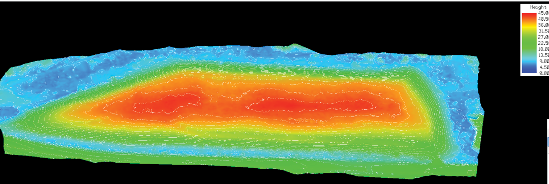
Figure 2. Route 29 & Duck Island Landfill. Shown here is a contoured elevation heatmap. The model that was created is 3D by default, so creating this view is extremely easy to do. The model shows little erosion along the top and steep sides. Inasmuch as the model is both precise and accurately geo-located, future surveyed models of this ecologically sensitive area can easily be compared to this model.