
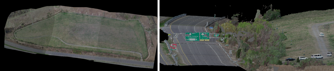
Figure 1. Route 29 & Duck Island Landfill. Requested by Environmental for 2D topographical purposes. The most cost-efficient method to fulfill the original 50+ acre objective was to fly the area with a photographic drone and create a model from the photos (Flown by the NJDOT Aeronautics Unit). Shown above are 2 views of the resulting 3D model.