NJDOT’s Next-Gen Approach to Mobility and Operations: Q&A Interview with CIA Team Lead

We recently spoke with Vandana Mathur, Supervisor of Transportation Mobility & Research at NJDOT, to learn more about the agency’s ongoing innovative mobility and operations initiatives. The discussion navigated advancements such as enhanced IMR truck equipment for safer incident response, real-time weather monitoring through the Weather Savvy program, and smart truck parking technology to address parking space shortages. These efforts reflect NJDOT’s commitment to using data-driven, next-generation solutions to improve roadway safety and efficiency across the state.


Q. Can you tell us about the initiative to equip NJDOT Incident Management Response (IMR) trucks with lighting towers and LED flares at incident scenes as part of the EDC-7 Next-Generation TIM – Technology for Saving Lives?

A. NJDOT secured funding from the Federal Highway Administration (FHWA) to enhance its Incident Management Response (IMR) trucks by equipping them with light towers and LED flares. This initiative has already significantly improved NJDOT’s on-scene operational capabilities—particularly in low-light conditions—by increasing both safety and efficiency. The light towers provide critical illumination, enabling first responders to better assess the scene, identify debris, and evaluate the extent of the crash. The improved visibility also enhances personnel safety by alerting approaching drivers to the presence of an emergency scene, giving them time to slow down and avoid secondary incidents.

LED flare deployed at an incident site

Unlike traditional emergency lights, which can be blinding, the LED flares equipped on NJDOT’s IMR trucks use a calmer, sequential lighting pattern that is less jarring to drivers while still maintaining a strong visual presence. The light towers provide wide-area illumination that surpasses the limited reach of standard vehicle emergency lights, ensuring that all personnel working at the scene are clearly visible. Designed for quick deployment, the towers deliver lighting rapidly when it’s most needed.

This initiative plays a critical role in supporting Traffic Incident Management (TIM) by enhancing the safety for both emergency responders and drivers during roadway incidents.

Q. You mentioned the benefits of the lighting towers and LED flares compared to traditional flashing lights – are emergency responders moving away from using flashing lights altogether? Additionally, have they been installed and implemented into all NJDOT IMR trucks or is this an ongoing process?

A. Yes, we often use the new tools instead of the flashing lights, especially because they can be deployed immediately. We have installed the lighting towers and LED flares on 22 IMR trucks across the state. These tools are used frequently—on average, once per week or several times per month—which shows they’re a valuable and necessary source for incident management. Because they have proven so effective, it is now standard practice to include light towers and LED flares on all new IMR trucks added to the fleet.

Q. Staying on TIM, can you describe the Drivewyze alert project? How does it collect and distribute data, and what are some potential benefits?

A. Drivewyze is a product that we are purchasing through the University of Maryland as part of the Transportation Data Marketplace (TDM) and the Eastern Transportation Coalition, which benefits New Jersey and the 19 other coalition member states. Drivewyze sends safety alerts to commercial vehicles’ Electronic Logging Devices (ELDs)—which all truckers have—and since the alerts are free, both drivers and fleet operators can sign up to receive them.

The system generates alerts using INRIX data and provides warnings for low bridges, high rollover zones, weight restrictions, “no trucks in left lane” zones, and sudden slowdowns and congestion. Because commercial vehicles need more time to stop than passenger vehicles, due to their size and weight, timely slowdown warnings can be especially critical for safety.

Drivewyze dashboard displaying the number of alerts, the type of alerts, and where the alerts are located

As part of its service, Drivewyze provided us with a dashboard that show the number of alerts sent, categorized by alert type. We use this data to assess performance. For example, by reviewing the number of alerts issued over the past three months, we evaluate whether alerts are being sent to the right places at the right times. When I joined the NJDOT team, I emphasized the importance of verifying and validating this data—not just accepting numbers that look good on paper.

We reached out to NJIT, our resource center, to help us conduct real-world testing during peak hours to confirm whether the alerts were actually reaching vehicles on the road. Initially, NJIT found that static alerts were working well, but congestion alerts were not coming through. When I contacted Drivewyze, they responded that they had forgotten to enable congestion alerts and said they had fixed the issue. NJIT conducted follow-up test runs in April to confirm the fix.

In the second round of testing, static alerts continued to perform well—NJIT even received a new static message related to a closure of Exit 34 due to a sinkhole. However, congestion alerts still underperformed. Despite driving through 83 congestion zones at speeds under 25 mph, NJIT researchers only received 5 congestion alerts. We will continue working with Drivewyze to make sure this issue is fully resolved.

Q. Moving to a different topic, at the most recent NJ STIC meeting you mentioned recent advancements in the Weather Savvy pilot. What technologies are used in the Weather Savvy program, what benefits does it provide, and how has it evolved since it first began?

A. We launched the Weather Savvy pilot project in 2020 to gain real-time situational awareness of roadway conditions. We began by equipping 12 NJDOT vehicles with Vaisala MD30 weather sensors. These sensors collect a range of data such as air temperature, road surface temperature, grip levels, frost point, dew point, and whether the road surface is wet, icy, or dry. Each vehicle also contains tablets that display this information to the driver and relays it to a central server, administered by NJIT, via a wireless router installed in the vehicle. A road-facing camera mounted on the vehicle provides real-time video of roadway and weather conditions.

Screenshot of the Weather Savvy portal hosted by NJIT

Since the project began, we have expanded from 12 to 45 NJDOT vehicles, including plow trucks, Safety Service Patrol (SSP) trucks, and operations supervisor pickup trucks. All collected data is accessible through a web portal developed by NJIT, which features a map showing each vehicle’s location, online/offline status, and travel history over the past 15 minutes. The portal also includes color-coded indicators for road surface conditions and allows users to click on specific locations for detailed information.

Last year, NJIT enhanced the portal by integrating additional roadside sensors, including Vaisala GroundCast and acoustic sensors. GroundCast is a battery-operated, in-pavement cylindrical sensor that collects data on surface, ground, and base temperatures, as well as the presence of roadway chemicals. The acoustic sensors record the sound of vehicles driving over the road and use an AI model to classify the road surface conditions. All of this data has been integrated into the Weather Savvy web portal to support better live monitoring of road conditions.

NJDOT workers installing Vaisala GroundCast into the pavement

Right now, we are working toward integrating three sources of weather data: the mobile Weather Savvy vehicles, stationary road sensors across the state, and potential virtual Road Weather Information Systems (RWIS) data. Our goal is to merge all three sources to create the most accurate, real-time understanding of road and weather conditions. This phase is still in the early pilot stage.

Q. Is NJIT’s Weather Savvy web portal publicly accessible, or is it only shared with NJDOT?

A. Right now, the Weather Savvy web portal is internal-only, since it’s still a pilot project. We want to ensure that we have a solid, data-driven foundation before releasing any information to the public. That said, it has been really exciting to see how the data comes together. I have shared many images during STIC and other state meetings to give people a look at the portal. It is a very cool and innovative project. In fact, NJDOT, NJIT, and our technical partners from Vaisala and EAI won the 2021 “Outstanding Project Award” from the Intelligent Transportation Society of New Jersey (ITS-NJ) for Weather Savvy.

Q. During the previous STIC meeting, the Mobility and Operations team mentioned that you are testing direct streaming from sensors to servers on two of the Weather Savvy vehicles. Can you explain this initiative?

A. For the Weather Savvy project, one of the challenges we’ve faced is ensuring consistent data transmission from the trucks. Since drivers are inside the vehicles managing multiple devices—including laptops and tablets—there are times when the laptops shut off or something else interrupts the data flow. With a fleet of 45 trucks, keeping them all fully operational is a year-round task that keeps us constantly busy.

To address these issues, NJIT developed an API that allows the data to be sent directly to their server, bypassing the middle steps involving the tablet, laptop, and router. At first, they planned to roll this change out across the entire fleet, but I told them to start with a small test—just two trucks—to see how well the direct data transmission works. This change will also only apply to certain vehicles; for example, the IMR trucks will keep their tablets in place.

Q. Can you describe some of the technology used in the Truck Parking Pilot, what NJDOT has implemented so far, and some next steps for the future?

A portable traffic microwave sensor deployed at the entrance of a rest area

A. For the Truck Parking Pilot, we have deployed a range of technologies to better monitor and manage available spaces. First, we use in-pavement magneto-resistive sensors—referred to as “pucks”—manufactured by a company called Sensis Networks. These sensors detect whether a truck is occupying a particular space, and because truck parking spaces are so long, we have installed two pucks per space to ensure accurate detection. In addition to pucks, we installed traffic microwave sensors—one at the entrance and one at the exit of rest areas—to help us count the number of trucks entering and exiting each site.  We also equipped the rest areas with CCTV cameras that provide live video feeds, supplementing the sensor data with visual information.

To transmit the collected data to NJIT servers, we use 4G and LTE modems, along with 4-port switches and Power over Ethernet devices. Each rest area has a dedicated equipment cabinet—installed by NJIT—that houses the pucks, cameras, and data transmission components.

We launched our first pilot site at the Harding rest area in 2021. That site features two microwave traffic sensors at the exit and entrance, nine CCTV cameras, and 44 pucks. In 2023, we expanded to the Deepwater rest area (also known as Carney’s Point), where we installed two traffic microwave sensors, one CCTV camera, and 68 pucks. All of this data feeds into a truck parking portal dashboard developed by NJIT to provide real-time insights. The dashboard displays the number of vehicles entering and exiting each site, average dwell time for trucks, the number of vehicles currently parked, and the occupancy status of individual parking spaces. It also tracks how long each spot has been occupied and provides historical usage statistics, including peak usage times.

The Truck Parking Pilot dashboard at Carney’s Point displaying the occupied parking spaces

A virtual video wall offers live views of each rest area and shows how many trucks are currently parked and how many spaces remain available, based on the combined data sources. This is particularly valuable because truck parking demand is so high in New Jersey that drivers often end up parking at entrances, along curbs, or even perpendicular to marked spaces—creating unsafe conditions and occasionally blocking cameras.

To help address this, we have been working with NJIT to install two portable Dynamic Message Signs (DMS) near the Harding pilot site, located within five miles of the rest area on I-287 and I-78. These signs will display real-time parking availability.

More recently, we started the process of expanding the project to the Knowlton rest area. My team and I, along with NJIT, recently visited the site to begin the process of installing the necessary technologies.

Q. Are there any other projects or innovations that your or your team are working on that you would like to highlight?

A. Right now, we are focusing on expanding the existing projects we already have in place. In addition, we have started exploring virtual RWIS technology, which is still very new to us. It is currently in the early stages of development, so nothing has been substantiated yet.

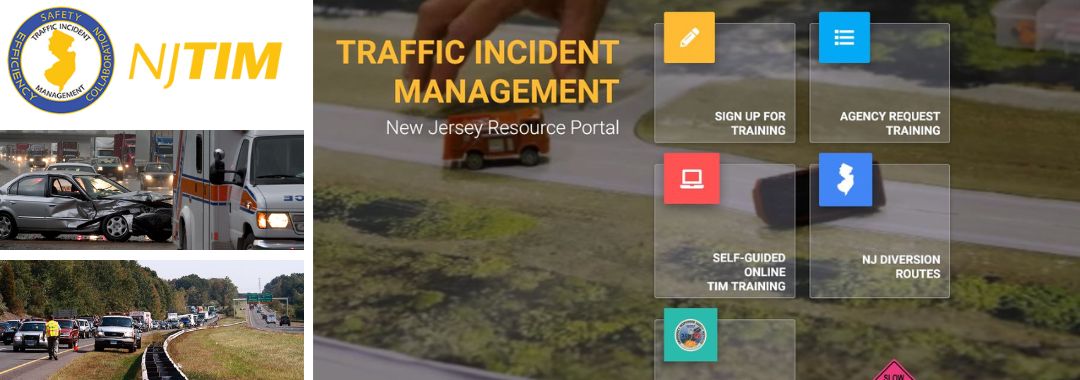
NJDOT Traffic Incident Management Training Course – Now Available Online as Self-Guided Course

The New Jersey Department of Transportation’s Traffic Incident Management (NJTIM) training is now available as an online, self-guided course. Bringing first responder training program to an online training platform should make it easier for even more emergency and incident response personnel to access a life-saving training. The new online course can be accessed through the NJTIM website.

The TIM training program focuses on a response effort that protects motorists and first responders during a roadside emergency, while minimizing impact on traffic flow. Since its inception in 2009, NJDOT and its partner agencies have trained more than 24,000 emergency and incident response personnel, including police, firefighters, EMS personnel, DOT crews, towing/recovery companies and other responders.

Training efforts, like these, are crucial in coordinating response efforts that keep all first responders and transportation professionals safe.

The new online training course can be found at NJ TIM Website: njtim.org

Providing easier access to TIM training for busy first responders and transportation professionals should prove more cost effective than traditional, in-person meetings for organizations with limited budgets. The online training program is asynchronous, offering greater flexibility in taking the training for personnel whose work schedules may not align with in-person training dates.

Online programs can also be easily updated and revised, ensuring that participants receive the most current and relevant information.

The online training is designed to engage training participants with videos, simulations, knowledge checks, and interactive scenarios that mimic real-world situations. The online TIM training utilizes assessments and certifications to evaluate the trainees’ understanding of the material and practice decision-making in high-stress scenarios without real world consequences.

The online TIM training program seeks to improve safely and coordination in responding to incidents on New Jersey’s roadways. The target audience for this training is county and municipal law enforcement and emergency personnel, including volunteer firefighters and EMTs.


FHWA’s Every Day Counts Program has recognized the importance of TIM as model safety and mobility innovation. In Round 6, Next-Generation TIM: Integrating Technology, Data, and Training, the importance of training of local agencies was encouraged.

The FHWA’s Talking TIM webinar series provides best practices, new technological innovations, and successful implementations. The webinar series provides a forum where TIM champions with any level of experience can exchange information about current practices, programs, and technologies.

More information on the rationale and benefits of the new course can be found in the video and the NJDOT press release.

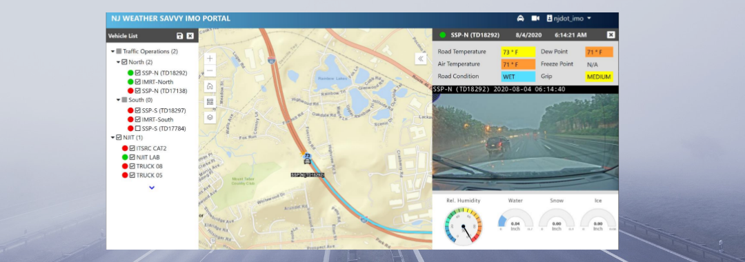
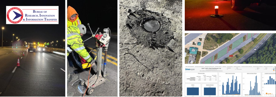
Innovation Spotlight: Testing and Deploying ITS Solutions for Safer Mobility and Operations

NJDOT’s Transportation Mobility unit is working on several initiatives related to FHWA Every Day Counts innovative initiatives, including: Crowdsourcing for Advancing Operations (EDC-4, EDC-6), Next Generation Traffic Incident Management (EDC-4, EDC-6), and Weather Responsive Management Strategies (EDC-4, EDC-5).  The unit has been creatively deploying STIC Incentive Grants and Accelerated Innovation Deployment (AID) grants to pilot test and evaluate innovations in recent years. We spoke with Sue Catlett, Project Manager in the Mobility Research Group, to provide updates on this work and discuss the coordination needed between agencies, organizations, and industry to make progress on these initiatives, and the barriers to deployment.

The Waycare crowdsourcing platform will feed information to NJDOT’s traffic operations centers to help resolve traffic issues and improve safety.

Crowdsourcing for Advancing Operations

Q.  Can you give us an update on the STIC incentive grant and the pilot of the Waycare crowdsourced data platform?

Waycare is in the DOT’s procurement process.  Once we have access to the information, the pilot will begin. We hope to see an increased situational awareness of the roadways.

Q.  Once it is deployed, will you have data coming in immediately?

We anticipate that we will have data but we will need to evaluate what that data means to us. For example, a key consideration is the definition of terms such as “crash incident,” and “accident.” We need to determine if we accept what the system’s definition of a term is or if we can set a definition.

Once the Waycare system is operating, NJDOT’s Intelligent Transportation Systems Resource Center (ITSRC), housed at New Jersey Institute of Technology (NJIT), will be working with NJDOT on the evaluation of the information coming in and matching it up with other information that DOT is utilizing.

Next Generation Traffic Incident Management

Q.  Can you update us on the deployment of the Computer Aided Dispatch (CAD) integration with the State Police?  At the 3rd Quarter STIC meeting in September 2021, you mentioned that the State Police had deployed their CAD system and are still doing some fine-tuning.

The State Police deployed their system at the end of June and are continuing to make adjustments to the system and train staff in its use. They will be building out the system by adding modules. We are working with the State Police to determine how we will have access to the information gathered and we are working towards an agreement.

Q.  Traffic Incident Management must require coordination with numerous organizations, yes?

The Department promotes the safety of traffic incident first responders through their Move Over campaign.

Yes, in fact, we just had our statewide Traffic Incident Management (TIM) meeting today where we reported out on what we have been working on, what we will be doing in the next six months, and what help we will need from others. The various participating groups also report out. TIM involves coordination with first aid, EMS, the State Police, the MPOs, municipal fire departments, the Department of Health, and many others. We have been working on the Move Over bumper sticker campaign, and the National Crash Responder Safety Week was in November, so there are a lot of initiatives that we are working on through the year with a purpose of reducing time an incident is on a roadway and keeping first responders safe while responding to an incident.

Q.  Has there been any progress on establishing an Advanced Traffic Management System (ATMS) platform or core software? What are the steps involved? What are you ultimately looking for with this platform?

In our operations centers, we gather data from many systems such as highway cameras, and travel times, as well as other information. The ATMS platform would combine these multiple platforms into one so that NJDOT operators can look in one place for all the information collected. The State Police CAD data could be included in this core software system.

We want one platform for our existing systems and we are also looking towards what we will need in the future. We worked with an engineering consultant firm to determine required elements, desired elements, and future needs. We were looking for a vendor that has a system that was already built and could then be customized to meet the Department’s needs. Any system would need to work with systems that DOT is currently using. We consulted with NJDOT Safety Service Patrol (SSP) and electrical maintenance, among others, to see what future needs they could anticipate. We wanted to cast a wide enough net to avoid missing something that other groups can anticipate now that they would need later on. We also talked to other state DOTs to receive feedback about their systems.  The pandemic slowed progress on this effort and we have not contracted with a vendor yet.

It is anticipated that the platform will be built out through the addition of modular components. This makes it difficult to predict when the platform will be ready to use.

Weather Responsive Management Systems (WRMS)

Q.  Congratulations on receiving the ITS-NJ 2021 Outstanding Project Award for the Weather Savvy Roads project. What is happening with the project?

The Weather Savvy Roads project was a collaboration with many individuals and organizations.  The project has expanded to 23, and soon to be 24, equipped vehicles. Equipped trucks include six Safety Service Patrol vehicles (3 north, 3 south) which operate 24/7, two incident management response (IMRT) trucks which can respond to incidents at any time (1 north, 1 south), and Operations vehicles including 7 snow plow vehicles (3 north, 2 central, 2 south) and pickup trucks used by supervisors who can respond where needed. We are still working on modifications and analysis of the data we have received.

Weather Savvy instrumentation displays atmospheric conditions and a dashboard view of road conditions in real time.

The Mobile Road Weather Information System (MRWIS) provides information on ambient temperature, road temperature, road condition and grip, as well as a windshield view of road conditions. Management can see what the drivers are seeing. The information helps to assess a storm’s duration and intensity while it is ongoing. The data available through the system has helped management make decisions. For example, last winter a Director referred to the system to determine how much longer crews  would need to be out on the road based on conditions, and could predict another two hours commitment.

WRMS can also assist in traffic incident management. Video of an incident, captured by an NJDOT responder truck, provides much more information than a verbal description of an incident scene. The detail can help ensure that individuals in the field can get the appropriate support and get the road back open more quickly.

NJDOT has extended the pilot deadline to June 2022 to include a second winter using the WRMS. This expansion will allow us to test the system on a potentially wider range of weather conditions, and assess the durability of the equipment. Last winter, NJIT analyzed the information we were collecting and found an issue with the data being reported. The vendor had to change their manufacturing process to address condensation issues and we installed replacement sensors.

Q.  What do you anticipate being the next steps?

We are exploring how to bring this system inside the Department. Currently, the Weather Savvy website is hosted by the ITSRC at NJIT.

Other Innovative Initiatives Underway through Research or Other Activities

Q.  Are there non-EDC innovations being undertaken at NJDOT or elsewhere in NJ that should be highlighted to STIC partners? 

Drivewyze® is a phone app that is used to inform truck drivers of upcoming weigh stations, enabling drive-by of weigh stations, and provides in-cab alerts about slowdowns or other road issues. The Department could use the system to alert truckers to specific conditions, such as truck restrictions on snow-covered roadways before they enter the State, to allow truckers to make adjustments. NJDOT is trying the system out for a year to look at the value of the information and what impact it may have.

We are also using video analytics to look at truck parking in the Harding Truck Rest Area during winter storms. Both commercial trucks and Safety Service Patrol vehicles use this rest area, and the space can become overly full and entrances and exits can be blocked. SSP vehicles need to be able to get into and out of the area to respond to incidents and for shift changes. We installed devices in the parking stalls, which provide information indicating when they are occupied, and cameras identify when trucks are parked in non-marked parking spaces. From the data collected, we hope to determine prime times for usage, and we are trying to find a way to communicate with truckers. NJIT is conducting this study through the ITSRC.


Resources

More Information on the STIC initiatives highlighted in this interview is available using the following links:

Crowdsourcing for Advancing Operations - https://www.njdottechtransfer.net/2021/01/01/crowdsourcing-for-advancing-operations/

Next Generation TIM - https://www.njdottechtransfer.net/2021/04/19/next-generation-tim/

Weather Responsive Management Strategies - https://www.njdottechtransfer.net/weather-responsive-management-strategies/