How Collaborations Like NJCTII Advance Connected Vehicle Technology

Advancements in automobile technologies have prompted the New Jersey Department of Transportation (NJDOT) and other stakeholders across the nation and globe to explore the potential of Connected Vehicle systems. Connected Vehicle (CV) technology allows cars on the road to remotely communicate with surrounding digital systems, and react accordingly to ensure safety, operations and mobility benefits.

These communication networks are often divided into three broad concepts (1):

  • Vehicle to Vehicle (V2V): CVs communicating with each other to alert riders or prevent potential collisions.
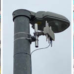
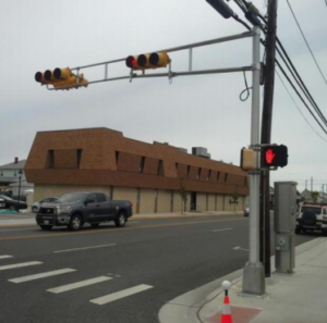
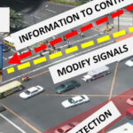
  • Vehicle to Infrastructure (V2I): CVs communicating with road or city systems, such as stoplights, to orient and guide safer road navigation.
  • Vehicle to Everything (V2X): CVs communicating with potentially any accessible device, such as a pedestrian’s phone to prevent unsafe traffic interactions.
CVs can be integrated with array of digital systems to improve vehicle safety.  Source: MnDOT
CVs can be integrated with array of digital systems to improve vehicle safety. Source: MnDOT

Over several years, NJDOT has introduced several initiatives and participated in various CV-related working groups to evaluate the requirements for upgrading its digital infrastructure to support the successful deployment and integration of CV equipment into the existing NJDOT ITS architecture. From these evaluations, NJDOT determined that the best way to implement a real-world Transportation System Management and Operations (TSMO) solution would be to establish a complete CV test-bed environment with pilot field locations. This determination led to NJDOT completing its New Jersey Connected Technology Integration and Implementation (NJCTII) project. NJDOT recently drafted a case study published by the National Operations Center of Excellence (NOCoE) that describes the lessons learned from the NJCTII initiative in advancing CV technologies (2).

TSMO Planning Strategies and Deployment

As part of the case study, NJDOT noted that a thorough planning and evaluation process was required to carry out the procurement, deployment and validation processes that could lead to the enhanced digital infrastructure hardware and software required for CV technologies. NJDOT described how its efforts followed the Federal Highway Administration’s (FHWA) System Engineering Process, highlighting several key implementation steps:

  • Capability Maturity Matrix (CMM): A process tool that allowed the NJCTII to prioritize the proper actions and areas of emphasis throughout the NJCTII project.
  • Concept of Operations (ConOPS): A document that outlined the NJDOT’s current digital infrastructure and communications systems and identified the needs required to achieve statewide connectivity, CV data management and networking, procurement, and CV application deployment.
  • System Requirements Document (SRD): A document and a new process was created to evaluate deployment locations and determine needs for CV technology implementation, such as requirements for location selection, hardware selection, data flows security, and interoperability with existing NJDOT systems. NJDOT hosted or participated in several workshops to determine the overall system requirements of the digital infrastructure and CV technologies for successful deployment.
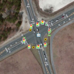
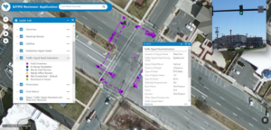
  • Solution Design Document (SDD): A document that utilized information from the SRD to design the digital infrastructure and CV systems for deployment at five pilot intersections, including wiring diagrams, networking, network equipment layout and field equipment installation.

Following this detailed TSMO implementation process, NJDOT was able to procure the hardware and software components required to complete a full CV system validation in a lab facility located at The College of New Jersey (TCNJ) before conducting installation and field testing at pilot locations.

The laboratory testing and pilot implementation phases have involved a broad collaboration of government, academia, technology provider and engineering industry, stakeholders, among others. 
Source: NOCoE Report
The laboratory testing and pilot implementation phases have involved a broad collaboration of government, academia, technology provider and engineering industry, stakeholders, among others. Source: NOCoE Report

Outreach and Communications Lessons

The case study highlights the importance of outreach and communications processes that were conducted to coordinate with key stakeholders and other transportation agencies. These processes were used to determine the goals and needs for the CV system deployment on NJ’s roadway network and to consider the operational and safety issues that could be addressed through TSMO deployment strategies for CV systems. These activities included direct coordination with other transportation agencies within NJ, CV vendor and Original Equipment Manufacturers (OEMs), along with other departments within NJDOT.

Recognizing that there were many groups within NJ that were investigating CV technologies, but that they were working independent of each other, NJDOT and the NJCTII project team organized or participated in CV topic conferences, trainings, and laboratory demonstrations to disseminate knowledge of the emerging technology.  The team found that involving many stakeholders in the CV planning and development process was a useful means to improve knowledge-sharing among practitioners and organizations, avoid and minimize redundant breakthroughs, accelerate the output of R&D, and increase buy-in across organizations.


CV systems connect to variety of digital inputs and outputs to advance road safety controls beyond what a particular element could achieve in isolation.  Source: NJCTII Case Study Report
CV systems connect to variety of digital inputs and outputs to advance road safety controls beyond what a particular element could achieve in isolation. Source: NJCTII Case Study Report

Outcomes and Benefits

The case study highlights several notable outcomes and benefits.  One key benefit was that NJDOT successfully deployed and integrated CV technology for several purposes: Signaling, Phase and Timing (SpaT), Traveler Information Message (TIM), Basic Safety Message (BSM), Personal Safety Message (PSM) and MAP (i.e., messaging set to provide intersections) CV data.  The NJCTII team used a spiral based testing approach in the lab to validate the CV systems. NJDOT used the lessons learned from the lab to deploy a fully functional CV system at 5 pilot intersections.

Advancing Projects Through Pipeline

A pipeline of Smart and Connected Corridor projects, which use CV technology, are at various stages of planning, design and implementation in New Jersey demonstrating the fruits of the efforts to-date (3).  Earlier this year, the South Jersey Transportation Authority was awarded a $8.74 million grant for the Smart and Connected Atlantic City Expressway project (4). This project will utilize V2X and advanced intelligent transportation systems (ITS) technology to improve traffic safety and efficiency. The project is being funded via the Advanced Transportation and Congestion Management Technologies Deployment (ATCMTD) grant, a program launched through the Bi-Partisan Infrastructure Bill, that is also supporting the implementation of CV systems in at least 9 other ITS projects (4). Another notable ATCMTD recipient-project is Kentucky’s Wrong Way Driving and Integrated Safety Technology System (4), which further highlights the potential of CV and ITS systems to implement road safety controls.

With an estimated 42,000 American car crash fatalities in 2021 alone (6), CVs’ potential to save lives and reduce congestion-generating crashes warrants increased attention. Models of better cooperation and general understanding of CVs, such as NJCTII, will continue to accelerate the improvement of the technology. The NJCTII initiative offers some useful lessons for other state DOTs and organizations in its approaches to test bed and pilot field-testing; use of trainings and lab demonstrations and other events to educate staff and stakeholders on CV technologies; and the development and sharing of documents to advance technological know-how and implementation through planning, design, procurement and installation phases.

References

(1) United States Department of Transportation (2020, February 27). How Connected Vehicles Work. https://www.transportation.gov/research-and-technology/how-connected-vehicles-work#:~:text=The%20CV%20concept%20uses%20data,doing%20and%20identify%20potential%20hazards

(2) National Operations Center of Excellence (2022). New Jersey Connected Technology Integration and Implementation (NJCTII). https://transportationops.org/case-studies/new-jersey-connected-technology-integration-and-implementation-njctii

(3) Intelligent Transportation System of New Jersey (2021, April 21). NJDOT’s Smart and Connected Corridor Program. Presentation: https://docplayer.net/211213418-Njdot-s-smart-and-connected-corridor-program.html

(4) NJ Biz (2022, August 11). SJTA receives $8.7M grant for AC Expressway project. https://njbiz.com/sjta-receives-8-7m-grant-for-ac-expressway-project/

(5) U.S. Department of Transportation (2022, August 10). U.S. Department of Transportation Awards $5.14 Million for Safe Driving Technologies in Kentucky https://highways.dot.gov/newsroom/us-department-transportation-awards-514-million-safe-driving-technologies-kentucky

(6) National Highway Traffic Safety Administration (2022, May 17). Newly Released Estimates Show Traffic Fatalities Reached a 16-Year High in 2021. https://www.nhtsa.gov/press-releases/early-estimate-2021-traffic-fatalities


Additional CV, ITS, and Smart and Connected Corridor Resources

Minnesota Department of Transportation (2022). Connected and Automated Vehicles. http://www.dot.state.mn.us/automated/

DriveOhio (Accessed 2022, November 15). 33 Smart Mobility Corridor. https://drive.ohio.gov/programs/av-cv/33-smart-mobility-corridor


The Impact of SJTPO’s Traffic Signal Inventory on Signal Operations

As technology advances, so does the need for data—information that allows engineers, planners, and others to utilize innovative ways to improve transportation and safety. To implement smart traffic systems, whereby centrally controlled traffic signals and sensors regulate the flow of traffic, agencies must know the present state of their traffic signal infrastructure. The South Jersey Transportation Planning Organization (SJTPO), the metropolitan planning organization for four counties in South Jersey, sought to better understand their infrastructure by developing a database of all traffic signals in the region. Completed in 2017, the database provides local agencies with the information needed to target intersections and signals for upgrades and replacements. Replacement with newer integrated traffic signals improves traffic flow, allows for remote signal monitoring and regional signal maintenance, and supports bicycle and pedestrian improvements at intersections.

A traffic signal located in SJTPO’s region. (Source: Tracy, 2017)

In 2016, SJTPO sought to create a database for all traffic signals within Atlantic, Cape May, and Salem Counties. Previously, Cumberland County had developed a traffic signal inventory which SJTPO plans to integrate into the new, comprehensive database. SJTPO and county governments wanted to know the count, age, and types of signals in their jurisdictions. An SJTPO study in Vineland found that many of their signals were very old, with one using circa 1955 electromechanical components to operate. In addition, traffic signal maintenance progressively transferred from municipalities to counties and records of some signals were found to be deficient. The lack of information needed to properly maintain signals was a major impetus for creating the database, according to Andrew Tracy formerly of SJTPO (Source: Tracy, 2017).

Agencies across the country have created similar traffic signal databases. The Chicago Metropolitan Agency for Planning (CMAP), the regional metropolitan planning organization for Chicago and the surrounding seven counties, undertook development of a signal database in 2013 for the region, with the first version released to the public in 2018. CMAP’s goals for the database reflect those of SJTPO. The agency seeks to use the information for planning, and targeting specific signals and intersections for upgrades and replacement.

For an RFP issued to support its regional signal timing initiative,  SJTPO included a list of specific intersections identified by the counties for possible improvements. Extensive outreach to counties and municipalities to acquire signal data and plans took place prior to the database assembly to minimize the field work needed. For all data acquisition requiring field work, the subcontractor created an application to minimize errors with data input. The participating counties gave data collectors the keys to their controller cabinets along with a permission note in case police questioned them during their field work efforts. The signals were classified by features such as signal location, mast arm, head, sign, and presence of pedestrian push buttons. Additional information collected included intersection features such as ADA ramps, crosswalks, etc.

A look at SJTPO’s map and reviewer application for data input. (Source: Tracy, 2017)

Traffic data was also collected at identified intersections, including turning movement counts, queue lengths, delays, and travel times. This information could be used for traffic simulation modeling, performance measurement of intersections, and  revised signal timing plans. Extensive photography of the signals and intersections complemented the data set and provided visual aids. In total, 431 signals, including 258 traditional traffic signals and 173 beacons, were logged in the database across the 3 counties. The signal inventory was completed in 2017 and each county updates the database when a signal or intersection receives upgrades.

The traffic signal inventory database has created a variety of benefits for SJTPO and the region’s residents. One of the most noticeable benefits for local agencies has been access to data to target specific signals for upgraded technology, such as vehicle detection cameras and GPS clocks for signal coordination, or installation of new signals. The database can help identify intersections for bicycle and pedestrian facility improvements and greater accessibility for individuals with disabilities, such as wheelchair ramps and improved crosswalks. Signal upgrades benefit residents by improving traffic flow, and allowing for implementation of remote signal monitoring and signal maintenance at a regional, rather than local, level. Finally, the database reinforces knowledge preservation to ease any transitions in the event of staff turnover.

For other agencies considering a similar database, a Signal Inventory configuration is available via Collector for ArcGIS and performs similar functions as the SJTPO in-house application. Additional information on the process for assembling the SJTPO’s Traffic Signal Inventory Database can be found in a webinar (see below)  hosted by the Mid-Atlantic Geospatial Transportation Users Group.

Sources:

Chicago Metropolitan Agency for Planning. “Highway Traffic Signal Inventory: Draft Proposal.” CMAP, October 29, 2015. https://www.cmap.illinois.gov/documents/10180/481346/RegionnalSignals_Proposal_20151029_forRTOC.pdf/3aef6a03-a792-44ed-9515-11496c9c25f8.

South Jersey Transportation Planning Organization. “Request for Proposals: Regional Signal Timing Initiative.” SJTPO, July 13, 2017. https://www.sjtpo.org/wp-content/uploads/2017/03/SJTPO-RFP-Regional_Signal_Timing_Initiative.pdf.

Tracy, Andrew. October 30, 2017. The South Jersey Regional Traffic Signal Improvement Program. Presentation. https://www.sjtpo.org/wp-content/uploads/2017/11/CAC-10-30-2017-Andrew-Tracy-Signals.pdf.

Tracy, Andrew, Colleen Richwald, David Braig, and Matthew Duffy. October 12, 2017. https://www.youtube.com/watch?v=mMO7-NYuXZ0.

Getting through the Green: Smarter Traffic Management with Adaptive Signal Control

NJDOT Assistant Commissioner for Transportation Systems Management, C. William Kingsland, spoke about Adaptive Signal Control (ASCT) during the third Lunchtime Tech Talk hosted by the Bureau of Research on November 29, 2017.

The Federal Highway Administration (FHWA) defines ASCT as technologies that capture current traffic demand data to adjust traffic signal timing to optimize flow in coordinated traffic signal systems.  FHWA established ASCT as one of its Every Day Counts Round One initiatives in 2011-2012. New Jersey has implemented ASCT through the work of the Traffic Management Systems unit.

Assistant Commissioner Kingsland pointed out that commuters anticipate the time it will take for their typical commute routine and that reliability in travel time is important; people do not like fluctuation in the time it takes to get from A to B. When there is reliability of travel time, people’s expectations are met. ASCT effectively reduces congestion and fuel consumption, thus reducing complaints and frustration.

The ASCT system continuously learns based upon the traffic that is out there and will respond to changes in traffic patterns. Thus, the ability to adapt to unexpected changes in traffic conditions will produce improved mobility through a given area. Furthermore, as connected vehicles become more prominent, the system has the ability to gather information through Vehicle-to-Infrastructure communication and provide timely data of vehicle spacing and signal timing.

Assistant Commissioner Kingsland also provided some highlights about COAST- NJ, the management system developed by AECOM and the New Jersey Institute of Technology that is used to help decide where the ASCT systems will be placed. Using quantitative analysis, the tool ranks sections of corridors based on severity of congestion, variability of congestion, signal spacing, and traffic volume. COAST -NJ provides a classification system scoring process that encompasses 2,562 signalized intersections, 297 signalized arterial corridors, and 56 signal systems. It was officially released for use in March 2017.

During the Q&A portion of the Tech Talk, a member of the audience asked whether the system retains the collected traffic flow information to be able to look back to a certain date and time. The answer is that yes, it can. The issue, however, becomes length of records retention and where to store all of this information over the long-term.

In NJ, some of the NJDOT project locations with ASCT are along Route 130 (MP 69.79 to 74.51) with 15 intersections tied in; Route 168 (MP 6.79 to 9.72) with 11 intersections; and Route 32 (MP 0.0 to 1.20) with two intersections. Mr. Kingsland noted that Route 18 South in New Brunswick to East Brunswick is about to go online

Other agencies are also implementing ASCT. While not a NJDOT project, in the Meadowlands area there are 140 intersections tied into one ASCT system area managed by the Meadowlands Commission.

Mr. Kingsland was asked if rural areas with large distance between signals could possibly have cameras placed at intermediate sections between intersections. Kingsland replied that they certainly could, but the cost of such projects is prohibitive at this point in time.

Due to popular demand, Assistant Commissioner Kingsland presented this Tech Talk again on January 29, 2018.

Resources

Kingsland, W. (2017). Adaptive Signal Control—Getting Through The Green (Presentation).