What will Rebuilding American Infrastructure with Sustainability and Equity (RAISE) Funding Be Used for in New Jersey and Beyond

The U.S. Department of Transportation recently announced $2.2 billion in project funding awards for the Rebuilding American Infrastructure with Sustainability and Equity (RAISE) program for 2022.  The 2022 RAISE grants are for planning and capital investments that support roads, bridges, transit, rail, ports, or intermodal transportation. The RAISE program received a significant increase in its funding due chiefly to additional allocations afforded by the Infrastructure Investment and Jobs Act (also known as IIJA or the Bipartisan Infrastructure Law).

Chris Coes, FHWA's Assistant Secretary for Transportation Policy, highlighted in a press release that 52 percent of the RAISE funding in the current round was for roadway projects with a substantial amount of that intended for “Complete Streets” projects -- that is, pedestrian-friendly renovations to existing roadways (1). Complete Street initiatives, such as San Francisco’s RAISE-funded introduction of concrete buffers and protected bike lanes to Howard Street (2), are expected to create safer, more equitable communities where the automobile has disrupted livability.  RAISE can likewise leapfrog funds directly to local governments and metropolitan planning organizations in this pursuit.

RAISE’s funding is a major break from its predecessor program in its greater support for modal diversity and the application of the equity lens in project prioritization. According to the Urbanist, transportation analyst Yonah Freemark claims “that just 10% of the dollar amounts [of RAISE’s 2022 budget is] set to fund projects that build new roadways or expand existing ones” (3). For comparison, BUILD (a Trump-era successor to the Obama-era TIGER program) devoted roughly 50 percent of its funds toward expanding and building new automobile roadways (3). Additionally, 50% of RAISE funding will go to rural communities (1) and roughly two-thirds will go to areas of persistent poverty or historically disadvantaged communities (1), ensuring equity is a centerpiece of RAISE.

In the current funding round, the US DOT has announced 166 projects that are receiving RAISE funds with roughly 7 percent of the competitive funding program going to maritime projects and 4 percent for rail (1). Environmental Justice considerations and equity concerns are intertwined with port intermodal projects such as the “Port Miami Net Zero Program” in Florida, which will expand its intermodal rail capacity, add electric cranes, and improve its stormwater drainage system (2). Often diesel powered infrastructure at port facilities or vehicular traffic along highways can emit harmful air pollutants into nearby vulnerable communities; in this context, RAISE investment in port, rail, and vehicle electrification may yield a reduction in the environmental harms borne by nearby populations and communities.

Physical barriers or guard poles funded through RAISE will address safety inequities affecting cyclists. Courtesy of the San Francisco Municipal Transportation Agency.
Planned RAISE-funded renovations combine improvements to efficiency and equity with greater investment in sustainable, greener technologies at America’s ports and in other transportation systems. Courtesy of U.S. Department of Transportation.
RAISE 2022 Factsheets show that the planned ferry route between the City of Elizabeth and Manhattan will also take advantage of connections between Elizabeth’s waterfront and Newark Liberty Airport. Courtesy of U.S. Department of Transportation.

In a similar vein, a $5 million RAISE planning grant to the City of Elizabeth will examine, identify and assess the feasibility of an electric ferry service from the Elizabeth, NJ waterfront to New York. The envisioned project would provide a ferry terminal and ferry service to and from Manhattan (2).  Beyond studying the congestion and carbon emission reductions and energy savings from such infrastructure for NJ-NYC commutes, the RAISE planning grant to Elizabeth will also analyze the land development and economic impacts of project enhancements to the municipality's waterfront (2). With the potential implementation of "cordon-based" congestion pricing in Manhattan, the Elizabeth ferry service might provide more affordable access, or another mass transit travel option to reach NYC’s employment centers or its entertainment and recreational destinations for New Jersey residents (4) in the face of steeper priced travel by auto.

In New Jersey, the Atlantic City Resilient Route 40 Project was awarded $20 million in RAISE funding.  Preparing for rising flood risks, the New Jersey Department of Transportation (NJDOT) seeks to elevate one of Atlantic City's main evacuation routes for vehicles and pedestrians, improve storm drainage in the busy Route 40 corridor, and relocate associated utilities (2). Thousands of commuters use Route 40 to reach their employment in Atlantic City’s casino industries (2). Reducing floods to vulnerable Route 40 paths will prevent low-income travelers from being forced to take the Atlantic City Expressway Toll Road as an alternative (2). NJDOT’s drainage efforts are no less important to the environmental equity aims of the RAISE-funded project; it is commonly found that the socioeconomically marginalized tend to live and work in areas of increased flooding risk. The inclusion of an updated 800-foot extension of an Atlantic City seawall and roadway drainage improvement will reduce hazards that would likely impact disadvantaged residents most directly.

Addressing Atlantic City’s coastal vulnerability with the RAISE-funded resiliency project could have measurable benefit to insurance rates for flood-vulnerable residents in addition to managing potential hazards. Courtesy of U.S. Department of Transportation.

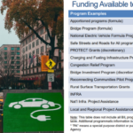
Over the next five years, the RAISE program is expected to provide $7.5 billion in planning and capital improvements for transportation projects.  Under this competitively awarded program, projects should be aligned with key project selection criteria, including safety, environmental sustainability, quality of life, economic competitiveness and opportunity, partnership and collaboration, innovation, state of good repair, and mobility and community connectivity (1).  Within these areas, the U.S. DOT Department has emphasized that project selection will consider how projects improve accessibility for all travelers, bolster supply chain efficiency, and support racial equity and economic growth – especially in historically disadvantaged communities and areas of persistent poverty (1).

The RAISE program is just one of several programs that U.S. DOT has identified as covered by the Biden-Harris Administration's  Justice40 Initiative. The objective behind the Initiative is to address decades of underinvestment in disadvantaged communities and bring more Federal resources to communities most impacted by climate change, pollution, and environmental hazards (5).

Recent growth in available federal funding for transportation projects, including funding programs like RAISE, signal that the national transportation ecosystem can be reshaped -- to some extent -- through intentional planning, project selection, design and funding that looks to redress equity gaps and foster community livability and environmental sustainability  The nation's disadvantaged communities -- defined in Justice40 through several indicators that map and measure economic condition, health, transportation access, environment, resilience, and equity -- stand to gain from this greater commitment to the equity and opportunity lens in decisionmaking, and RAISE-funded projects are one means for actualizing this transformative objective.


REFERENCES

(1) Planetizen. (2022, August 11). $2.2 Billion in RAISE Grant Funding Announced for Transportation Projects. https://www.planetizen.com/news/2022/08/118257-22-billion-raise-grant-funding-announced-transportation-projects

(2) U.S. Department of Transportation. (2022, August). RAISE 2022 Fact Sheets. https://www.transportation.gov/sites/dot.gov/files/2022-08/RAISE%202022%20Award%20Fact%20Sheets.pdf

(3) The Urbanist. (2022, August 17). RAISE Grants Move Away From Road Expansion, But Not In Seattle Metro. https://www.theurbanist.org/2022/08/17/raise-grants-move-away-from-road-expansion-but-not-in-western-washington/

(4) TapInto. (2022, March 2). Coming Early This Summer: Elizabeth Fast Ferry to New York City. https://www.tapinto.net/towns/elizabeth/sections/business-and-finance/articles/coming-early-this-summer-elizabeth-fast-ferry-to-new-york-city 

(5) U.S. Department of Transportation (2022, September 9).  Justice 40 Initiative. https://www.transportation.gov/equity-Justice40


Reconnecting Communities: Redressing the Past to Advance a More Equitable Future

The interstate highway transportation building program undoubtedly yielded significant mobility and economic benefits for the nation in the post WW-II era but also imposed environmental and public health burdens for less favored communities. The benefits and burdens of the building program were not equitably distributed; the burdens were often disproportionately borne by predominantly minority and ethnic populations and lower-income communities that were powerless to halt transportation and land use decisions made in the name of “progress”, regional mobility, more efficient auto and truck travel, and urban renewal.

The Reconnecting Communities Pilot Program, a new and innovative program in the Bipartisan Infrastructure Law, takes a small step toward repairing and redressing the adverse consequences of these past planning and engineering decisions. (1)

The Bipartisan Infrastructure Law (BIL) enacted in the Infrastructure Investment and Jobs Act has been described as a “once in a generation” investment in our nation's infrastructure, promising two million jobs per year and delivering needed financial assistance to transit, highways, water, power, and communications. While much of the BIL’s transportation funding is intended to encourage and prioritize the repair, reconstruction, replacement, and maintenance of existing transportation infrastructure, the BIL also tilts investment and resources for programs, new and old, to tackle the challenges of the 21st century in the realms of safety, equity, and climate change and resilience.

The BIL includes an innovative new program, the Reconnecting Communities Pilot Program, that sets aside $1 billion to “restore community connectivity by removing, retrofitting, or mitigating highways or other transportation facilities that create barriers to community connectivity, including, mobility, access, or economic development.” From 2022 through 2026, the pilot program will receive $500 million from the Highway Trust Fund and $500 million from the general fund for Planning and Capital Construction grants. (2)

Emergency services on scene at O'Connor Electro-Plating explosion in Los Angeles, Calif., 1947. Courtesy of UCLA Library.
Freeway and Urban Renewal in the Bronx. Provided with permission from Segregation by Design.

The USDOT explains that the Reconnecting Communities pilot program will help reconnect communities that were previously cut off from economic opportunities by transportation infrastructure. Reconnecting a community could mean adapting existing infrastructure– such as building a pedestrian walkway over or under an existing highway– to better connect neighborhoods to opportunities or improve access through crosswalks and redesigned intersections.  The FY22 Notice of Funding Opportunity (NOFO) has been issued and is available on the USDOT website.

The primary goal of the program is to reconnect communities harmed by transportation infrastructure, through community-supported planning activities and capital construction projects that are championed by those communities. The planning grants support the funding of the planning processes for the entity performing the reconnection, to include project design and public outreach to the historically disconnected communities. Outreach can be tailored to overcome mistrust of the government entity that sited the infrastructure that disconnected the community, and explore potential strategies to redress the burdens of these past siting decisions. After planning is complete, capital construction grants will fund work to remove, replace, or mitigate the facility. The federal government will fund up to half of the costs of these projects.


Below Grade Portion of Cross Bronx Expressway under construction, provided with Permission from Segregation by Design
I-93 Construction in Boston, Provided with Permission by Segregation By Design

What the Reconnecting Communities Program Recognizes

The program is noteworthy for its recognition that, historically, many public and private entities presided over land use policies and the siting of transportation infrastructure that resulted in the isolation and segregation of poor and marginalized populations from the broader community. Some scholars have traced causes of spatial segregation to unfair enactment of zoning laws in the 1930s that peddled "health and safety" as the rationale for carrying out discriminatory land use policies.  Over time, the color line boundaries were maintained through redlining, realtor steering, block-busting, and disinvestment that shaped a geography of unequal access to opportunities for those concentrated in disadvantaged communities.

The intent of early zoning was to reinforce protection of citizens’ health and safety as established in nuisance law. It gave governments police powers to make sure that the state and its cities could be proactive in anticipation of negative impacts. Unfortunately, with these powers, the enfranchised voter, politician, planner, and engineer set the parameters of health and safety to fit their preferences and biases. Governments could consolidate disenfranchised populations in specific areas and permit the siting of health and safety nuisances in these communities through “spot zoning”. For example, in South Central LA, a majority black neighborhood, the City began to spot zone industrial uses in commercial portions of the neighborhood. An electroplating plant in the area exploded in 1947 killing 5 local residents and 15 workers while damaging 100 homes. The property next to a church was spot zoned industrial and when the pastor raised their concerns, they were why “Why don’t you people buy a church somewhere else?” (3 pp. 55-56). These local decisions had the silent approval of state and federal governments.

Concurrently, the rise of the personal automobile required the allocation of space to make trips easier and faster in and through traditionally dense American cities. At the beginning of the Highwaymen Era, cities sought to build expressways and parkways, often ignoring the residents who sat in the bulldozer’s path. The Cross-Bronx Expressway is an often-referenced example of how damaging the siting of urban expressway projects were to community life and how powerless the affected communities were to halt siting decisions.  In 1945, Robert Moses, perhaps the most infamous highwayman, sought to construct a seven-mile trench highway through the Bronx. He looked at the stretch as his to shape. Even when offered alternatives to his vision, alternatives that would have resulted in preserving more of the neighborhood and homes, he persisted with his alignment through the Bronx and its displacements of the families along the way. (4 pp. 839-878) Moses was not alone among the planners and engineers in ignoring the preferences and plight of local residents.

This process accelerated with passage of the Federal-Aid Highway Act in 1956 that funded the construction of mostly free to access, grade-separated roads that linked cities, towns, and states. The money and power prescribed to states from the federal government allowed the powers that be to run highways through neighborhoods of primarily underrepresented populations. The Embarcadero Freeway in San Francisco (5 pp. 46-96), I-93 in Boston (6), the several I-80’s of Oakland (7) , and many more cut deep into their cities in the name of progress (3 pp. 127-129). Individuals saw the divisive impacts of these highways on communities and eventually rallied in several cities to prevent their expansion, but it was too late for many communities. Hulking multilane highways that produced noise and air pollution cut up and cut off neighbors and communities (5 pp. 94-121).

Over time, people have organized and sought to mitigate or reverse the impacts of these highway sitings on the urban landscape. Several governmental bodies are engaged in planning processes for community reconnection and several projects have been successfully completed in the past two decades. The most famous two examples are The Embarcadero in San Francisco and Boston’s Big Dig. The Embarcadero Freeway was a multilevel highway that separated San Francisco Bay from the City. In 1989, an earthquake struck the Bay Area. The Embarcadero crumbled with the quake and people began to ask questions about how this massive waterfront space could be used. After fights with the State and a 6-5 vote at the municipal level, a boulevard and trolley tracks replaced the Embarcadero. (8) For the first time in decades, the bay, not pillars and concrete, bound San Francisco at its north end.

The most famous reconnection on the East Coast is probably the Big Dig. When constructed, I-93 tore through the historically Italian North End, cutting it off from the City proper. With no transit facilities, the neighborhood was isolated with large spans casting shadows into the residences of the North End.  While the North End could not be saved, witnessing the damage caused by the highway sparked highway revolts throughout the Boston area leading to the cancellation of several highway projects in Boston. With traffic pressures rising and lack of political will for more throughput, Massachusetts started to plan the Big Dig in the early 1980s to repair the damage done and improve throughput on I-93. Over the next 35 years, Boston engaged with the North End community, the citizens of the City and business and waterfront interests to shape the public space that would follow. This development process resulted in the current boulevard and park that caps I-93. (6)

Before and After Replacing the Embarcadero, Courtesy of the San Francisco Planning Department

Recent and Promising Reconnections

In Boston and San Francisco, the removal of the highways revived the space, but also led to land speculation that has fueled displacement and gentrification. With the successes and mistakes of these community reconnections in mind, other states and cities are exploring restorative strategies that will avoid and minimize community displacements.

The Inner Loop of Rochester is one of the more recent reconnection projects on the East Coast.  Its transformative effects have served as a "demonstration project for highway removal in other parts of the city" (9).  When completed in 1965, I-490 and New York State Route 940T created a loop around Rochester’s downtown, making the area difficult to access for most residents. As the 1970s brought significant economic impacts to Upstate New York, Rochester’s population declined and the city recognized the need to reconnect the downtown with the rest of the city. In the early 2000s, several proposals slowly coalesced into public engagement in 2013 through which the citizens helped shape plans for the initial removal of the loop. For $21 million, Rochester removed and buried its below grade highway and have since replaced it with housing and mixed-use development. (9,10)

Built between 1956 and 1968, I-94 connected the Twin Cities, but in the process badly damaged the majority Black neighborhood of Rondo, displacing 60 percent of its residents. In the late 2000s, a freeway cap was proposed to cover the highway in portions, but like many proposals at the time, it languished due to tight public budgets. In 2021, a local nonprofit, Reconnect Rondo, began spearheading an effort to reconnect portions of the community via a four-block land bridge. A land bridge option was settled on rather than removal or downgrading to a boulevard because that stretch of I-94 is considered the busiest segment of highway in the state. Reconnect Rondo is seeking justice in other ways for the cumulative impacts unleashed in part by the highway’s bisection of the community. They want to expand the neighborhood community land trust and provide housing and invest in local businesses while they pursue the highway cap. (11)

Modern day I-93 after the Big Dig, Courtesy of NewtonCourt and Wikimedia.
Rondo Neighborhood 1953 (left), 2020 (right), courtesy of Ramsey County, Minnesota

Syracuse is replacing I-81, the viaduct that runs through the core of its city. I-81’s construction ran through a neighborhood that was not only majority black, but also held a majority of all the black residents in Syracuse. The press depicted the neighborhood as slums and the State targeted the neighborhood for urban renewal in 1957. The completion of the viaduct left a soaring piece of infrastructure that isolated the community. Syracuse joined with several other municipalities in seeking to right the wrong created by I-81 and recently received funding from the State of New York to replace the highway with a boulevard. Community members fear that the growth resulting from the return of I-81 to the city’s grid may displace residents. NYSDOT’s only noted plan for addressing this potential impact is to ensure the ongoing update to the city’s development plan includes gathering the community’s input on how the new space incorporates with the community. (12-15)

New Jersey now has an opportunity to learn from those who have already planned and implemented community reconnection projects.  In recent years, two highway segments have been identified as candidate projects. In Northern New Jersey, I-280, when constructed, cut a deep swath underneath the streets of Newark, East Orange and Orange. Today, the interstate segment divides neighborhoods and generates traffic, noise, and air pollution and presents unsafe pathways for pedestrians and cyclists.  The North Jersey Transportation Planning Authority (NJTPA), in association with Essex County and the affected municipalities, examined strategies for reconnection in the Essex County Freeway Drive and Station Area: Safety and Public Realm Study in 2017.  This study examined access and circulation issues in Orange and East Orange, and around the East Orange, Brick Church and Orange train stations, Route 280, Freeway Drive East and West, and the NJ TRANSIT elevated rail line (16).  The Regional Planning Association’s Fourth Plan, completed in 2019, calls for capping I-280 in Newark and East Orange "to restore the street grid and knit back together neighborhoods." (17)

In the State Capitol, the city, county, and state all have sought to transform State Route 29. While not a part of the Interstate System, NJ-29 connects with I-195 and I-295 south of Trenton and winds along the Delaware River, separating Trenton residents from the waterfront. In 2009, the City of Trenton signed a memorandum of understanding with several agencies that proposed transformation of NJ-29 into a boulevard, but like I-94, the project has not advanced. A 2016 grant from the Delaware Valley Regional Planning Commission (DVRPC) spurred renewed interest in continuing the process. (18)  With the availability of funding, advocates are seeking state support to plan and rebuild a section of Route 29 in downtown Trenton (19,20).

Can affected communities and stakeholders in New Jersey draw inspiration from the reconciliation and restoration efforts of other states and regions? With federal funding available, advocates see an opportune time to get these or other projects off the ground that could reconnect the communities once divided by past roadway siting and design decisions.

Rendering of before and after I-81 is torn down, courtesy of NYSDOT

RESOURCES

  1. Wilson, Kea. Four Things Advocates Need to Know About the ‘Reconnecting Communities’ Program. Street Blog USA. [Online] 30 June 2022. https://usa.streetsblog.org/2022/06/30/four-things-advocates-need-to-know-about-the-reconnecting-communities-program/.
  2. U.S. Department of Transportation. Reconnecting Communities Pilot Program – Planning Grants and Capital Construction Grants. [Online] https://www.transportation.gov/grants/reconnecting-communities.
  3. Rothstein, Richard. The Color of Law: A Forgotten History of How Our Government Segregated America. s.l.: Liverwright Publishing, 2017.
  4. Caro, Robert. The Power Broker: Robert Moses and the Fall of New York. s.l.: Random House, 2015.
  5. Kelley, Albert Benjamin. The Pavers and the Paved: The Real Costs of America's Highway Program. s.l.: D.W. Brown, 1971.
  6. Crockett, Karilyn. People Before Highways: Boston Activists, Urban Planners, and a New Movement for City Making. s.l.: University of Massachusetts Press, 2018.
  7. Self, Robert O. American Babylon: Race and the Struggle for Postwar Oakland. s.l.: Princeton University Press, 2005.
  8. Rubin, Jasper. The Embarcadero Reborn. Found SF. [Online] u.d. https://www.foundsf.org/index.php?title=The_Embarcadero_Reborn.
  9. Congress for New Urbanism. Rochester | Inner Loop North. Campaign Cities. [Online] u.d. https://www.cnu.org/highways-boulevards/campaign-cities/buffalo-inner-loop-north.
  10. Inner Loop East - Public Participation. Inner Loop East - From Barrier to Beautiful. [Online] u.d. https://www.cityofrochester.gov/article.aspx?id=8589950580.
  11. Wilson, Kea. Land Bridge Seeks to Restore Minnesota Black Neighborhood. Streetsblog USA. [Online] 19 February 2021. https://usa.streetsblog.org/2021/02/19/land-bridge-seeks-to-restore-minnesota-black-neighborhood/.
  12. I-81 Viaduct Project: Community Grid. New York State Department of Transportation. [Online] https://webapps.dot.ny.gov/i-81-viaduct-project.
  13. Walker, Alissa. About Time: Syracuse’s I-81 Is Finally Being Demolished. Curbed. [Online] 26 January 2022. https://www.curbed.com/2022/01/hochul-syracuse-highway-removal-i-81.html.
  14. The Highway Was Supposed to Save This City. Can Tearing It Down Fix the Sins of the Past? Jalopnik. [Online] 5 April 2022. https://jalopnik.com/the-highway-was-supposed-to-save-this-city-can-tearing-1836529628.
  15. Congress for New Urbanism. Syracuse | I-81. Campaign Cities: Highways to Boulevards. [Online] u.d. https://www.cnu.org/highways-boulevards/campaign-cities/syracuse.
  16. North Jersey Transportation Planning Association (NJTPA).  Freeway Drive and Station Area: Safety and Public Realm Study. 2017.  Freeway-Drive-Report-Report-only-20170724.pdf (njtpa.org)
  17. Regional Plan Association. Fourth Regional Plan: Remove, Bury, or Deck Over Highways that Blight Communities. [Online] http://fourthplan.org/action/remove-highways.
  18. Congress for New Urbanism. Trenton | Route 29. Campaign Cities: Highways to Boulevards. [Online] https://www.cnu.org/highways-boulevards/campaign-cities/trenton-route-29.
  19. Hurdle, Jon. Push on to Jumpstart Route 29 Makeover in Trenton.  NJ Spotlight News. [Online] 21 July 21, 2022. https://www.njspotlightnews.org/2022/07/route-29-highway-makeover-trenton-federal-funding-advocates-city-link-river-economic-development-civic-pride/
  20. Route 29 Sign-On Letter to Office of Governor. Route 29 Boulevard: Transformational Opportunity for the City of Trenton.  Letter. [Online] 2 June, 2022.  https://www.njspotlightnews.org/wp-content/uploads/sites/123/2022/07/Route-29-Sign-On-Letter-June-2022.pdf

What is Innovative in the Bipartisan Infrastructure Law? Greater Investment in Safety, Equity, and Climate and Resilience

On November 15, 2021, the Infrastructure Investment and Jobs Act (IIJA), often referred to as the “Bipartisan Infrastructure Law” (BIL), was signed into law.  With the BIL’s passage, the United States has committed approximately $550 billion to transportation infrastructure within a wider $1 trillion + federal reinvestment in the nation’s infrastructure [1].

Much of the BIL transportation funding seeks to encourage and prioritize the repair, reconstruction and replacement and maintenance of existing transportation infrastructure with appropriations totaling some $350.8 billion (FY 2022-2026), drawing from the highway trust fund ($303.5 billion) and advance appropriations from the general fund (47.3 billion). Most of the highway funding is apportioned to States based on formulas specified in Federal law.  New Jersey could receive approximately $8.1 billion over five years for highways and bridges, based on the federal highway funding formula, or about 41.6 percent more than the State’s funding under current law [2]. However, the BiL also provides significant funding through various competitive grant programs such as the bridges and megaprojects that can demonstrate substantial economic benefits.  New Jersey’s Portal North Bridge under construction in Secaucus reportedly may meet the requirements for a Capital Investment Grant for transit projects [2].


All U.S. DOT modes will receive transportation funding from BiL with the greatest amount handled through the Federal Highway Administration (FHWA).
Most of the highway trust funding is apportioned by formula to the states.
A great deal of the BiL funding being directed for HIPs from the General Fund is formula-based.
Two new climate-focused programs, the Carbon Reduction Program and PROTECT, together match the scale of funding set aside for CMAQ—widening the scope of environmental concerns beyond congestion mitigation and air quality.

Notably, the BIL takes innovative steps in the realms of safety, equity, and climate change and resilience to increase investment and resources for programs, new and old, that will tackle the challenges of the 21st century in both a national and New Jersey-specific context. Growing awareness of the broad harms of road hazards, inequity and injustice, and climate change will inform not only the purpose of specific program investments but influence transportation planning, project delivery, and research for years to come.

Safety

A major program that will advance safety innovation and renovations across the country is the $5 billion, FY 2022-2026 Safe Streets for All (SS4A) Program. A “Complete Streets” program, SS4A is a discretionary program which seeks to advance USDOT’s goal of zero deaths and serious injuries on our nation’s roadways by implementing multi-modal improvements and safety treatments. Examples of applicable SS4A modifications include separated bicycle lanes, traffic calming road design changes, rumble strips, wider edge lines, flashing beacons, and better signage. Metropolitan planning organizations (MPOs), local, and tribal governments are eligible to apply for this funding. Separate provisions in BIL define Complete Streets standards and policies. Additional information on SS4A can be found here. FHWA provides accessible information on Complete Streets here.

A “complete street” in Washington, D.C. with several community livability features for an urban setting such as wide sidewalks with tree coverage, traffic calming design, and a physically protected middle bike lane.  Photo by Maria Oswalt on Unsplash.

Changes have been made to existing safety programs such as the Highway Safety Improvement Program (HSIP) which could prove to more holistically mitigate road hazards. Eligibility for HSIP’s funds (up to 10 percent) can now be used for “specified safety projects (including non-infrastructure safety projects related to education, research, enforcement, emergency services, and safe routes to school)” [1]. Definitions for the program have been modified to recognize as eligible a variety of new types of projects such as traffic control devices for pedestrians and bicyclists and “roadway improvements that separate motor vehicles from bicycles or pedestrians” [1]. State-level assessments of vulnerable road users are rolled into the requirements of the HSIP. More information on these guidance changes can be found here.

Funding for highway safety traffic programs under the BIL are $13 billion more than the levels established for the Fixing America’s Surface Transportation (FAST) Act. In FY2022-2026, 402 formula funding for highway safety traffic programs is expected to allocate approximately $42 million to New Jersey to help improve driver behavior and reduce deaths and injuries from motor vehicle-related crashes. This funding represents about a 29 percent increase over FAST Act levels [2] when averaged on an annual basis. Such increases in funding for roadway safety improvement provides an opportunity to put forward educational, enforcement and design strategies to counter a recent surge in US and NJ traffic fatalities.

Equity

To promote and implement equity-oriented innovation, the current administration has held itself to a “Justice40 commitment,” the goal of which is to deliver 40 percent of the benefits of the climate and energy related investments to disadvantaged communities [3]. This commitment is reflected in BIL’s transportation funding. One example provided by USDOT is that $5.6 billion in Low- or No-Emission Bus Grants to transition to low- or zero-emission buses will be assessed and likely partially directed to low-income communities to advance environmental justice.

USDOT developed a definition for disadvantaged communities (DACs) to be utilized in connection with certain criteria under Justice40-covered grant programs. The DAC definition draws upon data for 22 indicators collected at the U.S. Census tract level, which are then grouped into six categories of transportation disadvantage to identify places that are disadvantaged.

The Justice40 Disadvantaged Community Interim Definition goes as follows:

  • Transportation access disadvantage identifies communities and places where residents spend more, and take longer, to get where they need to go.
  • Health disadvantage identifies communities based on variables associated with adverse health outcomes, disability, as well as environmental exposures.
  • Environmental disadvantage identifies communities with disproportionately high levels of certain air pollutants and high potential presence of lead-based paint in housing units.
  • Economic disadvantage identifies areas and populations with high poverty, low wealth, lack of local jobs, low homeownership, low educational attainment, and high inequality.
  • Resilience disadvantage identifies communities vulnerable to hazards caused by climate change.
  • Equity disadvantage identifies communities with a high percentile of persons (age 5+) who speak English "less than well."

To assist grant applicants in identifying whether a proposed project is located in a DAC, USDOT provides a list of U.S. Census tracts that meet the DAC definition and a corresponding mapping tool,  Transportation Disadvantaged Census Tracts (Historically Disadvantaged Communities).

Several USDOT programs are using the interim definition of DACs to ask discretionary grant applicants and formula program administrators to identify how their projects benefit DACs. More information on how the Justice40 commitment shapes the equity orientation of BIL’s transportation funding can be found here.

One major new BIL program addressing inequities within America’s transportation infrastructure is the Reconnecting Communities Pilot Program. The discretionary program was conceived to provide $1 billion over five years to remedy the negative effects of past transportation investment decisions that divided communities [1], such as highway expansions that cut cities in half. Applicants for Reconnecting Communities funding can seek capital constructions grants (such as for the replacement of an eligible facility with a new facility that restores community connectivity) or as well as planning grants and technical assistance grants. More information about this innovative program to redress the adverse cumulative effects borne by communities from past transportation investments can be found here.

For New Jersey, the Reduction of Truck Emissions at Port Facilities Program is another innovative program that holds promise for redressing the environmental health effects attributable to siting and operating regional goods movement facilities. By funding the study of, and competitive grants to reduce, truck idling and emissions at ports (such as promotion of port electrification and possibly hydrogen-fuel technologies), pollutants and adverse health disparities borne by port communities could be reduced. Northern New Jersey, as one of the most important freight hubs in North America, is likely to receive some of the $400 million available in discretionary funding (FY2022-FY2026) as well as a portion of the Port Infrastructure Development Program’s annual budget, recently increased to $450 million. These investments to modernize and reduce the environmental burdens of the nation’s freight infrastructure could reduce unfairly distributed health hazards in New Jersey.

In line with the Justice40 commitment, a number of regulatory changes to existing programs contain equity-oriented provisions. In the continuation of the Fixing America's Surface Transportation (FAST) Act, the Metropolitan Planning Program has a BIL requirement “to consider equitable and proportional representation of population of metropolitan planning area when the MPO designates officials or representatives” [1]. Such requirements, even when non-binding, support a wider culture and consideration of equity in how the nation’s urban and transportation policies are devised and implemented. Many communities today live with the legacy of decisions made without their input, and so this innovative provision in the Metropolitan Planning Program is an appropriate step to discontinue such inequities in institutional processes.

USDOT’s Disadvantaged Communities map of New Jersey Census Tracts illustrates several places (in yellow) that should inform project planning that is aligned with the Justice40 Commitment

Climate & Resilience

The climate and resilience orientation of the BIL presents innovation not only in fashioning new programs but in integrating carbon reduction goals into existing infrastructure funding frameworks. The newly established Carbon Reduction Program is a formula-funded $6.4 billion addition to the Highway Trust Fund (HTF) for the purpose of backing projects that reduce transportation emissions, and support development of broader carbon reduction strategies. Projects as varied as congestion pricing systems, infrastructure for alternative fueled vehicles (electric, hydrogen, propane, and natural gas), port electrification, replacement of street lighting and traffic control devices with energy-efficient alternatives, and public transportation are eligible. Additional information on the Carbon Reduction Program can be found here.

Increased need for disaster resiliency in transportation systems informs the purpose of the newly established Promoting Resilient Operations for Transformative Efficient, and Cost-saving Transportation (PROTECT) program. Like the Carbon Reduction Program, PROTECT injects $7.3 billion in the HTF for a formula distribution to the states and also provides $1.4 billion in discretionary funds. This $8.7 billion will help fund resilience improvements in highways, transit systems, intercity passenger rail, and port facilities, as well as support the development of resiliency and evacuation plans. For FY2022 alone, New Jersey is expected to receive roughly $34 million [4] from PROTECT, presenting the opportunity to proactively guard the State’s transportation system from hazards related to climate change. Discussion from the National League of Cities on PROTECT can be found here.

Within the realm of innovative transportation technology, the National Electric Vehicle Infrastructure (NEVI) Formula Program seeks to expand the supply of infrastructure to support the growing presence, if not the transition, of the nation’s fleet to electric and alternative fuel vehicles. Providing approximately $5 billion over five years, NEVI is designed to establish Electric Vehicle (EV) charging stations “along designated Alternative Fuel Corridors, particularly along the Interstate Highway System.” Building on existing federal plans such as Alternative Fuel Corridors, NEVI seeks to guarantee interstate travel by electric vehicle nationally.

Given that New Jersey has the highest number of electric cars per charging station of any state in the country, this additional push is well-suited to the state’s needs and climate goals. The NEVI formula is expected to provide New Jersey with $104.4 million; at an estimated cost per station of $173,000, this level of investment would pay for around 600 charging stations [5]. This funding represents 2.5 percent of the total fund which is roughly commensurate with New Jersey’s Census 2020 population share of 2.8 percent. Another $1.4 billion is available through NEVI discretionary funding that New Jersey could compete to receive.

Similarly, the discretionary Charging and Fueling Infrastructure Program is a competitive funding program with $2.5 billion available to implement innovative fueling infrastructure. At least fifty percent of this funding must be used for a community grant program that prioritizes projects in rural areas, low- and moderate-income communities, and communities with a low ratio of private parking spaces. New Jersey governments’ ability to compete for this funding could shape the built environment and advance the state’s carbon reduction goals for years to come.

Additional information on the National Electric Vehicle Infrastructure Formula Program can be found here. Additional information on how NEVI and the Charging and Fueling Infrastructure program connect within new federal funding programs for EV Charging can found here.  An article of NEVI’s role in New Jersey can found here.

Charging Station sign: Increased investments in EV charging technology will promote changes in built environment and the energy mix of transportation.  Photo by Michael Marais on Unsplash.

Conclusion

These new and innovative programs and provisions of the BiL focus on safety, equity, climate change and resilience topics.  However, the BiL’s highway provisions establish funding and make changes to numerous other programs focused on the nation’s continuing infrastructure, congestion, safety, community, environmental and project delivery challenges. The Congestion Mitigation and Air Quality (CMAQ) Improvement Program, the Surface Transportation Block Grant (STBG) Program, the National Highway Freight Program (NHFP), the Highway System Improvement Program, and the National Highway Performance Program (NHPP) are just some of the existing Federal-aid apportioned programs for which changes in funding, eligible projects, eligible entities and federal shares, among other provisions, are being made.

Other new discretionary programs are established for significant infrastructure programs and freight, equity, planning and project delivery. Research, development, technology and education (RDT&E) program funding levels are authorized with various highway research set-asides established to support deployment and operation of innovative technologies to pilot road usage fees, accelerate digital construction management systems, and advance mobility programs.

The BiL has been characterized as a “once in a generation investment in infrastructure.”  As with prior Federal transportation spending bills, the BiL contains provisions that can be expected to influence the nation’s economic competitiveness, environmental sustainability and development priorities. In this case, the BiL offers new opportunities for planning, building, and maintaining a transportation system that is more reliable and safe, equitable, and resilient to economic and energy security challenges and climate change. 

FHWA has prepared a table to illustrate how various programs are available to a range of recipients . Interestingly, Safe Streets and Roads for All is the only program that states are not eligible for, conveying a truly neighborhood scale approach.
FHWA has prepared a table to illustrate how various programs are available to a range of recipients. Interestingly, Safe Streets and Roads for All is the only program that states are not eligible for, conveying a truly neighborhood scale approach.


RESOURCES

Referenced Resources:

[1] Bipartisan Infrastructure Law (BIL) * Overview of Highway Provisions file
[2] The Bipartisan Infrastructure Law Will Deliver for New Jersey https://www.transportation.gov/briefing-room/bipartisan-infrastructure-law-will-deliver-new-jersey
[3] Justice40 Initiative https://www.transportation.gov/equity-Justice40
[4] Distribution of Promoting Resilient Operations for the Transformative, Efficient, and Cost-Saving Transportation (PROTECT) Program Funds Apportioned for Fiscal Year 2022 https://www.fhwa.dot.gov/legsregs/directives/notices/n4510864/n4510864_t20.cfm
[5] NJ will receive $15.4 million to expand electric vehicle charging infrastructure this year https://dailytargum.com/article/2022/02/nj-will-receive-usd15-4-million-to-expand-electric-vehicle-charging

Other Resources Highlighted: