Federal Highway Administration Releases Third EDC-5 Progress Report

FHWA has released the latest report card for Every Day Counts (EDC)-5 innovation deployment status among state Departments of Transportation. The goal of the EDC program is rapid technology transfer and accelerated deployment of innovation across the country. The program seeks to develop a culture of innovation through shared best practices, data, specifications, case studies, and success stories. The report card depicts the implementation stage (Not Implementing, Development, Demonstration, Assessment, Institutionalized) for each innovation by state. Detailed information on NJDOT’s work on these Innovative Initiatives can be found here.

FHWA recently announced the next two-year round of innovations, EDC-6. Work on these innovations will begin in January 2021. Information on the seven innovations promoted in this round can be found here.

A-GaME: Avoiding Unforeseen Costs on Transportation Projects Through Early Detection of Subterranean Obstacles

The Federal Highway Administration is encouraging State Departments of Transportation to utilize A-GaME, one of the agency’s Every Day Counts (EDC-5) innovations, to mitigate risks and improve reliability of geotechnical site characterization with proven, effective exploration methods and practices.

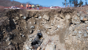
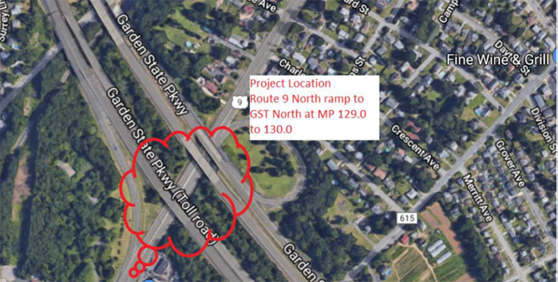
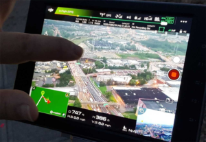
NJDOT used a drone to safely photograph the full extent of the soil erosion

NJDOT used a drone to safely photograph the full extent of the soil erosion

This article is a summary of an interview with New Jersey Department of Transportation (NJDOT) employees with expertise in engineering and geology from Geotechnical Engineering and Engineering Geology. The interview was held with Kim Sharp (Supervising Engineer, Geotechnical Engineering), John Jamerson (Project Engineer, Engineering Geology), and Amanda McElwain (Principal Engineer, Engineering Geology) to discuss how NJDOT utilizes A-GaME methods for its projects and the benefits these methods provide.

Q:  What is A-GaME?

A-GaME is an acronym for “Advanced Geotechnical Methods of Exploration” that encompasses a relatively new set of techniques for subsurface exploration that provides a more complete understanding of an area’s geotechnical and geological properties. In short, these techniques allow engineers to “see” what’s underground during a project’s design phase.

A-GaME techniques include the following processes:

Tools of the trade: sledgehammer, striking plate, and sensors are used to measure seismic vibrations through soil

Transportation projects typically use soil borings to collect soil samples, which are then tested in labs to determine the soil properties (e.g., water content, water depth, soil type, etc.) that will inform project design and construction. A-GaME techniques supplement soil borings and can more accurately identify obstructions, bedrock, and other soil conditions that could cause construction delays. They can also detect more subtle changes in soil conditions than conventional bore holes or penetration tests.

Q: Which of these methods has NJDOT used? Have they been successful?

Each A-GaME method yields benefits. The key is to find the right method for each project. NJDOT has utilized A-GaME methods in the preliminary design and design phases of several projects. In these projects, the results of the exploration have benefited project design and construction. Some of the more prominent examples of NJDOT’s use of A-GaME include:

  • Seismic Piezocone and P-S seismic logging techniques for the Pulaski Skyway seismic retrofitting of foundations. Consultants used these techniques in their site-specific seismic response analyses to derive shear wave velocity correlations and discover the various layers and depths of fill, organics, sands, clays, glacial till, and bedrock composition. This information allowed the engineers to determine how to retrofit each foundation to withstand a seismic event.
  • Mapping talus deposits – that is, collected rockfall piles – over bedrock on Route 80.
  • Microgravity surveys have been used in mine investigations. Northern New Jersey has several abandoned mines, and these surveys have provided safer and more complete methods to map and assess the structural integrity of these mines and inform remedial strategies.
  • Seismic methods were also used on another project near the Delaware Water Basin to measure the depth of talus deposits. Seismic activity was monitored from the road vibrations and the waves were measured at various points around the deposit to determine the locations of voids and the pile’s overall depth.
  • Mapping of rock joints for bridge foundation design along Route 4. Mapping the locations of the fractures in the rock allowed the design team to place the bridge foundations in structurally sound locations based on the competency of the rock mass. The process assisted in determining the long-term stability of the rock mass, the rippability (ease of excavation) and constructability of the mass, possible excavation angles, and the potential need for additional support.
  • Bathymetry Survey has been used in waterways upstream and downstream of structures on navigable waterways to provide river bottom elevation cross sections. This technique was used on the Pulaski Skyway project to reveal images of debris that had fallen off ships into the Hackensack River and could present issues during construction of the proposed foundation seismic retrofitting. The information saves time and money in the construction phase by alerting contractors to obstructions that will need to be removed.
  • Geophysical explorations have been used for finding shallow surface and river bottom debris, utility installations, and mapping existing bridge footing configurations underwater.
  • LiDAR survey has been used for site investigation on rock faces on a few projects during design.
  • Optical and acoustic tele-viewers have been used some down hole in soil borings to characterization of rock and any open voids.
  • Single Station Passive Seismic Survey (SSPSS) has been used to differentiate weathered rock from bedrock using ambient vibrations. Determining the interface between weathered rock and competent bedrock is essential, whether it is for rock slope stability, excavation concerns (mechanical or blasting), or foundations. SSPSS helped determine if the top layer was comprised of weathered rock, or if the top layer was comprised of loose boulders with lots of air-space in between.
  • Drones have been used in emergency situations to investigate large slope failures and to inform design on rockfall mitigation projects. On I-287, a drone equipped with a high-resolution camera was able to take photographs and videos revealing a broken drainage pipe that was contributing to erosion that required immediate remediation. This was safer and more cost effective than utilizing a team of workers to investigate. On I-280 and I-287, drones have also been used for rockface mapping and early site characterization as a design tool.
The source driver impacts the source, like a hammer striking a nail, and generates a wave. The pressure waves and seismic waves are recorded by the geophones as they travel through the fluid and soil walls.

The source driver impacts the source, like a hammer striking a nail, and generates a wave. The pressure waves and seismic waves are recorded by the geophones as they travel through the fluid and soil walls.

Q: Who determines which method to use, and who does the exploration?

Our office, in collaboration with design consulting firms, determines the most appropriate new technology methods for each project. The right method is largely determined by the type of project and its location. For example, projects that cross rivers may rely on sonar, LiDAR, or tomography to assess the conditions under the water and on the river’s slopes. On the other hand, a project in the mountains may require seismic methods of subsurface exploration because the steep slopes and rocky terrain make conventional testing impossible.

NJDOT often utilizes these methods during a project’s design phase to be proactive in reducing the risks and costs associated with underground soil conditions during construction. Some of these methods are also useful in emergency situations.

NJDOT sources A-GaME work to a small group of contractors that have knowledge on how to use the highly specialized and expensive equipment required to perform the tests, and the skilled, specialty trained personnel to conduct the tests and interpret the data. NJDOT and local governments rely upon private industry contractors to perform these specialized services; in fact, the geophysical firms themselves may not own the specialty equipment (e.g., seismographs, etc.), but will rent it out as needed due to the high costs of ownership. When we develop the boring program, the prime design consultant firm will often contract with a specialty geophysical firm. Sometimes the geophysical firm will be hired by the drilling contractor.

Q: You just said that these methods can be expensive, but isn’t an important benefit of these methods to save money?

A-GaME techniques tend to have a higher up-front cost, but these methods save money over the life of a project through risk reduction. When designers, DOTs, and contractors have a better understanding of the issues that could arise due to subterranean conditions (e.g., bedrock, air voids, old storage containers, abandoned mines), the project can account for these conditions rather than discovering them during the construction phase.

In the design phase, A-GaME methods can provide information to ensure that foundations are not overdesigned, or are appropriate for rocky terrain, and can improve constructability over the life of the project – which can deliver cost savings.  Overall, these techniques reduce costs associated with construction delays, change orders, and litigation.

In some environments, projects on mountainous terrain for example, the cost of soil borings can be very high to mobilize equipment, so supplementing borings with geophysical techniques brings the project cost down.

The information about soil known by traditional boring methods. Source: Minnesota DOT

The information about soil known by traditional boring methods. Source: Minnesota DOT

Q: What knowledge, skills, and abilities are needed to advance the use of A-GaME at NJDOT?

Delivering the specialized equipment, skills, and education needed for A-GaME are currently outside the capabilities and day-to-day responsibilities of NJDOT’s Geotechnical Engineering Department. Testing methods are complicated, and the resulting data often require the analyst to have a PhD in Geology.  The degree of specialization warrants the need for outsourcing the work to specialty contractors who would regularly perform these functions and hone their expertise.  Engineers entering the profession would not necessarily have had sufficient exposure to these techniques at the undergraduate level.

However, NJDOT staff have been going on-site when the specialty contractors perform work on NJDOT projects to learn more about these methods and climb the learning curve. When DOT staff have more knowledge about the methods, the odds of advancing their use in future projects increases.

Q:  What are some challenges to A-GaME’s deployment?

From an engineering perspective, all of the design firms need to become aware that there are lots of methodologies available to analyze and obtain soil and rock properties for better, and sometimes more efficient and cost-effective, designs of our foundations and rock slopes.  We work with firms of varying capacities including some less experienced firms with little awareness of the methods.  There are also some firms that would be interested in implementing these services on select projects, but until recently were not sure that NJDOT was open to their use, such as for rock work.

Information provided by ERI imaging is much more thorough. Source: Minnesota DOT

Information provided by ERI imaging is much more thorough. Source: Minnesota DOT

NJDOT project management teams also can be resistant to spending the extra up-front money for this type of testing and analysis. Soil boring drilling contractors do not want to work in tandem with geophysical firms because they have to wait for the firms to get out there and complete their work; for example, there are peripheral costs and scheduling uncertainties related to use of optical or acoustical televiewer work. The drilling contractors do not want to be idle while the geophysical work is being performed.  They want reliability as to when work will be completed so they can quickly move on to the next job.  So, we have found that fewer drilling contractors may actually bid on the job if they have to work in tandem or accommodate the geophysical firm services.  This can drive the bid costs up.

Q:  What are the next steps for A-GaME?

NJDOT and most other DOTs are still learning about A-GaME methods and their applications. The next step for NJDOT’s adoption of A-GaME is to continue to spread knowledge of these methods and encourage their use to supplement traditional boring techniques.

NJDOT’s Bridges and Structures Design Manual is being updated and, as part of the revision process, Geophysical Testing has been added to the new Sections 25 and 26.  While FHWA still must review these and other revisions to the Manual before it is made available to the public, the inclusion of A-GaME in the manual should eventually increase the awareness and use of these innovative methods among consultants. New innovative techniques are being added in the subsurface contract language as well.

Knowing where you will encounter bedrock is very helpful for excavation or drilling. You cannot get a complete picture such as this from bore samples. Courtesy of Jeff Reid, Hager-Richter Geoscience, Inc.

Knowing where you will encounter bedrock is very helpful for excavation or drilling. You cannot get a complete picture such as this from bore samples. Courtesy of Jeff Reid, Hager-Richter Geoscience, Inc.

NJDOT is encouraging designers to learn more about these methods and to seek approval for their use when designing NJDOT projects. NJDOT’s geotechnical team anticipates that, with familiarity, project managers will support additional funding for A-GaME during the design phase and use within the industry will grow.

Q:  Is there any other information you would like us to know about implementing the A-GaME?

These methodologies provide a wealth of information regarding soil and rock that soil borings and visual observations alone cannot provide us.  These methodologies better assist NJDOT in subsurface exploration for our highway structures and rockfall mitigation projects, as well as aid in determining pre-construction constructability issues on our heavily traveled waterways.

Resources

FHWA. (n.d.) Advanced Geotechnical Methods in Exploration (A-GaME). Retrieved from: https://www.fhwa.dot.gov/innovation/everydaycounts/edc_5/geotech_methods.cfm

Kelley V.C. (1987) Joints and fractures. In: Structural Geology and Tectonics. Encyclopedia of Earth Science. Springer, Berlin, Heidelberg. Retrieved from:  https://doi.org/10.1007/3-540-31080-0_56

NJDOT (n.d.). Innovative Initiative: What are Advanced Geotechnical Methods in Exploration? Retrieved from:  https://www.njdottechtransfer.net/advanced-geotechnical-exploration-methods/

Palmström A. (2001). Measurement and Characterization of Rock Mass Jointing, Chapter 2, In-Situ Characterization of Rocks. Editors: V.M. Sharma and K.R. Saxen. Retrieved from:   http://rockmass.net/ap/69_Palmstrom_on_Jointing_measurements.pdf

United States Geological Survey (n.d.) Geologic Units Containing Talus. Retrieved from: https://mrdata.usgs.gov/geology/state/sgmc-lith.php?code=1.5.5


Share Your Ideas on the NJ Transportation Research Ideas Portal!

The New Jersey Department of Transportation’s (NJDOT) Bureau of Research invites you to share your ideas on the NJ Transportation Research Ideas Portal.

We are asking NJDOT’s research customers and other transportation stakeholders to propose research ideas for the NJDOT Research Program. Join us in finding workable solutions to problems that affect the safety, accessibility, and mobility of New Jersey’s residents, workers, visitors and businesses.

REGISTER TO PARTICIPATE.  Once you are registered, you may submit ideas at any time.  If you registered last year, you do not need to register again.

HOW DO I SUBMIT AN IDEA?  Only registered participants can log in to submit a new idea or vote on other ideas to show your support. Register at the NJ Transportation Research Ideas website welcome page here:  https://njdottechtransfer.ideascale.com/

NEXT ROUND OF RESEARCH.  Please submit your research ideas no later than December 31, 2020 for the next round of research RFPs. The NJDOT Research Oversight Committee (ROC) will prioritize research ideas after this date, and high priority research needs will be posted for proposals.

Questions about how to register?
Email: ideas@njdottechtransfer.net

For more information about NJDOT Bureau of Research, visit our website: https://www.state.nj.us/transportation/business/research/

Or contact us:  Bureau.Research@dot.nj.gov or (609) 963-2242

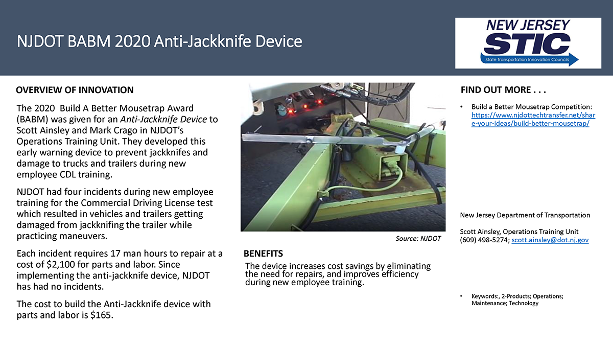
Build a Better Mousetrap Competition DEADLINE EXTENDED TO OCTOBER 1st!

People involved in the transportation industry often find better ways to do their jobs. Whether it’s a new gadget that improves the quality and safety of a project, or an innovative process that reduces costs and improves efficiency,  the people on the front lines are often the source of the innovations that become the latest and best practices.

New Jersey's Build a Better Mousetrap Competition provides a great opportunity to share new ideas with others and across the country.  We are looking for submissions from employees of local or state public agencies (municipalities, counties, parks commissions, NJ Department of Transportation, NJ Transit) that have developed new solutions to problems or found better ways of doing things. We will gather the best ideas from around the state and judge them using a 5-point rating system. The highest scoring entries will be entered into a Build a Better Mousetrap National competition.

Click the Better Mousetrap Competition for more information including an entry form to share your innovation and get in the game! Due to COVID-19, we have extended the deadline date for submissions to October 1st.

Want to know more about past winners of the New Jersey competition? Check out the videos below!

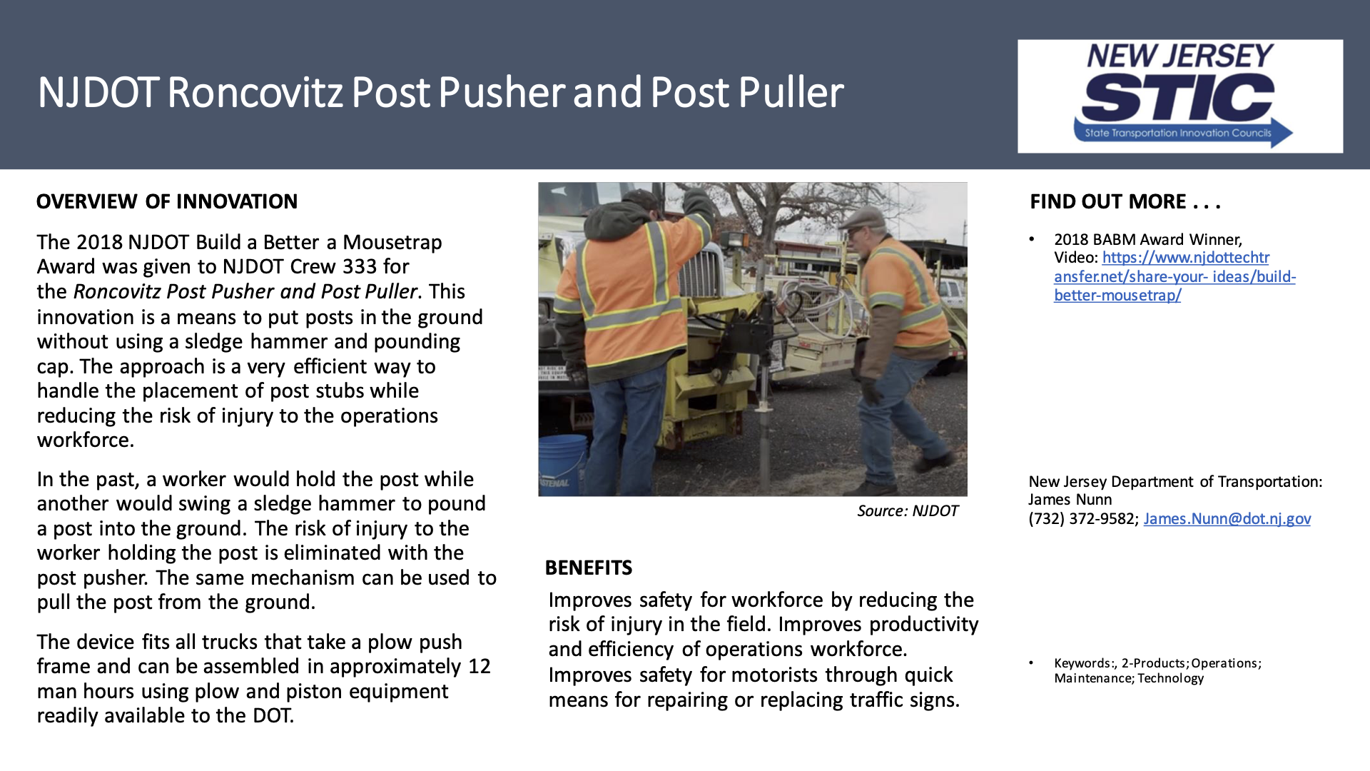
2018 Winner: Roncovitz Post Pusher and Post Puller, NJDOT Crew 333

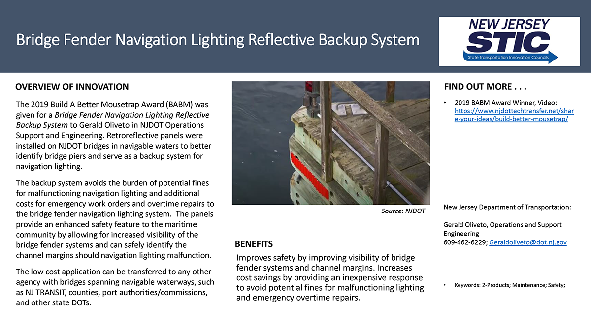
2019 Winner: Bridge Fender Navigation Lighting Reflective Backup System, Gerald Oliveto, NJDOT Operations Support and Engineering

FHWA Announces Every Day Counts (EDC-6) Innovation Areas

Every two years, FHWA works with state transportation departments, local governments, tribes, private industry and other stakeholders to identify and champion a new collection of innovations that merit accelerated deployment through the Every Day Counts Program (EDC). The FHWA’s Center for Accelerated Innovation (CAI) has recently issued the next round of areas of innovation, EDC-6.

EDC is a state-based model that identifies and rapidly deploys proven, yet underutilized innovations to shorten the project delivery process, enhance roadway safety, reduce traffic congestion, and improve environmental sustainability. Proven innovations promoted through EDC facilitate greater efficiency at the state and local levels, saving time, money and resources that can be used to deliver more projects.

FHWA’s CAI fosters collaboration between stakeholders within the transportation community through the State Transportation Innovation Councils (STIC), which are charged with evaluating innovations and spearheading their deployment in each state.

FHWA announced that it will officially launch EDC-6 by webinar on September 23, 2020. More information is expected to follow regarding virtual summits during which transportation leaders and front-line professionals from across the country will discuss and identify opportunities for implementing the innovations that best fit the needs of their respective state transportation program. Following the summits, New Jersey will finalize their selection of innovations, establish performance goals for the level of implementation and adoption over the upcoming two-year cycle, and begin to implement the innovations with the support and assistance of the technical teams established for each innovation.  Further descriptions of each of the EDC-6 Innovations are below:

Crowdsourcing for Advancing Operations. State and local transportation agencies need real-time, high-quality, and wide-ranging information to optimize roadway operations for reduced congestion and increased safety. Agencies are increasing the quality and quantity of operations data with crowdsourcing, which enables staff to make better decisions that lead to safer and more reliable travel and apply proactive strategies cost effectively. With crowdsourced data from multiple streams, agencies can capture in real time what happens between sensors, in rural areas, along arterials, and beyond jurisdictional boundaries.

e-Ticketing and Digital As-Builts. Highway construction projects generate massive amounts of valuable data that historically were communicated via paper, but agencies are improving on paper process by integrating them into electronic and digital workflows. Electronic ticketing improves the tracking, exchange, and archiving of materials tickets. Digital information, such as three-dimensional design models and other metadata, enhances the future usability of as-built plans for operations, maintenance, and asset management. Both can increase project safety, quality, and cost savings through efficient data gathering and sharing.

Strategic Workforce Development is among the innovative initiatives in EDC-6 offering strategies to identify, train, and place workers for highway construction jobs.

Next-Generation Traffic Incident Management: Integrating Technology, Data and Training. More than 6 million traffic crashes are reported each year, creating congestion and putting motorists and responders at risk of secondary crashes. Next-generation traffic incident management (NextGen TIM) builds on FHWA’s national TIM responder training program to shorten the duration and impact of incidents and improve the safety of motorists, crash victims, and responders. NextGen TIM offers tools, data, and training mechanisms that can benefit both new and existing TIM programs, including local agency and off-interstate applications.

Strategic Workforce Development. The demand for highway construction, maintenance, and operations workers is growing while the transportation industry is experiencing a revolution of emerging technologies that require new skills. The Highway Construction Workforce Partnership developed strategies and resources to demonstrate the value of a career in transportation and fill the jobs that support the Nation’s highway system. Resources include the “Identify, Train, Place” workforce development playbook and Roads to Your Future outreach campaign to attract and retain workers in highway construction jobs.

Targeted Overlay Pavement Solutions. Pavement overlays represent a significant portion of highway infrastructure dollars. Many pavements in the highway system have reached or are nearing the end of their design life while carrying traffic that exceeds their initial design criteria. Targeted overlay pavement solutions (TOPS) are now available for asphalt and concrete pavements that enable agencies to maximize their investment and help ensure safer, longer-lasting roadways. TOPS will improve performance, lessen traffic impacts, and reduce the cost of pavement ownership.

Ultra-High Performance Concrete for Bridge Preservation and Repair. Ultra-high performance concrete (UHPC)—a fiber-reinforced, cementitious composite material with mechanical and durability properties that far exceed those of conventional concrete—has become popular for field-cast prefabricated bridge elements. Bridge preservation and repair is a new application of UHPC that offers superior strength, enhanced performance, and improved life-cycle cost over traditional methods.

Virtual Public Involvement. Public engagement during transportation project planning and development helps agencies identify issues and concerns early in the process, which can ultimately accelerate project delivery. Virtual public involvement supports agency efforts to engage the public more effectively by supplementing face-to-face information sharing with technology. Techniques such as telephone town halls, online meetings, and social media increase the number and variety of ways to inform the public, receive feedback, and collect and consider stakeholder input.

STIC Incentive Funding Grant Awarded for Local Aid Software Training

FHWA recently announced the award of a State Transportation Innovation Council (STIC) funding grant ($38,490) to support NJDOT’s Division of Local Aid and Economic Development in their efforts to deliver software training to NJDOT and local transportation agency staff to perform electronic plan reviews.

The STIC-funded training initiative will be provided in conjunction with NJDOT’s efforts to implement features of the Project Management and Reporting System (PMRS), initially launched in 2018, to establish electronic document management, electronic plan review, and other 21st century project management innovations to help make project management more efficient. The PMRS is also being designed to integrate with tools, such as Bluebeam® Revu® and geographic information systems (GIS), to enable collaborative plan review and georeferencing project data.

NJDOT is continuing with its plan for an enterprise innovation shift to electronic project management. The NJDOT Division of Local Aid is about to implement Phase 2 of the PMRS.   This implementation includes transitioning plan review from a paper-based process to an electronic process offering greater standardization and tracking capabilities. The Department’s shift is well-aligned with EDC-3’s e-Construction initiative and Local Aid’s objectives to improve program delivery through electronic review.

With this shift, Local Aid project managers will have easier access to project plans and documents from the District Offices in electronic formats from anywhere.  The innovations embedded in the platform and supporting software will enable easy file sharing, efficient project transfers, tracking comments and their resolution, and the ability to track and review previous project phases more efficiently.

The STIC funding will support the NJDOT Division of Local Aid in the development of a software training program for municipal and county engineers and Local Aid staff.  The training will be conducted over a two-month period with various morning and afternoon classes to offer flexibility in scheduling and attendance.  The initial “live” training sessions are expected to be recorded for future online, “on-demand” use.  The course development and training initiative will be carried out by a team that manages the Local Aid Resource Center in association with NJDOT Local Aid staff.

The training seeks to accomplish key goals aligned with the Department’s commitment to using technology to enable staff to be more efficient in accomplishing routine tasks and collaborative activities with external stakeholders.   Ultimately, the transition to an online tool is expected to reduce paper consumption as well as centralize and standardize project management activities.

Click on NJ STIC Incentive Funding Grants to get more information on the purpose, eligibility and uses for which the NJ STIC has sought incentive funding in recent years.


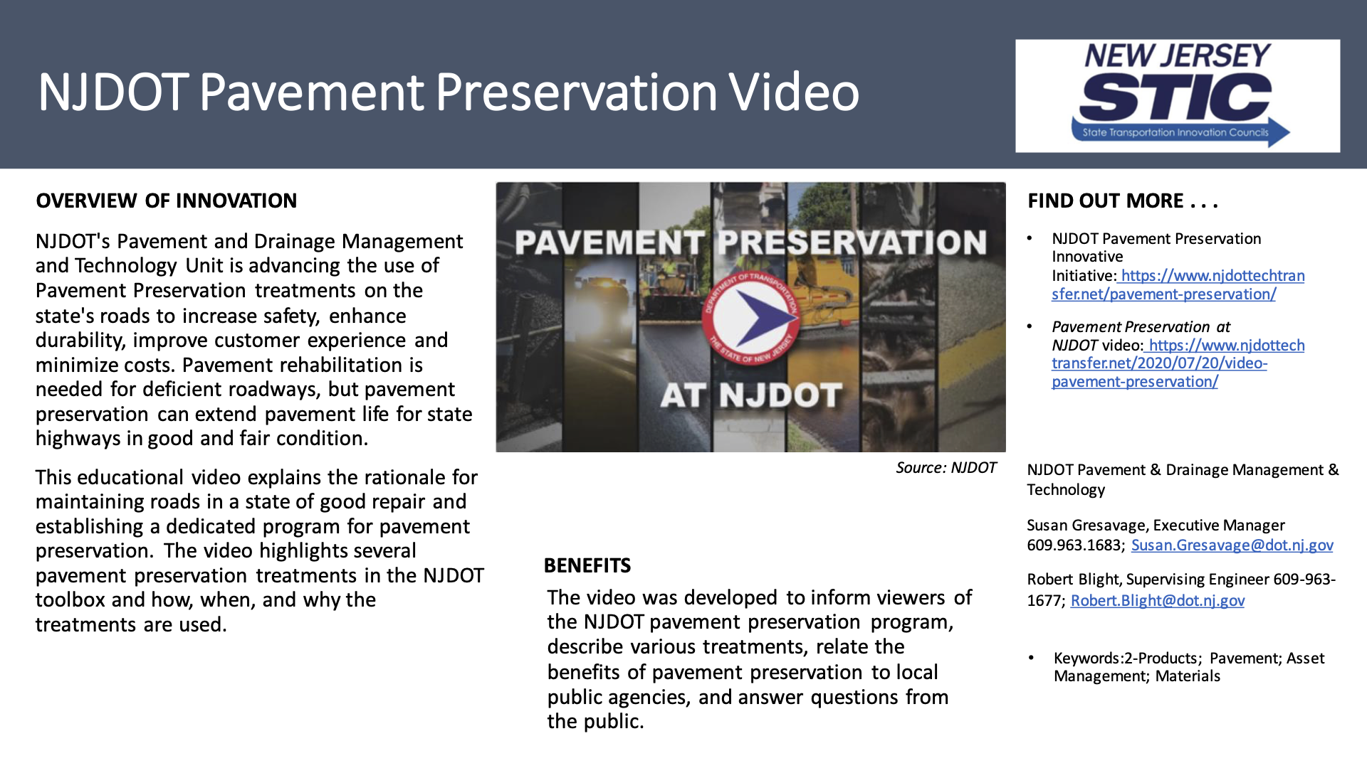
Pavement Preservation Treatments at NJDOT

NJDOT's Pavement and Drainage Management and Technology Unit is advancing the use of Pavement Preservation treatments on the state's roads to increase safety, enhance durability, improve customer experience and minimize costs. Pavement rehabilitation is needed for deficient roadways, but pavement preservation can extend pavement life for state highways in good and fair condition. 

Watch this educational video to learn more about the Pavement Preservation program at NJDOT and the tools in the pavement preservation toolbox. The video explains the rationale for maintaining roads in a state of good repair and establishing a dedicated program for pavement preservation. The video highlights several pavement preservation treatments in the NJDOT toolbox and how, when and why the treatments are used.

How New Jersey is Using Funds from the Volkswagen Settlement to Expand Clean Transportation Infrastructure

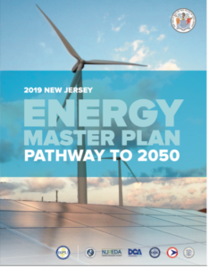
In January 2020, the State of NJ’s Energy Master Plan (EMP) was released which communicates the state’s aim to achieve 100 percent clean energy, defined as “carbon-neutral electricity generation,” by 2050. The plan provides a roadmap of seven key strategies to achieve this goal across a range of state agencies that include the New Jersey Board of Public Utilities (NJBPU), the Department of Environmental Protection (NJDEP), the Department of Transportation (NJDOT), the Department of Community Affairs (NJDCA), the Department of Labor and Workforce Development (NJDOL), the Economic Development Authority (NJEDA), and NJ TRANSIT. The EMP focuses heavily on the transportation sector as it is the state’s largest source of net greenhouse gas (GHG) emissions at 42 percent.

Strategic Mapping For Electric Vehicle DC Fast Charging Station Locations. Photo Source: NJDEP, 2020.

Strategic Mapping For Electric Vehicle DC Fast Charging Station Locations. Photo Source: NJDEP, 2020.

As the state works to reduce emissions from the transportation sector, the Volkswagen Mitigation Trust has provided a key source of early funding. In fall 2015, the United States Environmental Protection Agency (USEPA) and the California Air Resources Board (CARB) alleged that Volkswagen had secretly installed defeat devices in select Volkswagen, Audi, and Porsche-branded turbocharged direct injection diesel vehicles. The default devices had software that was specifically designed to cheat federal and state regulator emission tests. This resulted in vehicles with the devices emitting pollutant oxides of nitrogen (NOx) at up to 40 times the limit set by USEPA. NOx contributes to the materialization of ground level ozone which in turn causes harm to the respiratory system and cardiovascular health. Following this allegation, two Partial Consent Decrees were approved by the United States, California, and the defendants which formed an Environmental Mitigation Trust that provided funds to the 50 states, Washington D.C., Puerto Rico, and federally recognized tribes to counteract the negative impacts of the excess NOx emissions. Of the approximately $3 billion settlement, New Jersey was allocated $72.2 million, based on a calculation of the number of affected vehicles in the state, according to the state’s Beneficiary Mitigation Plan.

The Beneficiary Mitigation Plan states that 80 percent of the funds must be spent by October 2027, ten years after the Trust Effective Date, with five additional years for the remaining 20 percent if necessary. The settlement agreement outlines nine categories of eligible projects, which can be found here on NJDEP’s FAQ page. Additionally, the settlement allows for up to 15 percent of the funding to be used for light duty zero emission vehicle fueling and charging infrastructure. In support of the state’s target to achieve 100 percent clean energy by 2050, New Jersey’s goals for the mitigation funds are to reduce NOx, benefit communities disproportionately impacted by emissions, and support the expansion of zero emission vehicle adoption across the state. Additionally, NJDEP has a strong interest in pilot projects that help increase access to electric transportation modes such as bus transit or ride share in disproportionately impacted communities.

NJDEP is the lead agency assigned to prepare the state’s Mitigation Plan and authorize funds for approved projects with assistance from NJDOT, NJBPU, and NJ TRANSIT. According to Peg Hanna, Assistant Director of Air Monitoring and Mobile Sources at NJDEP and the lead for the Volkswagen Mitigation Trust at the agency, most states have appointed their environmental agency as the lead, with a few appointing their energy agency or governor’s office instead. Additionally, partner organizations outside the government include electric vehicle (EV) charging/fueling infrastructure providers, EV manufacturers, trade associations, and Environmental Justice (EJ) organizations.

Environmental Justice is a core component of the state’s goals in distributing the mitigation trust funds. Ms. Hanna explained that the primary way NJDEP has engaged with stakeholders in the EJ community is the agency’s EJ Advisory Council, using their meetings and subgroups to inform and seek feedback on the Volkswagen Mitigation Trust.

Currently, EJ communities are identified at the agency using several criteria, including whether it is an urban area, if it is a low- or moderate-income community, and whether it has been disproportionately impacted by air pollution. She mentioned this approach could change in the near-future with current state legislation S232, which would require NJDEP to evaluate environmental and public health impacts when reviewing permits for certain projects in overburdened communities. The bill provides a precise definition of an overburdened community which includes: 35 percent of the households qualify as low-income according to the U.S. Census, 40 percent of households are minority, or 40 percent of households have limited English proficiency. This definition is expected to be helpful moving forward to provide a clear map and list of municipalities that meet these criteria.

NJ VW Mitigation Trust Phase 1 Awards Map. Photo Source: NJDEP, 2020.

NJ VW Mitigation Trust Phase 1 Awards Map. Photo Source: NJDEP, 2020.

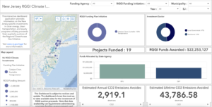
So far, NJDEP has allocated Volkswagen Mitigation Trust funding through two rounds in 2019, for a total of $27.2 million. In February 2019, the agency announced that $8 million would be used to purchase 8 new electric NJ Transit buses for the City of Camden and $3.2 million in grants were awarded for roughly 827 charging outlets at 533 charging stations across the state, which more than doubles the number of non-residential charging outlets across New Jersey.

The funding to expand chargers is distributed under NJDEP’s It Pay$ to Plug In grant program which aims to expand the state’s network of electric vehicle infrastructure in order to encourage residents, businesses, and government agencies to purchase electric vehicles.

A second round of funding was awarded in June 2019, when NJDEP announced $16 million would fund electric heavy-duty garbage trucks, school buses, and port-related vehicles. In the press release, NJDEP Commissioner Catherine R. McCabe said “The projects to be funded by this second round of grants will improve air quality in environmental justice communities that have for too long have had to bear a disproportionate burden of air pollution and its health consequences.” A breakdown of the projects awarded and dollar amounts disbursed so far can be found here.

Reflecting on these first two rounds of funding, NJDEP’s Peg Hanna saw the breadth of awardee projects which ranged from school buses to charging infrastructure as a positive, since it would help provide a range of information and lessons learned across different sectors. In contrast, some of the other states had plans focused solely on one type of transportation. For example, in Washington and Rhode Island, both states chose to spend their full amount on electric buses and charging infrastructure.

Currently, NJDEP is soliciting project proposals to allocate the remaining funding, with the application deadline on July 22. Of the remaining funds, $37.2 million will be used to convert old diesel trucks, buses, port equipment, marine vessels, and trains to electric power and $7.6 million will be allocated to charging infrastructure with priority for fast charging stations. Expanding fast charging infrastructure is supported by legislation signed into law in January 2020 which aimed to address “range anxiety” by expanding the network of electric vehicle chargers across the state. Additionally, this round of funding has a special project solicitation form for eMobility projects, which would expand electric car sharing or ride hailing in low and moderate income communities that have been disproportionally impacted by air pollution.

As New Jersey works towards the goal of 100 percent clean energy by 2050 as outlined in the Energy Master Plan, the VW Mitigation Trust serves as a key source of funding to help achieve this and address the large impact the transportation sector has on air pollution in the state.


Resources

Lamb, E. (2020, January 17). New Jersey Gov. Phil Murphy Signs Electric Vehicle Law. Transport Topics. https://www.ttnews.com/articles/new-jersey-gov-phil-murphy-signs-electric-vehicle-law.

Lanning, Z. (2019, March 1). State announces plans for first round of Volkswagen settlement funds. NJTV News. https://www.njtvonline.org/news/uncategorized/state-announces-plans-for-first-round-of-vw-settlement-funds/.

NJ Office of the Governor. (2020, January 27). Governor Murphy Unveils Energy Master Plan and Signs Executive Order Directing Sweeping Regulatory Reform to Reduce Emissions and Adapt to Climate Change. https://www.nj.gov/governor/news/news/562020/approved/20200127a.shtml.

NJ Office of the Governor. (2020, June 19). Governor Murphy Announces Support for Key Environmental Justice Legislation. https://nj.gov/governor/news/news/562020/approved/20200619b.shtml.

NJDEP. (2018, December 13). State of New Jersey Beneficiary Mitigation Plan for the Volkswagen Mitigation Trust. https://www.state.nj.us/dep/vw/BMPfinal.pdf.

NJDEP. (2019, June). NJDEP to Use First Round of Volkswagen Settlement Funds for Electric Vehicle Charging Stations. https://www.state.nj.us/dep/vw/phase1list.pdf.

NJDEP. (2020, June 15). Volkswagen Settlement Information. https://www.state.nj.us/dep/vw/.

NJDEP. (2020, July 1). Drive Green. https://www.drivegreen.nj.gov/plugin.html.

U.S. PIRG. (2019, May). Volkswagen Settlement State Scorecard. https://uspirg.org/sites/pirg/files/reports/USP%20VW%20Scorecard%20May19.pdf.

https://www.ttnews.com/articles/new-jersey-gov-phil-murphy-signs-electric-vehicle-law


Figure 3. Routes 55 & 47 were surveyed using a mobile unit which produces an enormous number of accurate and precise points (approximately ¼” inches apart for about 2 miles) for this bridge replacement project.

NJDOT Tech Transfer Innovation Interview: 3D Reality Modeling

In prior rounds of the Every Day Counts (EDC) program, the Federal Highway Administration (FHWA) sought to raise awareness and encourage the general education of transportation professionals in the uses of 3D models in all phases of project delivery, including the areas of planning, data collection and management, design, construction, operations and maintenance of highway facilities.  EDC-2 emphasized 3D engineered models for design and construction, while EDC-3 promoted the broader use of 3D models and digital data to further advance other application areas.

To find out a little more on what NJDOT has been doing to advance 3D modeling, we conducted an interview with Jim Coyle, a Geodetic Survey SME at NJDOT.  He is the supervisor of a relatively new unit, the Bureau of Survey Support that is working to deploy new technologies including the in-house integration of Lidar and software to create surveys from point clouds. The 3D modeling group within Survey Support is staffed with four individuals.  Below is an edited summary of our interview and follow-up discussion.

Q. What is meant by 3D Reality Modeling?

Reality modeling is the process of capturing the physical reality of an infrastructure asset, creating a representation of it, and maintaining it through surveys. Reality modeling gathers existing conditions in 3D using one or more devices—for example, cameras on drones, handheld camera, laser scanner, phones—to support mapping, design, construction, inspection and asset management.

At the foundational level, we start by establishing a 3D topographic map of the “existing world.” Other disciplines create their models, often using the 3D topo as a starting point or “designed-on-this-backdrop” model.

It’s handy to keep in mind that there are different definitions, references and standards in the usage of the term “modeling.” It depends on the discipline and who is supposed to make what deliverable or standard file type, but the backbone definition is obvious: an image speaks a thousand words.

Q. What is being done at NJDOT with 3-D reality modeling? What are typical use cases at NJDOT?

NJDOT is ahead of the curve in the use of mass data collection systems to create a visual model of existing conditions that planners can work within. We create this world using Lidar or reality capture through photogrammetry.

Photogrammetry is the process of capturing images of an object from many different angles and using these images to create three dimensional models, indexing and matching common features in each image. It is the science of making measurements from photographs. Lidar, or light detection and ranging, is a process whereby laser scanning produces accurate three-dimensional representations of elevations.

At NJDOT, we have used ContextCapture, a reality modeling software to create a 3D reality mesh. A reality mesh is a 3D model of real-world conditions that contains large amounts of triangles and image data that can be geospatially referenced. We coordinated with our Bureau of Aeronautics to fly a drone with a camera to do the data capture. Basically, the drone flies in a grid pattern taking a large number of overlapping pictures which can be plugged into software to create a 3D reality model. We used it to estimate the amount of dredging material for a project in Cape May as well as for a project at Route 29 and Duck Island (see Figures 1 and 2).

Figure 1. Route 29 & Duck Island Landfill. Requested by Environmental for 2D topographical purposes. The most cost-efficient method to fulfill the original 50+ acre objective was to fly the area with a photographic drone and create a model from the photos (Flown by the NJDOT Aeronautics Unit). Shown above are 2 views of the resulting 3D model.

Figure 1. ROUTE 29 & DUCK ISLAND LANDFILL. Requested by Environmental for 2D topographical purposes. The most cost-efficient method to fulfill the original 50+ acre objective was to fly the area with a photographic drone and create a model from the photos (Flown by the NJDOT Aeronautics Unit). Shown above are 2 views of the resulting 3D model.

There are different ways to collect laser scanning data such as through a drone, on a vehicle, or from the side of the road. NJDOT has purchased a static laser scanner that can be placed on the side of the road to collect point cloud data. It works a lot like a typical survey unit with control targets. We have used software, TopoDot, that puts in lines and features that creates the topographic layer and the digital terrain model, or DTM, surface file. We have done multiple projects with our static laser scanner.

Figure 2. Route 29 & Duck Island Landfill. Shown here is a contoured elevation heatmap. The model that was created is 3D by default, so creating this view is extremely easy to do. The model shows little erosion along the top and steep sides. Inasmuch as the model is both precise and accurately geo-located, future surveyed models of this ecologically sensitive area can easily be compared to this model.

Figure 2. ROUTE 29 & DUCK ISLAND LANDFILL. Shown here is a contoured elevation heatmap. The model that was created is 3D by default, so creating this view is extremely easy to do. The model shows little erosion along the top and steep sides. Inasmuch as the model is both precise and accurately geo-located, future surveyed models of this ecologically sensitive area can easily be compared to this model.

For larger projects, such as for roadway segments of two or three miles, a mobile scanner is needed. At present, NJDOT lacks a mobile scanner so this work has been outsourced to consultants. NJDOT has piloted the mobile scanning process, and we just used it for a bridge replacement project for the Route 55 Bridge over Route 47. The survey resulting from this mobile scanning is being used to support the design phase (see Figures 3 through 6).

The good thing about doing a laser scanner survey is that we get information from the surface all the way up—from signal heads to overhead wires. Normally, you do not deliver that for the survey work, but if the engineer later needs additional information you do not need to go back into the field with supplemental surveys. You can see that this can offer benefits in terms of safety, cost-savings and other efficiencies.

Traditionally, NJDOT did not have staff of photogrammetrists so the agency had to outsource to consultants all of its mapping. Now with this LIDAR technology, NJDOT is able to use the raw point cloud data (still collected by the consultant in the case of mobile scanning) to do the survey mapping in-house which appears to offer cost-savings.

Figure 3. Routes 55 & 47 were surveyed using a mobile unit which produces an enormous number of accurate and precise points (approximately ¼” inches apart for about 2 miles) for this bridge replacement project.

Figure 3. ROUTES 55 & 47 POINT CLOUD MODEL. Routes 55 & 47 were surveyed using a mobile unit which produces an enormous number of accurate and precise points (approximately ¼” inches apart for about 2 miles) for this bridge replacement project.

Q. Who will make use of 3-D Modeling in the future?

Everybody, but for this discussion we will focus on transportation, including planning, construction and maintenance of transportation systems.

3D models of transportation systems will enable planners to get a real world, spatially accurate, view of preexisting roadway features. 3D models are the foundation for 4D simulation models. For example, proposed traffic patterns and sight distances can be simulated visually. It is possible to lay down concept plans within this visual model essentially bringing the real world into your computer.

Designing in 3D is really a new paradigm. The combination of 3D modeling and Global Positioning Systems (GPS) will allow construction crews to use Automated Machine Guidance (AMG) to complete projects faster and with improved quality and safety. GPS-enabled construction equipment can run virtually non-stop with guidance from 3D model data and achieve precise grades on the first pass. GPS rovers can be used to spot check elevations and horizontal offsets. Traditional 2D methods rely on grade stakes and 2D paper plan sheets.

Figure 4. Switching the “view mode” of a point cloud is just a click. These views show the point cloud in contour mode (0.1 contours) and deviation from a plane mode.

Figure 4. ROUTES 55 & 47 POINT CLOUD MODEL. Switching the “view mode” of a point cloud is just a click. These views show the point cloud in contour mode (0.1 contours) and deviation from a plane mode.

The 3D model can be updated with as-built location data throughout the construction process. After construction, the 3D model becomes the record drawing. The 3D model will have useful benefits as a base map for future maintenance and can be stored in a GIS database for asset management.

Q. How does 3D reality modeling benefit the agency’s various operations?

Having all design elements in 3D improves accuracy and decreases unintended occurrences. Design conflicts become much more apparent.

It is also easier for each discipline to identify how they fit into the project as a whole. This understanding allows for efficient conflict resolution during design and an improved product that should be much easier to construct.

Figure 5. Low Cost As-Builts. In this view (RGB/real color mode) of the Route 55NB to Route 47 NB Ramp nose, assets such as signs, inlets, junction boxes, guide rail and post, striping, etc. are documented with true mapping grade 3D coordinates. The density of point cloud (approx. 4 to 5 mm apart) can be seen near the inlet/curb in the lower left.

Figure 5. ROUTES 55 & 47 POINT CLOUD MODEL. Low Cost As-Builts. In this view (RGB/real color mode) of the Route 55NB to Route 47 NB Ramp nose, assets such as signs, inlets, junction boxes, guide rail and post, striping, etc. are documented with true mapping grade 3D coordinates. The density of point cloud (approx. 4 to 5 mm apart) can be seen near the inlet/curb in the lower left.

With an engineered 3D model, everyone can see a lifelike representation of what the finished project will look like. These 3D project files can be uploaded anywhere, which means everyone—even those without a technical background—can quickly get up to speed around a project’s concept. The emphasis on 3D-driven design offers new ways of easily communicating information with clients and the public; from 3D KMZ files that can be viewed in Google Earth to full virtual reality (VR) tours of a virtual corridor; the final product has never been easier to visualize.

When a project is presented to the public in 3D, stakeholders quickly have a comprehensive understanding of what is occurring by seeing the depth and details they will ultimately see once the project is constructed.

Figure 6. Measuring and calculating bridge clearances takes seconds when using a 3D point cloud model, and no one had to step into the road to do it.

Figure 6. ROUTES 55 & 47 POINT CLOUD MODEL. Measuring and calculating bridge clearances takes seconds when using a 3D point cloud model, and no one had to step into the road to do it.

Q. What skills, knowledge and abilities are needed to advance the use of 3D reality modeling at NJDOT?

The skills required include an understanding of surveying general principles. There is a need for surveyors and technicians with the ability to interpret and render 3D data including data capture, registering, and creating the point cloud, and familiarity with MicroStation/CADD and TopoDOT software. Folks need to be comfortable working with computers and CADD.

Q. What tools, equipment, or techniques are being used by the agency to advance modeling?

The Bureau of Survey Support is currently working with Static/Mobile Lidar scanners, cameras, drones as well as traditional survey equipment and various software (Bentley/Leica Suite products). As I’ve mentioned, we are exploring how to use these products for projects in-house and in collaboration with our consultants where we may not have the scanning equipment.

The future is in 3D design. NJDOT Design is in the process of upgrading the Bentley CAD suite of software including OpenRoads Designer and OpenBridge Designer. NJDOT should have the tools within six months or a year. Following training, I anticipate that NJDOT will be designing with 3D within two to three years.

Resources

FHWA. (2017). 3D Engineered Models. Retrieved from: https://www.fhwa.dot.gov/construction/3d/


Development of Real-Time Traffic Signal Performance Measurement System

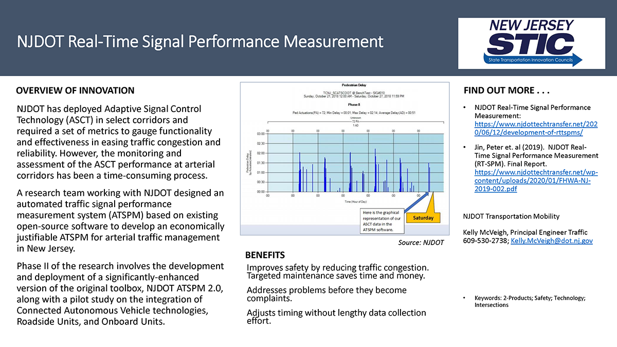
Adaptive Signal Control Technology (ASCT) is a smart traffic signal technology that adjusts timing of traffic signals to accommodate changing traffic patterns and reduce congestion. NJDOT recently deployed this technology in select corridors and required a set of metrics to gauge functionality and effectiveness in easing traffic congestion and reliability. However, the monitoring and assessment of the ASCT performance at arterial corridors has been a time-consuming process.

The Automated Traffic Signal Performance Measures system (ATSPMs) developed by Utah DOT is one of the widely-used platforms for traffic signal performance monitoring with a large suite of performance metrics. One limitation of the existing ATSPM platform is its dependency on high-resolution controllers and the need to set up hardware and software at each individual intersection. Upgrading the existing controllers and reconfiguring the hardware and software at each intersection requires significant investment of funding and labor hours.

Recently completed research funded by the New Jersey Department of Transportation’s Bureau of Research mobilized researchers from Rutgers University, The College of New Jersey (TCNJ), and Rowan University to assist in advancing the goal of establishing automated traffic signal performance measures. The goals of the needed research were to develop a prototype Automated Traffic Signal Performance Measures platform for ASCT systems. The main focus was how to take advantage of the centrally-stored signal event and detector data of ASCT systems to generate the ATSPM performance metrics without intersection-level hardware or software deployment.

The study’s primary objectives were to examine: 1) how to utilize existing field data and equipment to establish Signal Performance Measures (SPMs) for real-time monitoring; and 2) identify what additional data and equipment may be employed to generate additional SPMs while automating the real-time traffic signal monitoring process. This research is especially important for New Jersey (NJ) with the deployment of ATSPM and the establishment of NJDOT’s Arterial Management Center (AMC).

Background

At present, NJDOT maintains a traffic signal system comprised of many types of equipment that affect signal performance, including different signal configurations and vehicle detection devices. Older equipment and ineffective detection technologies make real-time traffic signal monitoring quite difficult to implement across the state. With the implementation of more centrally-controlled traffic signal systems and the Department’s Arterial Management Center (the central control for remotely monitoring these signals) coming online, NJDOT needed standards to assure that the signals would operate properly and ease traffic congestion, and that the signals could be monitored remotely in real-time effectively.

ATSPMs are promoted by FHWA (Federal Highway Administration) as an EDC-4 (Every Day Counts 4) initiative. The use of ATSPMs has important foreseeable benefits:

  • Increased Safety. A shift to proactive operations and maintenance practices can improve safety by reducing the traffic congestion that results from poor and outdated signal timing.
  • Targeted Maintenance. ATSPMs provide the actionable information needed to deliver high-quality service to customers, with significant cost savings to agencies.
  • Improved Operations. Active monitoring of signalized intersection performance lets agencies address problems before they become complaints.
  • Improved Traffic Signal Timing and Optimization Policies. Agencies are able to adjust traffic signal timing parameters based on quantitative data without requiring a robust data collection and modeling process.
Research Approach

The research team recognized that the deployment of various adaptive traffic control systems such as InSync and SCATS systems on major NJ corridors and networks improved the capability for building real-time performance measures. The study included: a review of the literature and best practices; several stakeholder meetings; and recommendations and development of performance metrics, system architectures, data management, and strategies for deploying ATSPM systems using existing and planned NJDOT arterial infrastructure and technologies.

Figure 1: An Example real-time performance monitoring on County Road 541 and Irwick Road, Burlington County, NJ

Figure 1. An Example real-time performance monitoring on County Road 541 and Irwick Road, Burlington County, NJ

The researchers first conducted a literature review to identify examples of existing Signal Performance Measurement (SPM) systems to help inform the development of ATSPMs. The researchers described several exemplary initiatives, including the following:

  • In 2013, the Utah Department of Transportation’s (UDOT) SPM Platform was named an American Association of State Highway and Transportation Officials (AASHTO) Innovation Initiative. Deployed across the state, the system allows UDOT to monitor and manage signal operations for all signals maintained by the agency while aiding in more efficient travel flows along corridors.
  • From 2006 to 2013, the Indiana Department of Transportation (INDOT), with Purdue University, established a testbed of signal performance measures. INDOT developed a common platform for collecting real-time signal data, which became the foundation for AASHTO’s Innovation Initiative on Signal Performance Measures. This performance system has now been deployed at more than 3,000 intersections across the country.
  • Researchers at The College of New Jersey have established a signal performance measurements testbed using Burlington County’s centralized traffic signal management system. Traffic signal data collected along County Route 541 has been used to generate real-time performance measures and identify infrastructure improvements that could advance NJDOT’s ability to use real-time SPMs. An example of the existing real-time performance monitoring for Irwick Road and CR541 in Westhampton, NJ in Burlington County is shown in Figure 1.
  • Many state or local agencies including Pennsylvania DOT, Michigan DOT, New Jersey DOT, Lake County (Illinois), and Maricopa County (Arizona), etc., are actively incorporating ATSPMs into their traffic management and operation strategies. Lessons learned from implementation of ATSPMs from different agencies revealed that ATSPMs are critical to ATCS.

The research team organized and facilitated targeted stakeholder meetings. These meetings confirmed that stakeholders were not currently able to perform efficient real-time post-processing of the existing available data.  Through the meetings, the research team was able to scope more deeply into the type of performance measurements that were feasible and what could be done with the collected information.  Stakeholders also conveyed that the total number of operating adaptive signal intersections would more than double in the near-term future, making the need to efficiently process and leverage data from adaptive systems a more pressing concern. The discussions further confirmed that the big question for study was how to best leverage these adaptive systems to evaluate and manage future corridors.

Figure 2. Corridors where NJDOT has deployed ASCT systems; red denotes full operation, yellow denotes under construction, and blue denotes concept development

Figure 2. Corridors where NJDOT has deployed ASCT systems; red denotes full operation, yellow denotes under construction, and blue denotes concept development

The research team sought to better understand the inventory of NJDOT’s existing and planned ASCT systems. In 2019, New Jersey had over 2,500 NJDOT-maintained signals, but only 76 signals were on Adaptive Traffic Signal Systems.  In addition to the existing five corridors and the district in which ASCT systems had been deployed, 3 corridors were under construction and/or in final design and another 11 corridors were in the concept development phase for future ASCT installation at the time of the study (see Figure 2).

The research team visited the state’s Arterial Management Center (AMC) and investigated several signal performance systems – specifically, the Sydney Coordinated Adaptive Traffic System (SCATS), Rhythm Engineering’s InSync, and the Transportation Operations Coordinating Committee’s (TRANSCOM) real-time data feed – to better understand their interfaces, different types of detectors and their availability.

Figure 3. System Operation Data Flow Diagram

Figure 3. System Operation Data Flow Diagram

The research team designed an automated traffic signal performance measurement system (ATSPM) based on existing ATSPM open-source software to develop an economically justifiable ATSPM for arterial traffic management in New Jersey.  The entire system operates as shown in Figure 3. The high-resolution controller belonging to existing infrastructure is connected to an AMC at each signalized intersection. The controller event log file contains signal state data that is sent to an AMC database. The research team’s program automatically retrieves these data logs and translates the unprocessed data into a standard event code. The converted event file is inserted into an ATSPM database and the ATSPM software can generate signal performance metrics and produce visualizations to support performance-based maintenance and operations by traffic engineers.

Key Research and Implementation Activities

The research team successfully created a bench test of the ATSPM system based on data collected from high-resolution data from adaptive signal control systems including 13 SCATS locations on NJ Route 18 and 2 InSync locations on US Route 1. As a result of the testing, the research team successfully assembled a prototype for automated traffic signal performance measures in New Jersey.

1
2
10
3
7
6
4
8
9
5
previous arrow
next arrow
1
2
10
3
7
6
4
8
9
5
previous arrow
next arrow

Key research activities from the project are as follows:

  • Create Inventory of Existing NJDOT Arterial Management System: The team investigated several signal performance systems including InSync, SCATS, and TRANSCOM fusion application interfaces and different types of detectors and their availability. The team also conducted intensive review of state-of-the-art-and-practice of ATSPM system and identified ways of migrating the system to NJ.
  • Identify Performance Metrics and Measurement Methods for NJDOT ATSPM System: The team conducted a comprehensive review of SPMs built into an ATSPM system. The team investigated and customized SPMs that can be generated by NJDOT detector and travel time data.
  • Develop System Architecture and Concept of Operations for NJDOT ATSPM System and Established a Bench Test of ATSPM Located on TCNJ’s Campus: To leverage the existing ATCS system, the team developed a signal event conversion program to translate existing SCATS and InSync history log file to an event code that can be recognized by ATSPM. The detailed metrics are summarized in the figures to the right.
  • Prepare Real-Time Traffic Signal Data Management Guidelines: The research team created data management guidelines and a manual for data processing. The team validated the outputs through a comprehensive process. The team also completed a test to automatically connect to an ATSPM database using a VPN and MSSQL database management system.
  • Develop Deployment Strategies Considering Existing, Planned, and Future Systems/ Conduct Case Studies of System Deployment: The team initiated the pulling of one-month of data into their platform for the ATSPM. Large scale deployment of this system was expected to be conducted as part of Phase II research.

The research team observed that ATSPMs have distinct advantages over traditional traffic signal monitoring and the accompanying management process. The systems help shorten feedback loops with easier data collection and signal performance comparisons to enable before and after timing adjustments.

Future Work

In the first phase of the research project, the research team developed a software toolbox, NJDOT ATSPM 1.0.  The toolbox can convert the event output data from SCATS and InSync ATSC Systems into event data that can be processed by the ATSPM platform. The primary accomplishment was to integrate ATSPMs with existing ATCS from the centralized management console, instead of configuring at each controlled intersection on field. The proposed system bridges the gap between increasingly deployed ATSC and emerging ATSPMs without investment on new controllers. The effect of this research was validated on two selected corridors. NJDOT arterial management operators are able to use the ATSPM platform to generate key performance metrics and conduct system analysis for NJDOT’s ATSC corridors.

While the initial deployment and analysis was successful, it was limited in its scope. Phase II of the research involves the development and deployment of a significantly-enhanced version of the original toolbox, NJDOT ATSPM 2.0, along with a pilot study on the integration of ATSC controllers with Connected Autonomous Vehicle (CAV) technologies.

The research team will work with NJDOT to identify and add new performance metrics to generate additional Signal Performance Measures. The team can incorporate proprietary data from traveler information providers (e.g. INRIX and HERE) to generate other performance metrics such as queue/wait time, degree of saturation, predicted volumes, etc., and incorporate them into the NJDOT ATSPM platform. The team will also conduct pilot testing on the integration of Connected and Automated Vehicle (CAV), Roadside Units (RSU), On Board Unit (OBU) with the existing and planned NJDOT ATSC systems.

This developed ATSPM system from Phase II will bridge the gap between collected traffic data (e.g., signal controller data, detector data, and historical data) and needed performance information for decision-making. Phase II research is underway with an expected completion by November 2021.

Relationship to Strategic Goals

The development of RT-SPMs and the adapting and deployment of ATSPM with existing NJ ATSC systems is aligned with the FHWA EDC (Every Day Counts) Initiative to promote the rapid deployment of proven innovations. NJDOT ATSPM 2.0 will help meet the strategic EDC goal to accelerate the deployment of ATSPMs on existing and planned arterial corridors to reduce crashes, injuries, and fatalities, optimize mobility and enhance the quality of life.

The Phase II research supports the state initiative on advancing policy and testing of CAV technologies in New Jersey. The outcome of the project will be reported to NJDOT which is part of the New Jersey Advanced Autonomous Vehicle Task Force to make recommendations on laws, regulations and guidance to safely integrate advanced autonomous vehicle testing on the State’s highways, streets, and roads.


Resources

McVeigh, Kelly. (2019). Automated Traffic Signal Performance Measures.  Presentation at NJ STIC May 7th, 2019 Meeting.

Jin, P. J., Zhang, T., Brennan Jr, T. M., & Jalayer, M. (2019). Real-Time Signal Performance Measurement (RT-SPM) (No. FHWA NJ-2019-002).  Retrieved at: https://www.njdottechtransfer.net/wp-content/uploads/2020/01/FHWA-NJ-2019-002.pdf

Jin, P. J., Zhang, T., Brennan Jr, T. M., & Jalayer, M. (2019). Real-Time Signal Performance Measurement (RT-SPM) – Technical Brief Retrieved at: https://www.njdottechtransfer.net/wp-content/uploads/2020/01/FHWA-NJ-2019-002-TBrev.pdf

Zhang T., Jin P., Brennan, T., McVeigh, K. and Jalayer, M, Automating the Traffic Signal Performance Measures for Adaptive Traffic Signal Control System. ITS World Congress. 2020.