NJDOT’s Research Library Hosts Tool to Find Recent Transportation Research Publications

The NJDOT Research Library maintains a “Did You Know” page to share basic facts about the research library's operations, available transportation research resources, and newly issued publications.

Hot Topic Searches are available on the TRID Searches page

The NJDOT Research Library also has a "TRID Searches" page that contains a list of searches for recent publications indexed in the TRID database, based on 37 subject areas, covering all modes and disciplines of the transportation field.

Select "Hot Topic" searches are also maintained that list ongoing projects and publications issued in the last five years that are stored in the TRID Database.  These hot topics include:

  • Diversity, Equity and Inclusion
  • Planning & Safety
  • Resilience
  • Sustainability
  • Transformational Technologies
  • Workforce Recruitment and Retention

TRID (Transport Research International Documentation) is the world's largest and most comprehensive bibliographic resource on transportation research information. It combines the records from the Transportation Research Information Services (TRIS) database of the Transportation Research Board (TRB) and the Joint Transport Research Centre’s International Transport Research Documentation (ITRD) database of the Organisation for Economic Co-operation and Development (OECD).

viperagp | Adobe Stock

TRID helps researchers locate solutions to problems, avoid duplication of work, and save resources. It includes records of AASHTO publications, federal and state DOT reports, University Transportation Center (UTC) reports, and commercial journal literature, among other sources. It also satisfies the U.S. Federal Highway Administration (FHWA) requirements to consult TRB's TRIS databases to identify ongoing or previously completed research on a given topic.

To expand your search to projects, or for any other research questions, please contact Eric Schwarz, the NJDOT Research Librarian, at eric_cnslt.schwarz@dot.nj.gov or 609-963-1898.

National STIC Network Meeting – January 2023 (Recording)

The National STIC Network meeting was held on January 25, 2023. The meeting featured Ohio STIC and Idaho STIC which were awarded 2022 STIC Excellence Awards.  The recording of the January 2023 National STIC Network meeting is available here.

The Ohio STIC representative discussed expansion of STIC membership to Rural Transportation Planning Organizations and Institutes of Higher Education, increased collaboration and development of criteria for STIC Incentive project selection, and cost savings achieved through innovation in Ohio DOT internal processes.

The Idaho STIC representative spoke about the STIC’s support of the Idaho Career Opportunities – Next in Construction (ICONIC) training program, their On the Job Training/ Supportive Services program. With this support, the program tripled in size, and increased outreach to, diversity of, and employment opportunities for program participants.

The NJ STIC was also awarded a 2022 STIC Excellence Award.  The activities and accomplishments of the NJ STIC were featured during the National STIC Network Meeting – June 1, 2022 (Recording).

Attendees were encouraged to register for the FHWA EDC-7 Virtual Summit which will be held Feb 14-16, 2023.


Presentation: Design, Construction, and Evaluation of UHPC Bridge Deck Overlays for NJDOT

UHPC for Bridge Preservation and Repair is a model innovation in the sixth round of the FHWA’s Every Day Counts Program (EDC-6).  Ultra High Performance Concrete (UHPC) is recognized as an innovative new material that can be used to extend the life of bridges. Its enhanced strength reduces the need for repairs, adding to the service life of a facility.    

NJDOT recently installed UHPC Bridge Deck overlays on four bridges in New Jersey. NJDOT engineers, Jess Mendenhall and Samer Rabie, explained the rationale for UHPC's installation and highlighted key lessons learned in bridge selection, existing conditions & testing, design, materials specifications, construction methods and evaluation during the NJ STIC 4th Quarter 2022 meeting.

Their recorded presentation, Design, Construction, and Evaluation of UHPC Bridge Deck Overlays for NJDOT, is viewable below.  Their presentation can be downloaded here or from the NJ STIC 4th Quarter Meeting page.

NJ STIC's UHPC Innovative Initiative page highlights the deployment progress and activities of the core team in seeking to advance UHPC for Bridge Preservation and Repair and contains other articles and resources.


NJDOT’s Research Library Hosts Tool to Find Recent Transportation Research Publications

viperagp | Adobe Stock

The NJDOT Research Library maintains a “Did You Know” page to share basic facts about the research library's operations, available transportation research resources, and newly issued publications. The NJDOT Research Library has compiled a list of searches for recent publications indexed in the TRID database, based on 37 subject areas, covering all modes and disciplines of the transportation field.

TRID (Transport Research International Documentation) is the world's largest and most comprehensive bibliographic resource on transportation research information. It combines the records from the Transportation Research Information Services (TRIS) database of the Transportation Research Board (TRB) and the Joint Transport Research Centre’s International Transport Research Documentation (ITRD) database of the Organisation for Economic Co-operation and Development (OECD).

TRID helps researchers locate solutions to problems, avoid duplication of work, and save resources. It includes records of AASHTO publications, federal and state DOT reports, University Transportation Center (UTC) reports, and commercial journal literature, among other sources. It also satisfies the U.S. Federal Highway Administration (FHWA) requirements to consult TRB's TRIS databases to identify ongoing or previously completed research on a given topic.

To keep the results manageable, these searches do not include current or recently completed transportation research projects.

To expand your search to projects, or for any other research questions, please contact Eric Schwarz, the NJDOT Research Librarian, at eric_cnslt.schwarz@dot.nj.gov or 609-963-1898.

NJ STIC 3rd Quarter 2022 Meeting

The NJ State Transportation Innovation Council (NJ STIC) convened virtually for the 3rd Quarter Meeting on September 19, 2022. The NJ STIC Agenda had been distributed to the invitees prior to the meeting. Participants could use the Microsoft Teams platform chat feature to offer comments or ask questions of the speakers during the online meeting.

Brandee Chapman, NJDOT Innovation Coordinator greeted the meeting participants, followed by Assistant Commissioner Michael Russo who provided the Welcome and Opening Remarks.

FHWA EDC Innovation. Helene Roberts, Innovation Coordinator and Performance Manager for the FHWA NJ Office, noted that there are three months remaining in EDC-6 and the EDC-7 cycle will begin in January 2023. She does not have information about the initiatives that will be part of the next cycle, but they should be announced soon. The EDC-7 Summit will likely be held in early December as a virtual event, featuring some states that have used the initiatives successfully, and will be followed by a NJ Caucus, where the NJ STIC will discuss the opportunities and barriers of the new initiatives and consider what initiatives New Jersey should pursue. The final reports for EDC-6 will be completed in January 2023.

Core Innovation Area (CIA) Updates. The meeting continued with presentations from Core Innovative Area (CIA) leaders who provided updates of the status of EDC initiatives on the topics of Safety, Infrastructure Preservation, Mobility and Operations, and Organizational Improvement and Support.

There was a brief break during which meeting participants could take part in a transportation trivia quiz through Mentimeter.

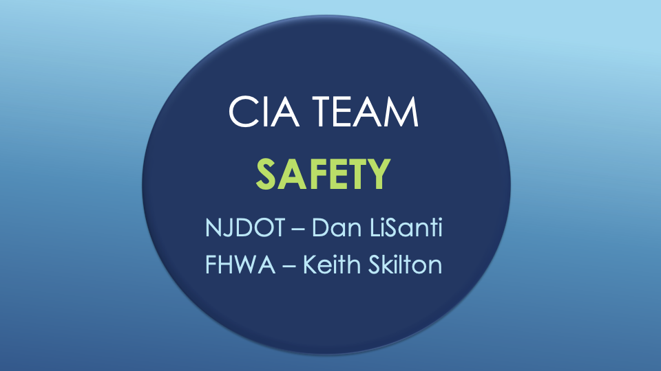
Featured Presentation – Safety CIA Team. The featured presentation was delivered by Daniel Lisanti, Manager, and Jeevanjot Singh, Section Chief for the Bureau of Safety, Bicycle & Pedestrian Programs (BSBPP).

Mr. Lisanti noted that the Bureau comprises three units: the Office of Safety Program Management, Office of Bicycle and Pedestrian Planning, and the Office of Complete Streets Implementation. The Bureau manages the federally-funded Highway Safety Improvement Program (HSIP) for all roads in the State, manages the implementation of the 2020 New Jersey Strategic Highway Safety Plan (SHSP) for Bicycle and Pedestrian Planning, and serves as the Subject Matter Expert (SME) on Complete Streets Implementation. The Bureau also manages technical projects that identify, inventory, review and analyze safety concerns along state and non-state roads, and suggest safety countermeasures, among other responsibilities.

Currently, the Bureau has 214 active HSIP projects in various stages of development. Mr. Lisanti gave an overview of the Bureau and the evolution of the programs over the past decade, explaining that HSIP funding increased and NJDOT shifted from funding low-cost, quick-fix maintenance projects to supporting larger scale capital improvement projects.

Mr. Lisanti reviewed the Bureau’s previous STIC-related accomplishments which include work on the Safe Transportation for Every Pedestrian (STEP) initiative for EDC-4 and EDC-5 involving an action plan for pedestrian crossing countermeasures at uncontrolled locations, and systemic safety projects for midblock crosswalk safety improvements. For EDC-3, the Bureau used STIC funding to hold local safety peer exchanges to discuss Data Driven Safety Analysis and substantive safety and the systemic safety approach.  Related to the EDC-5 initiative Reducing Rural Roadway Departures, NJDOT held a three-day virtual training with FHWA and the FHWA Resource Center.

The Bureau has changed focus to consider why crashes happen, and to take steps to proactively address the risk of a crash. Projects include Horizontal Curve Safety Assessment which is nearing completion, Wrong Way Driving, and forthcoming safety assessments for School Zones and Intersections. Other areas of focus include Vegetation Safety Management and Midblock Crosswalk Improvements on NJDOT roadways.

Ms. Singh reviewed several improvements to the Safety Project Delivery Process to institutionalize safety in all of their projects. The Bureau is using condensed CD checklists in the limited scope process for the Horizontal Curve Sign Program and High Friction Surface Treatment to fast-track deployment. They have included Highway Safety Manual analysis and Complete Streets checklist activities to the Capital Project Delivery Process network diagram to ensure project managers are aware of requirements for HSIP projects. The Bureau is working with consultant selection teams for proposal reviews for HSIP projects to determine the best consultant team. The Bureau has developed a Post Deployment Evaluation process which incorporates three and half years of data. This process has been submitted to FHWA for approval. If approved, the process will be used for assessment of Center Line Rumble Strips, High Friction Surface Treatment, and Road Diets. Ms. Singh discussed the introduction of split funding and job order contracting for Safety Project Delivery using HSIP monies. The Bureau is diversifying their project portfolio and coordinating with NJDOT Maintenance on vegetation management, with Technology on wrong way driving warning systems, pedestrian detection systems, and Lead Pedestrian Intervals, and with Communications on Public Service Announcements (PSAs) and public outreach.

As previously noted, the Bureau is responsible for SHSP implementation. Ms. Singh noted a robust process that has engaged 200 stakeholders. She provided an update on progress on the original 35 priority actions and noted that 22 action items have been added for Year 2.

Finally, Ms. Singh made note of the Safety Resource Center (SRC), a one-stop centralized clearinghouse for transportation safety in NJ. The SRC disseminates information and connects multimodal transportation experts, public officials, academia, and the public to industry resources such as safety trainings, technical standards, guidance, plans, research, case studies, best practices, and technical assistance. In the future, the SRC will be responsible for the NJDOT SHSP plans and updates.

 Reminders and Updates. Ms. Chapman closed the meeting with information and reminders on the online location of several resources that highlight the NJ STIC and other innovation topics funded through research and technology transfer activities, including:

The NJ STIC Innovative Initiatives Survey has been distributed via email. Responses will be shared at a future STIC meeting and innovative initiatives will be featured through the NJDOT Technology Transfer program. The survey will help identify examples of implemented EDC initiatives and other innovative practices in New Jersey, and consider the challenges of implementing innovative practices. Please share the survey with your networks – the target audience is members of local public agencies, MPOs and other transportation professionals. Responses are due by September 30th. The survey can be found here.

Ms. Chapman announced the 2022 Build a Better Mousetrap Competition Winner – The Sawcut Vertical Curb. The Sawcut Vertical Curb method involves cutting a typical 4-inch curb to 2-inches to comply with updated standards for guard rail. The existing guide rail can remain in place while cutting the curb and the construction crew can remove and upgrade the guide rail later. This new method saves time, money, and improves the safety of both work crews and road users.

Ms. Gendek and Ms. Chapman submitted the Sawcut Vertical Curb as the first nomination to the annual AASHTO Innovative Initiatives competition earlier this month, and a winner will be selected by the end of the calendar year. The competition is for proven advancements in transportation technology and AASHTO is using the competition to accelerate adoption of innovations by agencies nationwide.

FHWA featured NJ STIC in the September/October issue of the Innovator publication. Using excerpts from our presentation at the National STIC meeting, the article mentions the STIC Communications Plan, piloting of the Let’s Go! Workshop, and more. You can read the full article at the link here.

Ms. Chapman reported that she attended the 2022 State Innovation Forum in San Diego, CA. The purpose of the forum was to exchange ideas with DOT Innovation peers, helping to shape the future of transportation innovation. Attendees also included AASHTO, TRB, and FHWA who were looking to gain insight into new tools and learn about the needs of the group.

The 2022 NJDOT Safety Summit will be held as a virtual event on October 11, from 10am-12pm. Go to saferoadsforallnj.com for more information.

STIC Incentive Program funds are still available for 2022 and more funds will be available soon for the coming year. The FHWA offers these funds, as well as technical assistance, to support the costs of standardizing innovative practices in a state transportation agency or other public sector STIC stakeholder. NJ STIC receives $100,000 each year. Ms. Chapman asked that the STIC network members communicate these grant opportunities through their networks. Local public agencies are eligible to apply. Find more information, including examples of allowable activities and prior recipients, here.

Amanda Gendek, Manager of the NJDOT Bureau of Research, and Mike Russo provided closing remarks.

A recording of the NJ STIC September 2022 meeting can be found here.

The Meeting Presentations can be found in its entirety here and or in sections below.

NJ STIC September 2022 Meeting Recording

Slide image reading: Welcome, Mike Russo, Assistant Commissioner, NJDOT Planning, Multimodal & Grant AdministrationWelcome Remarks

Slide image reading: FHWA Updates, Helene Roberts, P.E., Innovation Coordinator & Performance Manager, FHWA, NJ Division OfficeFHWA EDC Innovation Updates

Slide image reading: CIA Team Safety NJDOT - Dan LiSanti, FHWA - Keith SkiltonCIA Team Update: Safety

CIA Team Update: Infrastructure Preservation

CIA Team Update: Organizational Improvement and Support

CIA Team Update: Mobility and Operations

Feature Presentation: NJDOT Innovative Approach to Safety

Reminders, Announcements, and Thank You

Share Your Ideas on the NJ Transportation Research Ideas Portal!

The New Jersey Department of Transportation’s (NJDOT) Bureau of Research invites you to share your ideas on the NJ Transportation Research Ideas Portal.

We are asking NJDOT’s research customers and other transportation stakeholders to propose research ideas for the NJDOT Research Program. Join us in finding workable solutions to problems that affect the safety, accessibility, and mobility of New Jersey’s residents, workers, visitors and businesses.

REGISTER TO PARTICIPATE.  Once you are registered, you may submit ideas at any time.  If you registered previously, you should not need to register again.  Click on the “+” button at the top of the page to register.

HOW DO I SUBMIT AN IDEA?  Only registered participants can log in to submit a new idea or vote on other ideas to show your support. Register at the NJ Transportation Research Ideas here:  https://njdottechtransfer.ideascale.com/

MORE INFO.  Our Welcome and FAQs page offers more information.

NEXT ROUND OF RESEARCH.  Submit your research ideas no later than December 31, 2022 for the next round of research RFPs. The NJDOT Research Oversight Committee (ROC) will prioritize research ideas after this date, and high priority research needs will be posted for proposals.

Questions about how to register?
Email: ideas@njdottechtransfer.net

For more information about NJDOT Bureau of Research, visit our website: https://www.state.nj.us/transportation/business/research/

Or contact us:  Bureau.Research@dot.nj.gov or (609) 963-2242

NJDOT’s Commercial Vehicle Alerts Initiative Featured in National Operations for Excellence Webinar

Commercial vehicle safety-related alerts can notify drivers of major slowdowns from incidents and weather to inform decision-making. Source: Sblover99, Wikimedia

The National Operations Center for Excellence held a webinar featuring New Jersey and Colorado DOT initiatives to establish private sector partnerships that use crowdsourced data to deliver real-time information to commercial vehicles to improve the safety of all road users.  Transportation agencies can now deliver in-cab alerts about road conditions through connected truck service providers to help commercial vehicle drivers approach and react more quickly to roadway incidents, work zones, and adverse weather conditions.

For this event, the NJDOT’s Senior Director for Transportation Mobility, Sal Cowan, gave a presentation, “NJDOT Using Crowdsourced Data to Improve Road Safety:  Real Time Communications with Truck Drivers”.  He was joined in making this presentation by NJDOT's private sector partners for this initiative, Amy Lopez, Director, Public Sector Services and Smart City Strategy for INRIX, and Marc Nichols, Director, Government & Industry Partnerships for Drivewyze.

As traffic deaths rise, NJDOT wants to get more information into the hands of drivers about changing roadway conditions – the earlier the better – to inform their decision making in an effort to reduce crashes.  Summoning the key phrase, “Whatever It Takes”, Director Cowan framed the life-saving imperative behind NJDOT's willingness to make greater use of crowdsourcing and real-time data tools to reduce the risk of crashes.  He highlighted how commercial vehicle alerts can inform truck drivers of hazards on the road, such as sudden slowdowns, disabled vehicles, and debris before the truck is affected by the incident. The driver can seek an alternate route or pull over until the slowdown is cleared.

INRIX collects extensive traffic data for state transportation agencies. They provide two types of alerts: "curated" incidents are from multiple sources such as DOTs, Twitter feeds, Waze, police scanners and other sources that are managed by the INRIX incident team; and "calculated" incidents such as dangerous or sudden slowdowns that are mathematically calculated by INRIX and compare real time speeds with free flow speeds at specific segment locations to identify abnormal conditions. The INRIX system has the ability to deliver real-time data that detects and describes sudden slowdowns, closures, and queues by location for specific events. This data is passed on to Drivewyze to send out alerts.

Drivewyze, introduced as North America’s largest connected truck network, provides communication with some 2.8 million trucks via its Drivewyze application which is embedded in the electronic logging device (ELD) of the truck. Drivewyze takes data from INRIX and communicates it to commercial truck drivers. The system works with severity thresholds and trigger warnings so only events that exceed these thresholds are reported. Commercial drivers receive the messages through the ELD in their cab. The reported information can be customized to include notification of specific weather events, incidents, work zones, and bridge and road closures.

A "major winter storm alert" was distributed to several states in the Northeast and reached some 4,811 trucks at a critical time.

NJDOT plays a pivotal role in providing weather and detour related data. Through this partnership NJDOT can collect extensive data regarding issues and incidents that it otherwise could not directly obtain.  This allows the state to identify areas along key highways that produce issues and NJDOT can then begin to identify ways to resolve them. In addition to analysis, NJDOT can work proactively with is partners to prevent crashes.  During Winter Storm Kenan, NJDOT was able to send alerts out through Drivewyze to thousands of trucks across the Northeast to alert drivers to a major winter storm and hazardous road conditions and to take precautions.

The webinar, part of the FHWA's Adventures in Crowdsourcing Webinar Series, had two featured presentations on initiatives to address commercial vehicle safety through crowdsourcing.  The webinar explored lessons from New Jersey, Colorado and other states through presentations and information exchange with attendees from the FHWA, other state DOTs, and private sector partners.  To learn more about the New Jersey initiative and the capabilities of its private sector partners, check out the full presentation here, starting at the 29th minute.   The presentations given by the NJ team and other presenters can be downloaded here.

Reconnecting Communities: Redressing the Past to Advance a More Equitable Future

The interstate highway transportation building program undoubtedly yielded significant mobility and economic benefits for the nation in the post WW-II era but also imposed environmental and public health burdens for less favored communities. The benefits and burdens of the building program were not equitably distributed; the burdens were often disproportionately borne by predominantly minority and ethnic populations and lower-income communities that were powerless to halt transportation and land use decisions made in the name of “progress”, regional mobility, more efficient auto and truck travel, and urban renewal.

The Reconnecting Communities Pilot Program, a new and innovative program in the Bipartisan Infrastructure Law, takes a small step toward repairing and redressing the adverse consequences of these past planning and engineering decisions. (1)

The Bipartisan Infrastructure Law (BIL) enacted in the Infrastructure Investment and Jobs Act has been described as a “once in a generation” investment in our nation's infrastructure, promising two million jobs per year and delivering needed financial assistance to transit, highways, water, power, and communications. While much of the BIL’s transportation funding is intended to encourage and prioritize the repair, reconstruction, replacement, and maintenance of existing transportation infrastructure, the BIL also tilts investment and resources for programs, new and old, to tackle the challenges of the 21st century in the realms of safety, equity, and climate change and resilience.

The BIL includes an innovative new program, the Reconnecting Communities Pilot Program, that sets aside $1 billion to “restore community connectivity by removing, retrofitting, or mitigating highways or other transportation facilities that create barriers to community connectivity, including, mobility, access, or economic development.” From 2022 through 2026, the pilot program will receive $500 million from the Highway Trust Fund and $500 million from the general fund for Planning and Capital Construction grants. (2)

Emergency services on scene at O'Connor Electro-Plating explosion in Los Angeles, Calif., 1947. Courtesy of UCLA Library.
Freeway and Urban Renewal in the Bronx. Provided with permission from Segregation by Design.

The USDOT explains that the Reconnecting Communities pilot program will help reconnect communities that were previously cut off from economic opportunities by transportation infrastructure. Reconnecting a community could mean adapting existing infrastructure– such as building a pedestrian walkway over or under an existing highway– to better connect neighborhoods to opportunities or improve access through crosswalks and redesigned intersections.  The FY22 Notice of Funding Opportunity (NOFO) has been issued and is available on the USDOT website.

The primary goal of the program is to reconnect communities harmed by transportation infrastructure, through community-supported planning activities and capital construction projects that are championed by those communities. The planning grants support the funding of the planning processes for the entity performing the reconnection, to include project design and public outreach to the historically disconnected communities. Outreach can be tailored to overcome mistrust of the government entity that sited the infrastructure that disconnected the community, and explore potential strategies to redress the burdens of these past siting decisions. After planning is complete, capital construction grants will fund work to remove, replace, or mitigate the facility. The federal government will fund up to half of the costs of these projects.


Below Grade Portion of Cross Bronx Expressway under construction, provided with Permission from Segregation by Design
I-93 Construction in Boston, Provided with Permission by Segregation By Design

What the Reconnecting Communities Program Recognizes

The program is noteworthy for its recognition that, historically, many public and private entities presided over land use policies and the siting of transportation infrastructure that resulted in the isolation and segregation of poor and marginalized populations from the broader community. Some scholars have traced causes of spatial segregation to unfair enactment of zoning laws in the 1930s that peddled "health and safety" as the rationale for carrying out discriminatory land use policies.  Over time, the color line boundaries were maintained through redlining, realtor steering, block-busting, and disinvestment that shaped a geography of unequal access to opportunities for those concentrated in disadvantaged communities.

The intent of early zoning was to reinforce protection of citizens’ health and safety as established in nuisance law. It gave governments police powers to make sure that the state and its cities could be proactive in anticipation of negative impacts. Unfortunately, with these powers, the enfranchised voter, politician, planner, and engineer set the parameters of health and safety to fit their preferences and biases. Governments could consolidate disenfranchised populations in specific areas and permit the siting of health and safety nuisances in these communities through “spot zoning”. For example, in South Central LA, a majority black neighborhood, the City began to spot zone industrial uses in commercial portions of the neighborhood. An electroplating plant in the area exploded in 1947 killing 5 local residents and 15 workers while damaging 100 homes. The property next to a church was spot zoned industrial and when the pastor raised their concerns, they were why “Why don’t you people buy a church somewhere else?” (3 pp. 55-56). These local decisions had the silent approval of state and federal governments.

Concurrently, the rise of the personal automobile required the allocation of space to make trips easier and faster in and through traditionally dense American cities. At the beginning of the Highwaymen Era, cities sought to build expressways and parkways, often ignoring the residents who sat in the bulldozer’s path. The Cross-Bronx Expressway is an often-referenced example of how damaging the siting of urban expressway projects were to community life and how powerless the affected communities were to halt siting decisions.  In 1945, Robert Moses, perhaps the most infamous highwayman, sought to construct a seven-mile trench highway through the Bronx. He looked at the stretch as his to shape. Even when offered alternatives to his vision, alternatives that would have resulted in preserving more of the neighborhood and homes, he persisted with his alignment through the Bronx and its displacements of the families along the way. (4 pp. 839-878) Moses was not alone among the planners and engineers in ignoring the preferences and plight of local residents.

This process accelerated with passage of the Federal-Aid Highway Act in 1956 that funded the construction of mostly free to access, grade-separated roads that linked cities, towns, and states. The money and power prescribed to states from the federal government allowed the powers that be to run highways through neighborhoods of primarily underrepresented populations. The Embarcadero Freeway in San Francisco (5 pp. 46-96), I-93 in Boston (6), the several I-80’s of Oakland (7) , and many more cut deep into their cities in the name of progress (3 pp. 127-129). Individuals saw the divisive impacts of these highways on communities and eventually rallied in several cities to prevent their expansion, but it was too late for many communities. Hulking multilane highways that produced noise and air pollution cut up and cut off neighbors and communities (5 pp. 94-121).

Over time, people have organized and sought to mitigate or reverse the impacts of these highway sitings on the urban landscape. Several governmental bodies are engaged in planning processes for community reconnection and several projects have been successfully completed in the past two decades. The most famous two examples are The Embarcadero in San Francisco and Boston’s Big Dig. The Embarcadero Freeway was a multilevel highway that separated San Francisco Bay from the City. In 1989, an earthquake struck the Bay Area. The Embarcadero crumbled with the quake and people began to ask questions about how this massive waterfront space could be used. After fights with the State and a 6-5 vote at the municipal level, a boulevard and trolley tracks replaced the Embarcadero. (8) For the first time in decades, the bay, not pillars and concrete, bound San Francisco at its north end.

The most famous reconnection on the East Coast is probably the Big Dig. When constructed, I-93 tore through the historically Italian North End, cutting it off from the City proper. With no transit facilities, the neighborhood was isolated with large spans casting shadows into the residences of the North End.  While the North End could not be saved, witnessing the damage caused by the highway sparked highway revolts throughout the Boston area leading to the cancellation of several highway projects in Boston. With traffic pressures rising and lack of political will for more throughput, Massachusetts started to plan the Big Dig in the early 1980s to repair the damage done and improve throughput on I-93. Over the next 35 years, Boston engaged with the North End community, the citizens of the City and business and waterfront interests to shape the public space that would follow. This development process resulted in the current boulevard and park that caps I-93. (6)

Before and After Replacing the Embarcadero, Courtesy of the San Francisco Planning Department

Recent and Promising Reconnections

In Boston and San Francisco, the removal of the highways revived the space, but also led to land speculation that has fueled displacement and gentrification. With the successes and mistakes of these community reconnections in mind, other states and cities are exploring restorative strategies that will avoid and minimize community displacements.

The Inner Loop of Rochester is one of the more recent reconnection projects on the East Coast.  Its transformative effects have served as a "demonstration project for highway removal in other parts of the city" (9).  When completed in 1965, I-490 and New York State Route 940T created a loop around Rochester’s downtown, making the area difficult to access for most residents. As the 1970s brought significant economic impacts to Upstate New York, Rochester’s population declined and the city recognized the need to reconnect the downtown with the rest of the city. In the early 2000s, several proposals slowly coalesced into public engagement in 2013 through which the citizens helped shape plans for the initial removal of the loop. For $21 million, Rochester removed and buried its below grade highway and have since replaced it with housing and mixed-use development. (9,10)

Built between 1956 and 1968, I-94 connected the Twin Cities, but in the process badly damaged the majority Black neighborhood of Rondo, displacing 60 percent of its residents. In the late 2000s, a freeway cap was proposed to cover the highway in portions, but like many proposals at the time, it languished due to tight public budgets. In 2021, a local nonprofit, Reconnect Rondo, began spearheading an effort to reconnect portions of the community via a four-block land bridge. A land bridge option was settled on rather than removal or downgrading to a boulevard because that stretch of I-94 is considered the busiest segment of highway in the state. Reconnect Rondo is seeking justice in other ways for the cumulative impacts unleashed in part by the highway’s bisection of the community. They want to expand the neighborhood community land trust and provide housing and invest in local businesses while they pursue the highway cap. (11)

Modern day I-93 after the Big Dig, Courtesy of NewtonCourt and Wikimedia.
Rondo Neighborhood 1953 (left), 2020 (right), courtesy of Ramsey County, Minnesota

Syracuse is replacing I-81, the viaduct that runs through the core of its city. I-81’s construction ran through a neighborhood that was not only majority black, but also held a majority of all the black residents in Syracuse. The press depicted the neighborhood as slums and the State targeted the neighborhood for urban renewal in 1957. The completion of the viaduct left a soaring piece of infrastructure that isolated the community. Syracuse joined with several other municipalities in seeking to right the wrong created by I-81 and recently received funding from the State of New York to replace the highway with a boulevard. Community members fear that the growth resulting from the return of I-81 to the city’s grid may displace residents. NYSDOT’s only noted plan for addressing this potential impact is to ensure the ongoing update to the city’s development plan includes gathering the community’s input on how the new space incorporates with the community. (12-15)

New Jersey now has an opportunity to learn from those who have already planned and implemented community reconnection projects.  In recent years, two highway segments have been identified as candidate projects. In Northern New Jersey, I-280, when constructed, cut a deep swath underneath the streets of Newark, East Orange and Orange. Today, the interstate segment divides neighborhoods and generates traffic, noise, and air pollution and presents unsafe pathways for pedestrians and cyclists.  The North Jersey Transportation Planning Authority (NJTPA), in association with Essex County and the affected municipalities, examined strategies for reconnection in the Essex County Freeway Drive and Station Area: Safety and Public Realm Study in 2017.  This study examined access and circulation issues in Orange and East Orange, and around the East Orange, Brick Church and Orange train stations, Route 280, Freeway Drive East and West, and the NJ TRANSIT elevated rail line (16).  The Regional Planning Association’s Fourth Plan, completed in 2019, calls for capping I-280 in Newark and East Orange "to restore the street grid and knit back together neighborhoods." (17)

In the State Capitol, the city, county, and state all have sought to transform State Route 29. While not a part of the Interstate System, NJ-29 connects with I-195 and I-295 south of Trenton and winds along the Delaware River, separating Trenton residents from the waterfront. In 2009, the City of Trenton signed a memorandum of understanding with several agencies that proposed transformation of NJ-29 into a boulevard, but like I-94, the project has not advanced. A 2016 grant from the Delaware Valley Regional Planning Commission (DVRPC) spurred renewed interest in continuing the process. (18)  With the availability of funding, advocates are seeking state support to plan and rebuild a section of Route 29 in downtown Trenton (19,20).

Can affected communities and stakeholders in New Jersey draw inspiration from the reconciliation and restoration efforts of other states and regions? With federal funding available, advocates see an opportune time to get these or other projects off the ground that could reconnect the communities once divided by past roadway siting and design decisions.

Rendering of before and after I-81 is torn down, courtesy of NYSDOT

RESOURCES

  1. Wilson, Kea. Four Things Advocates Need to Know About the ‘Reconnecting Communities’ Program. Street Blog USA. [Online] 30 June 2022. https://usa.streetsblog.org/2022/06/30/four-things-advocates-need-to-know-about-the-reconnecting-communities-program/.
  2. U.S. Department of Transportation. Reconnecting Communities Pilot Program – Planning Grants and Capital Construction Grants. [Online] https://www.transportation.gov/grants/reconnecting-communities.
  3. Rothstein, Richard. The Color of Law: A Forgotten History of How Our Government Segregated America. s.l.: Liverwright Publishing, 2017.
  4. Caro, Robert. The Power Broker: Robert Moses and the Fall of New York. s.l.: Random House, 2015.
  5. Kelley, Albert Benjamin. The Pavers and the Paved: The Real Costs of America's Highway Program. s.l.: D.W. Brown, 1971.
  6. Crockett, Karilyn. People Before Highways: Boston Activists, Urban Planners, and a New Movement for City Making. s.l.: University of Massachusetts Press, 2018.
  7. Self, Robert O. American Babylon: Race and the Struggle for Postwar Oakland. s.l.: Princeton University Press, 2005.
  8. Rubin, Jasper. The Embarcadero Reborn. Found SF. [Online] u.d. https://www.foundsf.org/index.php?title=The_Embarcadero_Reborn.
  9. Congress for New Urbanism. Rochester | Inner Loop North. Campaign Cities. [Online] u.d. https://www.cnu.org/highways-boulevards/campaign-cities/buffalo-inner-loop-north.
  10. Inner Loop East - Public Participation. Inner Loop East - From Barrier to Beautiful. [Online] u.d. https://www.cityofrochester.gov/article.aspx?id=8589950580.
  11. Wilson, Kea. Land Bridge Seeks to Restore Minnesota Black Neighborhood. Streetsblog USA. [Online] 19 February 2021. https://usa.streetsblog.org/2021/02/19/land-bridge-seeks-to-restore-minnesota-black-neighborhood/.
  12. I-81 Viaduct Project: Community Grid. New York State Department of Transportation. [Online] https://webapps.dot.ny.gov/i-81-viaduct-project.
  13. Walker, Alissa. About Time: Syracuse’s I-81 Is Finally Being Demolished. Curbed. [Online] 26 January 2022. https://www.curbed.com/2022/01/hochul-syracuse-highway-removal-i-81.html.
  14. The Highway Was Supposed to Save This City. Can Tearing It Down Fix the Sins of the Past? Jalopnik. [Online] 5 April 2022. https://jalopnik.com/the-highway-was-supposed-to-save-this-city-can-tearing-1836529628.
  15. Congress for New Urbanism. Syracuse | I-81. Campaign Cities: Highways to Boulevards. [Online] u.d. https://www.cnu.org/highways-boulevards/campaign-cities/syracuse.
  16. North Jersey Transportation Planning Association (NJTPA).  Freeway Drive and Station Area: Safety and Public Realm Study. 2017.  Freeway-Drive-Report-Report-only-20170724.pdf (njtpa.org)
  17. Regional Plan Association. Fourth Regional Plan: Remove, Bury, or Deck Over Highways that Blight Communities. [Online] http://fourthplan.org/action/remove-highways.
  18. Congress for New Urbanism. Trenton | Route 29. Campaign Cities: Highways to Boulevards. [Online] https://www.cnu.org/highways-boulevards/campaign-cities/trenton-route-29.
  19. Hurdle, Jon. Push on to Jumpstart Route 29 Makeover in Trenton.  NJ Spotlight News. [Online] 21 July 21, 2022. https://www.njspotlightnews.org/2022/07/route-29-highway-makeover-trenton-federal-funding-advocates-city-link-river-economic-development-civic-pride/
  20. Route 29 Sign-On Letter to Office of Governor. Route 29 Boulevard: Transformational Opportunity for the City of Trenton.  Letter. [Online] 2 June, 2022.  https://www.njspotlightnews.org/wp-content/uploads/sites/123/2022/07/Route-29-Sign-On-Letter-June-2022.pdf

A-GaME’s Webinar Series: Ready When You Are & Geophysics Users Group Meetings

The FHWA is putting on its “A-GaME Summer Super Sessions Series” for 2022, specifically focused on improving geotechnical site characterization practices for construction decisions and constructability. Save the dates and forward to your peers, partners and construction and project managers! These sessions are free.

June 22 – Session 1: Step into the Contractor’s Boots. Hear directly from four contractors on the “asks,” risks and decisions they face when preparing bids and making decisions based on subsurface conditions that might or might not be well investigated, characterized or communicated. A recording is available through registering here

July 20 – Session 2: Manage Risk: Reduce Geotechnical Uncertainties Before Construction. Dive into the types of problems we experience during construction as a result of geotechnical uncertainties, and explore A-GaME technologies and other effective solutions to minimize those geotechnical uncertainties through case histories, applications of appropriate site characterization techniques and discussion. A recording is available through registering here

­­­­­­August 17 – Session 3: Bridge the Gap: Communicating Subsurface Conditions for Construction. Geotechnical subsurface investigations are not just about design parameters. Geotechnical site characterization must also inform constructability decisions and provide contractors with the information needed to get the job done efficiently and effectively. Explore ways to improve our investigation processes, to effectively communicate site conditions to all stakeholders, and to establish a collective understanding of anticipated conditions and contingencies for bidding and construction decisions. Registration links will be posted when available. 

August 24 – Special Owner’s Only Forum: Making it Happen: Improving Site Characterization for Constructability and Construction Decisions. Intended for DOT Construction and Project Managers, Geotechnical Engineers and other owner representatives, this session will include large and small group discussions, and intra-agency collaboration to improve internal site characterization processes and procedures. Information about this session will be sent at a later date.


In recent years, the FHWA A-GaME webinar series has featured topics that highlight proven, effective exploration method and practices for enhanced, effective site characterization that reduce project risks, improve quality and accelerate project delivery.  Experts from the FHWA, state DOTs, industry and academia have covered everything from the nuts and bolts of A-GaME methods to visualization and design. 

If you missed the webinars live or want to review content, the archived webinars are now hosted on Deep Foundations Institute’s YouTube channel and available to watch on demand.

To stay in the know on A-GaME updates, FHWA invites you to Subscribe to A-GaME e-News!

For more information, contact Ben Rivers at Benjamin.Rivers@dot.gov.


Geophysics Users Group

The joint industry Geophysics Users Group was created in cooperation with FHWA, Geo-Institute, DOTs, DFI and TRB Committees AKG20 and AKG60 to address geophysics users’ needs. The group will be undertaking a launch project, DIGGS for Geophysics, that will contribute to the ASCE/DIGGS XML schema by incorporating geophysical data. The ambitious goal of the project is to develop a fully functional geophysical module in DIGGS in about one year.

If you are interested in geophysics, join the monthly virtual meetings on the second Tuesday of the month at 3:00 p.m. (ET). The meetings are held via Microsoft Teams, which will also be used to house information generated by the group. For more information visit the Geophysics Users Group Committee web page or contact Derrick Dasenbrock, FHWA Resource Center, at derrick.dasenbrock@dot.gov.


National STIC Network Meeting – June 2022 (Recording)

The National STIC Network Meeting was held on June 1,  2022. The activities and accomplishments of the New Jersey STIC were featured during this national event. The FHWA has posted a recording of the meeting for those who may have missed it, National STIC Network Meeting – June 1, 2022 (Recording).

The NJ STIC team’s presenters highlighted the NJ STIC Communications Plan, the Unmanned Aerial Systems (UAS) Program and its participation with the FHWA in piloting a “Let’s Go Workshop” – a team-building and strategy setting exercise for advancing the deployment of select innovations. The NJ STIC presentation can be found here.